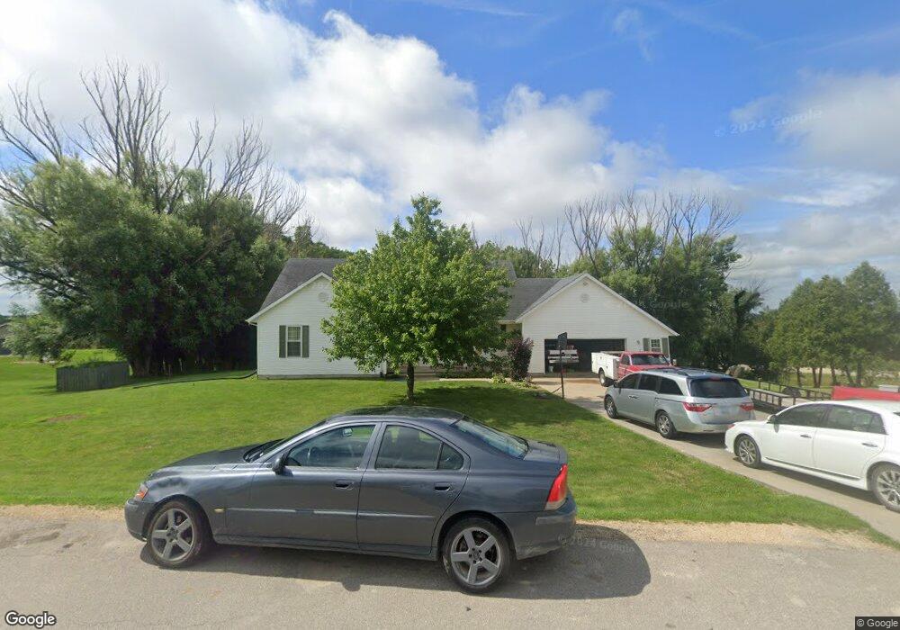
21101 131st St Anamosa, IA 52205
Estimated Value: $351,000 - $391,000
4
Beds
4
Baths
1,864
Sq Ft
$198/Sq Ft
Est. Value
About This Home
This home is located at 21101 131st St, Anamosa, IA 52205 and is currently estimated at $369,452, approximately $198 per square foot. 21101 131st St is a home located in Jones County with nearby schools including Strawberry Hill Elementary School, Anamosa Middle School, and Anamosa High School.
Ownership History
Date
Name
Owned For
Owner Type
Purchase Details
Closed on
Oct 1, 2015
Sold by
Forsd Street Land Co Llc
Bought by
Knapp Llc
Current Estimated Value
Home Financials for this Owner
Home Financials are based on the most recent Mortgage that was taken out on this home.
Original Mortgage
$190,740
Outstanding Balance
$149,401
Interest Rate
3.91%
Mortgage Type
New Conventional
Estimated Equity
$220,051
Purchase Details
Closed on
Sep 10, 2015
Sold by
Lerma Carlos D and Lerma Kimberly J
Bought by
Knapp Perry D and Knapp Kristi M
Home Financials for this Owner
Home Financials are based on the most recent Mortgage that was taken out on this home.
Original Mortgage
$190,740
Outstanding Balance
$149,401
Interest Rate
3.91%
Mortgage Type
New Conventional
Estimated Equity
$220,051
Create a Home Valuation Report for This Property
The Home Valuation Report is an in-depth analysis detailing your home's value as well as a comparison with similar homes in the area
Home Values in the Area
Average Home Value in this Area
Purchase History
| Date | Buyer | Sale Price | Title Company |
|---|---|---|---|
| Knapp Llc | $125,000 | None Available | |
| Knapp Perry D | $187,000 | None Available |
Source: Public Records
Mortgage History
| Date | Status | Borrower | Loan Amount |
|---|---|---|---|
| Open | Knapp Perry D | $190,740 |
Source: Public Records
Tax History Compared to Growth
Tax History
| Year | Tax Paid | Tax Assessment Tax Assessment Total Assessment is a certain percentage of the fair market value that is determined by local assessors to be the total taxable value of land and additions on the property. | Land | Improvement |
|---|---|---|---|---|
| 2025 | $4,492 | $374,520 | $45,090 | $329,430 |
| 2024 | $4,492 | $345,570 | $45,090 | $300,480 |
| 2023 | $4,368 | $345,570 | $45,090 | $300,480 |
| 2022 | $3,930 | $275,910 | $42,080 | $233,830 |
| 2021 | $3,930 | $275,910 | $42,080 | $233,830 |
| 2020 | $3,740 | $254,660 | $42,080 | $212,580 |
| 2019 | $3,578 | $235,350 | $0 | $0 |
| 2018 | $3,394 | $235,350 | $0 | $0 |
| 2017 | $3,394 | $222,140 | $0 | $0 |
| 2016 | $3,048 | $222,140 | $0 | $0 |
| 2015 | $3,048 | $222,140 | $24,070 | $198,070 |
| 2014 | $3,016 | $211,880 | $22,060 | $189,820 |
| 2013 | $2,904 | $211,880 | $22,060 | $189,820 |
Source: Public Records
Map
Nearby Homes
- 21051 131st St
- 21191 131st St
- 21012 131st St
- 21052 131st St
- 10761 225th Ave
- 21011 131st St
- 12864 County Road X31
- 21102 131st St
- 21192 131st St
- 21002 131st St
- 13292 212th Ave
- 13111 County Road X31
- 13133 Valley Dr
- 13295 212th Ave
- 13135 Valley Dr
- 13296 212th Ave
- 13027 Old Cass Rd
- 13137 Valley Dr
- 13297 212th Ave
- 20901 131st St