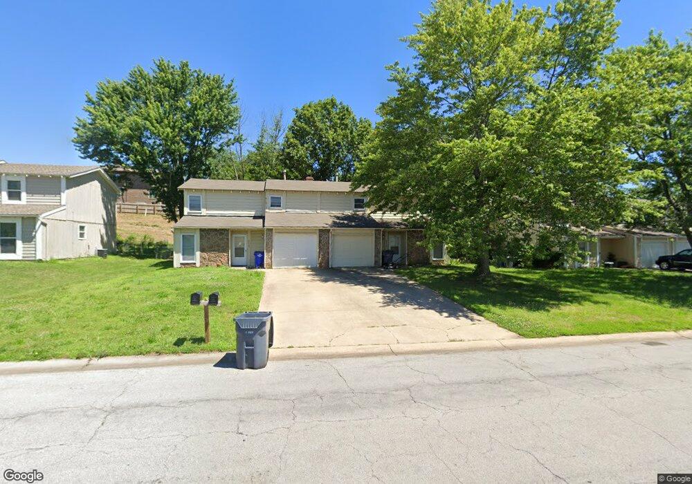
2112 E Cedar St Olathe, KS 66062
Estimated Value: $389,596 - $470,000
6
Beds
6
Baths
2,926
Sq Ft
$146/Sq Ft
Est. Value
About This Home
This home is located at 2112 E Cedar St, Olathe, KS 66062 and is currently estimated at $427,399, approximately $146 per square foot. 2112 E Cedar St is a home located in Johnson County with nearby schools including Tomahawk Elementary School, Indian Trail Middle School, and Olathe North Sr High School.
Ownership History
Date
Name
Owned For
Owner Type
Purchase Details
Closed on
Oct 12, 2010
Sold by
Carson Vicky S
Bought by
Patry Levi E and Patry Katie M
Current Estimated Value
Home Financials for this Owner
Home Financials are based on the most recent Mortgage that was taken out on this home.
Original Mortgage
$150,375
Outstanding Balance
$97,820
Interest Rate
4.38%
Mortgage Type
New Conventional
Estimated Equity
$329,579
Create a Home Valuation Report for This Property
The Home Valuation Report is an in-depth analysis detailing your home's value as well as a comparison with similar homes in the area
Home Values in the Area
Average Home Value in this Area
Purchase History
| Date | Buyer | Sale Price | Title Company |
|---|---|---|---|
| Patry Levi E | -- | Kansas Secured Title |
Source: Public Records
Mortgage History
| Date | Status | Borrower | Loan Amount |
|---|---|---|---|
| Open | Patry Levi E | $150,375 |
Source: Public Records
Tax History
| Year | Tax Paid | Tax Assessment Tax Assessment Total Assessment is a certain percentage of the fair market value that is determined by local assessors to be the total taxable value of land and additions on the property. | Land | Improvement |
|---|---|---|---|---|
| 2025 | $4,476 | $43,275 | $6,762 | $36,513 |
| 2023 | $4,352 | $38,019 | $5,813 | $32,206 |
| 2022 | $4,160 | $35,340 | $5,280 | $30,060 |
| 2021 | $3,588 | $29,073 | $4,589 | $24,484 |
| 2020 | $3,414 | $27,428 | $4,589 | $22,839 |
| 2019 | $3,451 | $27,531 | $3,827 | $23,704 |
| 2018 | $3,213 | $25,472 | $3,827 | $21,645 |
| 2017 | $2,909 | $22,850 | $3,827 | $19,023 |
| 2016 | $2,636 | $21,263 | $3,827 | $17,436 |
| 2015 | $2,414 | $19,504 | $3,827 | $15,677 |
| 2013 | -- | $19,205 | $3,827 | $15,378 |
Source: Public Records
Map
Nearby Homes
- 1924 E Cedar St
- 16868 S Cardinal Dr
- 16248 W Briarwood Ct
- 521 S Cardinal Dr
- 13924 S Brookwood Ct
- 14014 S Cottonwood Dr
- 16474 W 132nd Cir
- 15717 W 138th St
- 304 S Central St
- 16413 Indian Creek Pkwy
- 735 N Somerset Terrace
- 1409 - 1411 E Ridgeway Dr
- 17390 S Raintree Dr Unit Bldg I Unit 34
- 17394 S Raintree Dr Unit Bldg I Unit 33
- 722 S Central St
- Lot 4 W 144th St
- 13112 S Brougham Dr
- 13016 S Trenton St
- 13020 S Brougham Dr
- 12939 S Raintree Dr
- 2114 E Cedar St
- 2108 E Cedar St
- 2116 E Cedar St
- 2104 E Cedar St
- 301 S Scarborough St
- 2120 E Cedar St
- 2100 E Cedar St
- 300 S Kenwood Ln
- 305 S Scarborough St
- 2124 E Cedar St
- 304 S Kenwood Ln
- 2016 E Cedar St
- 309 S Scarborough St
- 2128 E Cedar St
- 2301 E Cedar St
- 2303 E Cedar St
- 308 S Kenwood Ln
- 2305 E Cedar St
- 2014 E Cedar St
- 2307 E Cedar St
Your Personal Tour Guide
Ask me questions while you tour the home.