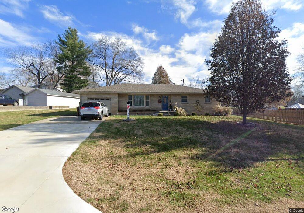
2112 Mark Twain Ave Seymour, IN 47274
Estimated Value: $201,000 - $235,000
3
Beds
2
Baths
1,320
Sq Ft
$163/Sq Ft
Est. Value
About This Home
This home is located at 2112 Mark Twain Ave, Seymour, IN 47274 and is currently estimated at $215,183, approximately $163 per square foot. 2112 Mark Twain Ave is a home located in Jackson County with nearby schools including Seymour-Redding Elementary School, Seymour Middle School, and Seymour Senior High School.
Ownership History
Date
Name
Owned For
Owner Type
Purchase Details
Closed on
Aug 14, 2008
Sold by
Smith Billy R
Bought by
Richards Tamera S
Current Estimated Value
Home Financials for this Owner
Home Financials are based on the most recent Mortgage that was taken out on this home.
Original Mortgage
$93,673
Outstanding Balance
$60,119
Interest Rate
6.31%
Mortgage Type
New Conventional
Estimated Equity
$155,064
Purchase Details
Closed on
Jan 30, 2008
Sold by
Smith Billy R and Estate Of Peggy R Smith
Bought by
Smith Billy R
Create a Home Valuation Report for This Property
The Home Valuation Report is an in-depth analysis detailing your home's value as well as a comparison with similar homes in the area
Home Values in the Area
Average Home Value in this Area
Purchase History
| Date | Buyer | Sale Price | Title Company |
|---|---|---|---|
| Richards Tamera S | $82,000 | Abstract Company | |
| Richaards Tamera S | -- | None Available | |
| Smith Billy R | -- | None Available |
Source: Public Records
Mortgage History
| Date | Status | Borrower | Loan Amount |
|---|---|---|---|
| Open | Richaards Tamera S | $93,673 |
Source: Public Records
Tax History
| Year | Tax Paid | Tax Assessment Tax Assessment Total Assessment is a certain percentage of the fair market value that is determined by local assessors to be the total taxable value of land and additions on the property. | Land | Improvement |
|---|---|---|---|---|
| 2025 | $687 | $154,400 | $26,000 | $128,400 |
| 2024 | $687 | $139,300 | $26,000 | $113,300 |
| 2023 | $707 | $144,400 | $26,000 | $118,400 |
| 2022 | $724 | $141,400 | $26,000 | $115,400 |
| 2021 | $545 | $131,800 | $26,000 | $105,800 |
| 2020 | $546 | $133,300 | $26,000 | $107,300 |
| 2019 | $423 | $115,000 | $26,000 | $89,000 |
| 2018 | $412 | $115,000 | $26,000 | $89,000 |
| 2017 | $487 | $113,400 | $26,000 | $87,400 |
| 2016 | $382 | $113,400 | $26,000 | $87,400 |
| 2014 | $445 | $102,600 | $26,000 | $76,600 |
| 2013 | $445 | $103,700 | $26,000 | $77,700 |
Source: Public Records
Map
Nearby Homes
- 737 Enos Rd
- 1935 N Ewing St
- 6782 Coreopsis Ln
- 6776 Redbud Ln
- 6784 Coreopsis Ln
- 6774 Redbud Ln
- 6797 Redbud Ln
- 6788 Coreopsis Ln
- 6785 Coreopsis Ln
- 6764 Redbud Ln
- 6803 Sunflower Ct
- 6804 Sunflower Ct
- 6827 Bluebird Ln
- 6800 Coreopsis Ln
- 1778 G Williams Pkwy
- 9162 Janelle Dr
- 1510 Shields Ave
- 422 Skaggs Ct
- 637 E 14th St
- 1408 N Blish St
- 2120 Mark Twain Ave
- 625 Redding Rd
- 2115 Mark Twain Ave
- 2126 Mark Twain Ave
- 619 Redding Rd
- 2121 Mark Twain Ave
- 2134 Mark Twain Ave
- 613 Redding Rd
- 2135 Mark Twain Ave
- 2127 Mark Twain Ave
- 645 Redding Rd
- 675 Redding Rd
- 638 Redding Rd
- 2006 Chelsea Ct
- 632 Roger Dr
- 626 Roger Dr
- 2112 Hillside Dr
- 620 Redding Rd
- 620 Roger Dr
- 630 Redding Rd
Your Personal Tour Guide
Ask me questions while you tour the home.