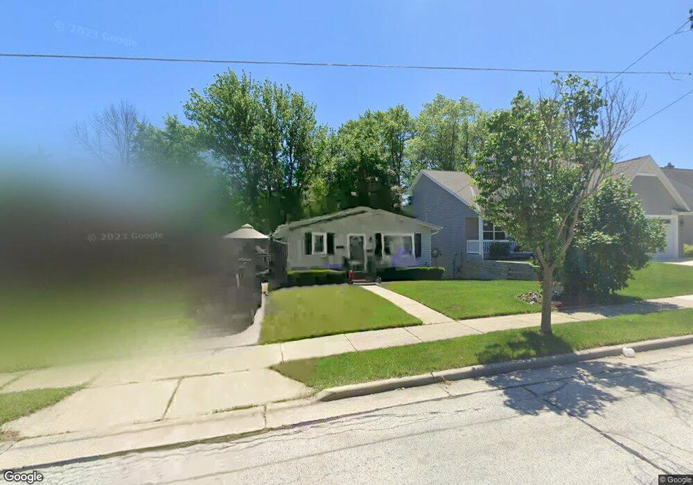
2115 Norton Ave Waukesha, WI 53188
Estimated Value: $263,251 - $286,000
3
Beds
1
Bath
1,052
Sq Ft
$261/Sq Ft
Est. Value
About This Home
This home is located at 2115 Norton Ave, Waukesha, WI 53188 and is currently estimated at $274,813, approximately $261 per square foot. 2115 Norton Ave is a home located in Waukesha County with nearby schools including Summit View Elementary School, Butler Middle School, and North High School.
Ownership History
Date
Name
Owned For
Owner Type
Purchase Details
Closed on
Mar 25, 2009
Sold by
Anderson Karri K and Anderson Kerri K
Bought by
Anderson Kerri K
Current Estimated Value
Home Financials for this Owner
Home Financials are based on the most recent Mortgage that was taken out on this home.
Original Mortgage
$135,200
Interest Rate
5.11%
Mortgage Type
New Conventional
Purchase Details
Closed on
Oct 12, 1999
Sold by
Anderson Wayne S
Bought by
Anderson Karri K
Create a Home Valuation Report for This Property
The Home Valuation Report is an in-depth analysis detailing your home's value as well as a comparison with similar homes in the area
Home Values in the Area
Average Home Value in this Area
Purchase History
| Date | Buyer | Sale Price | Title Company |
|---|---|---|---|
| Anderson Kerri K | -- | None Available | |
| Anderson Karri K | -- | -- |
Source: Public Records
Mortgage History
| Date | Status | Borrower | Loan Amount |
|---|---|---|---|
| Closed | Anderson Kerri K | $135,200 |
Source: Public Records
Tax History Compared to Growth
Tax History
| Year | Tax Paid | Tax Assessment Tax Assessment Total Assessment is a certain percentage of the fair market value that is determined by local assessors to be the total taxable value of land and additions on the property. | Land | Improvement |
|---|---|---|---|---|
| 2024 | $2,973 | $205,700 | $46,700 | $159,000 |
| 2023 | $2,875 | $205,700 | $46,700 | $159,000 |
| 2022 | $3,090 | $164,800 | $45,100 | $119,700 |
| 2021 | $3,152 | $164,800 | $45,100 | $119,700 |
| 2020 | $3,062 | $164,800 | $45,100 | $119,700 |
| 2019 | $2,957 | $164,800 | $45,100 | $119,700 |
| 2018 | $2,719 | $148,500 | $36,900 | $111,600 |
| 2017 | $2,723 | $148,500 | $36,900 | $111,600 |
| 2016 | $2,819 | $144,200 | $34,400 | $109,800 |
| 2015 | $2,806 | $144,200 | $34,400 | $109,800 |
| 2014 | $2,780 | $137,300 | $34,400 | $102,900 |
| 2013 | $2,780 | $137,300 | $34,400 | $102,900 |
Source: Public Records
Map
Nearby Homes
- 2012 Sunkist Ave
- 1606 Pleasant View Ave
- 1513 N Bel Ayr Dr
- 704 Western Ave
- 1901 Wall St
- 2207 Norwood Dr
- 630 Westowne Ave
- 2300 Norwood Dr
- 2145 Broken Hill Rd Unit 5
- 608 N Grandview Blvd
- 1911 Woodburn Rd Unit C
- 2013 Woodburn Rd Unit A
- 610 Glendon Way
- 2740 Northview Rd Unit 102
- 2732 Northview Rd Unit 88
- 2740 Northview Rd
- 1917 Tree Line Ct
- 2728 Northview Rd
- 2728 Northview Rd Unit 61
- 331 Jasper Ln
- 2117 Norton Ave
- 2125 Norton Ave
- 2112 Norton Ave
- 2108 Norton Ave
- 2120 Norton Ave
- 2121 Norton Ave
- 2109 Norton Ave
- 2104 Norton Ave
- 2124 Norton Ave
- 2105 Norton Ave
- 2116 Norton Ave
- 2129 Norton Ave
- 2128 Norton Ave
- 2101 Norton Ave
- 2024 Norton Ave
- 2128 Oaklawn Ave
- 2108 Oaklawn Ave
- 2200 Norton Ave
- 2104 Oaklawn Ave
- 2115 Oaklawn Ave