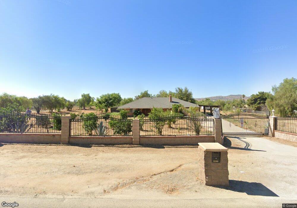
21165 Dawes St Perris, CA 92570
Estimated Value: $625,000 - $734,000
3
Beds
4
Baths
2,820
Sq Ft
$237/Sq Ft
Est. Value
About This Home
This home is located at 21165 Dawes St, Perris, CA 92570 and is currently estimated at $669,333, approximately $237 per square foot. 21165 Dawes St is a home located in Riverside County with nearby schools including Manuel L. Real Elementary School, Tomas Rivera Middle School, and Citrus Hill High School.
Ownership History
Date
Name
Owned For
Owner Type
Purchase Details
Closed on
Dec 10, 2001
Sold by
Colmenero Rudy L
Bought by
Cervantes Arturo and Cervantes Jackie
Current Estimated Value
Home Financials for this Owner
Home Financials are based on the most recent Mortgage that was taken out on this home.
Original Mortgage
$116,000
Interest Rate
7.13%
Mortgage Type
Commercial
Create a Home Valuation Report for This Property
The Home Valuation Report is an in-depth analysis detailing your home's value as well as a comparison with similar homes in the area
Home Values in the Area
Average Home Value in this Area
Purchase History
| Date | Buyer | Sale Price | Title Company |
|---|---|---|---|
| Cervantes Arturo | $145,000 | Orange Coast Title |
Source: Public Records
Mortgage History
| Date | Status | Borrower | Loan Amount |
|---|---|---|---|
| Previous Owner | Cervantes Arturo | $116,000 |
Source: Public Records
Tax History Compared to Growth
Tax History
| Year | Tax Paid | Tax Assessment Tax Assessment Total Assessment is a certain percentage of the fair market value that is determined by local assessors to be the total taxable value of land and additions on the property. | Land | Improvement |
|---|---|---|---|---|
| 2025 | $3,502 | $312,690 | $88,621 | $224,069 |
| 2023 | $3,502 | $300,550 | $85,181 | $215,369 |
| 2022 | $3,401 | $294,658 | $83,511 | $211,147 |
| 2021 | $3,335 | $288,881 | $81,874 | $207,007 |
| 2020 | $3,302 | $285,920 | $81,035 | $204,885 |
| 2019 | $3,103 | $280,315 | $79,447 | $200,868 |
| 2018 | $3,060 | $274,820 | $77,891 | $196,929 |
| 2017 | $2,989 | $269,432 | $76,364 | $193,068 |
| 2016 | $2,955 | $264,150 | $74,867 | $189,283 |
| 2015 | $2,912 | $260,185 | $73,744 | $186,441 |
| 2014 | $2,877 | $255,090 | $72,300 | $182,790 |
Source: Public Records
Map
Nearby Homes
- 21277 Kinney St
- 21402 Shortridge Ave
- 0 Marquez Rd
- 20748 Martin St
- 18759 Clark St
- 20541 Moore St
- 20561 Hunter St
- 18510 Brown St
- 0 Old Elsinore Rd Unit CV25117444
- 21580 Lane St
- 0 Day St Unit CV24223167
- 20415 Myron St
- 20243 Lee Rd
- 21889 Mary St
- 21821 Markham St
- 20407 Markham St
- 20975 Oleander Ave
- 21994 Mack St
- 20810 Oleander Ave
- 18420 Decker Rd
- 21168 Dawes St
- 21182 Dawes St
- 21158 Dawes St
- 21146 Dawes St
- 19265 Haines St
- 21200 Dawes St
- 21222 Dawes St
- 19308 Florence St
- 19285 Haines St
- 0 Haines St Unit IV18096245
- 0 Haines St Unit IV18069173
- 0 Haines St Unit I08045500
- 0 Haines St Unit I08094236
- 0 Haines St Unit P688223
- 0 Haines St Unit K09098330
- 0 Haines St Unit I10040527
- 0 Haines St Unit P756649
- 0 Haines St Unit I11012443
- 0 Haines St Unit I11075083
- 0 Haines St Unit K12093791