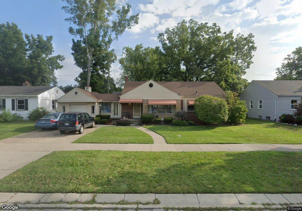
21181 Outer Dr Dearborn, MI 48124
Ford Homes Historic District NeighborhoodEstimated Value: $218,000 - $339,000
3
Beds
1
Bath
1,672
Sq Ft
$168/Sq Ft
Est. Value
About This Home
This home is located at 21181 Outer Dr, Dearborn, MI 48124 and is currently estimated at $280,208, approximately $167 per square foot. 21181 Outer Dr is a home located in Wayne County with nearby schools including Whitmore-Bolles Elementary School, Smith Middle School, and Edsel Ford High School.
Ownership History
Date
Name
Owned For
Owner Type
Purchase Details
Closed on
Jun 25, 2008
Sold by
Molnar Carolyn
Bought by
Molnar Carolyn
Current Estimated Value
Purchase Details
Closed on
Aug 15, 1994
Sold by
Furnier Richard L
Bought by
Molnar Carolyn
Home Financials for this Owner
Home Financials are based on the most recent Mortgage that was taken out on this home.
Original Mortgage
$69,000
Interest Rate
8.73%
Mortgage Type
New Conventional
Create a Home Valuation Report for This Property
The Home Valuation Report is an in-depth analysis detailing your home's value as well as a comparison with similar homes in the area
Home Values in the Area
Average Home Value in this Area
Purchase History
| Date | Buyer | Sale Price | Title Company |
|---|---|---|---|
| Molnar Carolyn | -- | Michigan Bankers Title | |
| Molnar Carolyn | $130,000 | -- |
Source: Public Records
Mortgage History
| Date | Status | Borrower | Loan Amount |
|---|---|---|---|
| Closed | Molnar Carolyn | $69,000 |
Source: Public Records
Tax History
| Year | Tax Paid | Tax Assessment Tax Assessment Total Assessment is a certain percentage of the fair market value that is determined by local assessors to be the total taxable value of land and additions on the property. | Land | Improvement |
|---|---|---|---|---|
| 2025 | $2,981 | $119,100 | $0 | $0 |
| 2024 | $2,916 | $107,700 | $0 | $0 |
| 2023 | $2,759 | $102,100 | $0 | $0 |
| 2022 | $3,105 | $84,700 | $0 | $0 |
| 2021 | $3,608 | $79,400 | $0 | $0 |
| 2019 | $3,572 | $68,700 | $0 | $0 |
| 2018 | $3,029 | $62,200 | $0 | $0 |
| 2017 | $868 | $57,500 | $0 | $0 |
| 2016 | $2,831 | $54,400 | $0 | $0 |
| 2015 | $5,385 | $53,850 | $0 | $0 |
| 2013 | $5,330 | $53,300 | $0 | $0 |
| 2011 | -- | $60,550 | $0 | $0 |
Source: Public Records
Map
Nearby Homes
- 21236 Outer Dr
- 21230 Audette St
- 21047 Outer Dr
- 21123 Audette St
- 3238 Harding St
- 3313 Alice St
- 3245 Gertrude St
- 3321 Williams St
- 3400 Dudley St
- 3131 Mckinley St
- 22043 Edison St
- 22321 Cleveland St
- 3346 Roosevelt St
- 3205 Lincoln St
- 22101 Francis St
- 20561 Audette St
- 21130 Carlysle St
- 3604 Merrick St
- 3530 Roosevelt St
- 22152 Francis St
- 21195 Outer Dr
- 21167 Outer Dr
- 21345 Audette St
- 21353 Audette St
- 21337 Audette St
- 21361 Audette St
- 21329 Audette St
- 21157 Outer Dr
- 21321 Audette St
- 21211 Outer Dr
- 21369 Audette St
- 21313 Audette St
- 21383 Audette St
- 21301 Audette St
- 0 Alice St
- 21170 Outer Dr
- 21188 Outer Dr
- 21135 Outer Dr
- 21150 Outer Dr
- 21344 Audette St
Your Personal Tour Guide
Ask me questions while you tour the home.