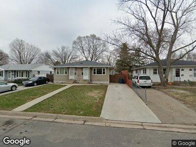
212 Ash St W South Saint Paul, MN 55075
Estimated Value: $296,000 - $339,999
6
Beds
3
Baths
1,754
Sq Ft
$177/Sq Ft
Est. Value
About This Home
This home is located at 212 Ash St W, South Saint Paul, MN 55075 and is currently estimated at $311,250, approximately $177 per square foot. 212 Ash St W is a home located in Dakota County with nearby schools including Kaposia Education Center Elementary, South St. Paul Secondary, and Discovery Charter School.
Ownership History
Date
Name
Owned For
Owner Type
Purchase Details
Closed on
Jul 12, 2021
Sold by
Manteuffel John Michael
Bought by
Manteuffel John Edward and Manteuffel Shenna Marie
Current Estimated Value
Purchase Details
Closed on
Oct 4, 2017
Sold by
Manteulfel Mary Jean
Bought by
Manteuffel John Michael
Home Financials for this Owner
Home Financials are based on the most recent Mortgage that was taken out on this home.
Original Mortgage
$100,000
Outstanding Balance
$85,393
Interest Rate
3.86%
Mortgage Type
New Conventional
Estimated Equity
$233,600
Create a Home Valuation Report for This Property
The Home Valuation Report is an in-depth analysis detailing your home's value as well as a comparison with similar homes in the area
Home Values in the Area
Average Home Value in this Area
Purchase History
| Date | Buyer | Sale Price | Title Company |
|---|---|---|---|
| Manteuffel John Michael | -- | Arden Title Llo |
Source: Public Records
Mortgage History
| Date | Status | Borrower | Loan Amount |
|---|---|---|---|
| Open | Manteuffel John Michael | $100,000 |
Source: Public Records
Tax History Compared to Growth
Tax History
| Year | Tax Paid | Tax Assessment Tax Assessment Total Assessment is a certain percentage of the fair market value that is determined by local assessors to be the total taxable value of land and additions on the property. | Land | Improvement |
|---|---|---|---|---|
| 2023 | $5,036 | $303,500 | $77,500 | $226,000 |
| 2022 | $4,504 | $292,600 | $77,500 | $215,100 |
| 2021 | $4,328 | $265,700 | $67,400 | $198,300 |
| 2020 | $3,944 | $250,900 | $64,200 | $186,700 |
| 2019 | $3,472 | $234,400 | $61,100 | $173,300 |
| 2018 | $3,320 | $196,800 | $55,500 | $141,300 |
| 2017 | $3,070 | $181,200 | $52,900 | $128,300 |
| 2016 | $2,993 | $168,100 | $48,100 | $120,000 |
| 2015 | $2,993 | $157,800 | $45,800 | $112,000 |
| 2014 | $189 | $126,260 | $38,551 | $87,709 |
| 2013 | $1,814 | $113,180 | $33,052 | $80,128 |
Source: Public Records
Map
Nearby Homes
- 1442 7th Ave S
- 5898 Cahill Ave
- 1239 7th Ave S
- 1440 8th Ave S
- 146 Dale St W
- 1114 6th Ave S
- 6050 Cahill Ave
- 1107 9th Ave S
- 239 Buron Ln
- 1550 Lincoln Park Dr
- 150 Park St W
- 159 9th St S
- 928 8th Ave S
- 5845 Blackberry Trail
- 5887 Blackberry Bridge Path
- 840 7th Ave S
- 831 2nd Ave S
- 824 3rd Ave S
- 813 4th Ave S
- 1663 Concord St S