Estimated Value: $514,880 - $554,000
3
Beds
2
Baths
2,633
Sq Ft
$205/Sq Ft
Est. Value
About This Home
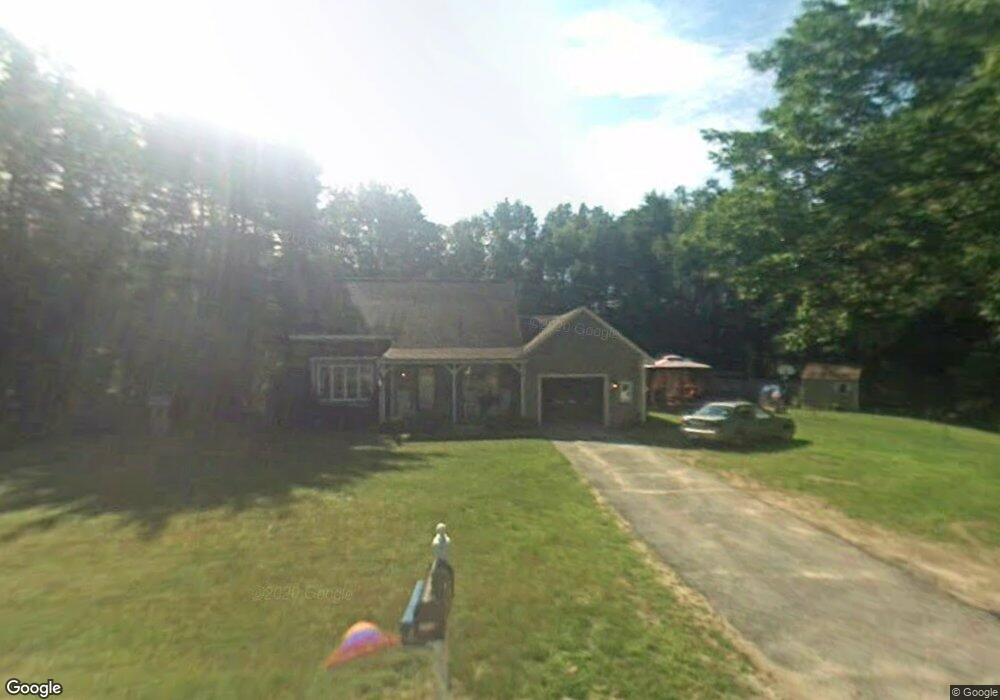
This home is located at 212 Barnard Hill Rd, Weare, NH 03281 and is currently estimated at $539,470, approximately $204 per square foot. 212 Barnard Hill Rd is a home with nearby schools including Center Woods Elementary School, Weare Middle School, and John Stark Regional High School.
Ownership History
Date
Name
Owned For
Owner Type
Purchase Details
Closed on
Sep 5, 2017
Sold by
Davis Joan E
Bought by
Davis Eric
Current Estimated Value
Home Financials for this Owner
Home Financials are based on the most recent Mortgage that was taken out on this home.
Original Mortgage
$264,568
Outstanding Balance
$219,703
Interest Rate
3.96%
Mortgage Type
VA
Estimated Equity
$319,767
Purchase Details
Closed on
May 21, 1999
Sold by
Cote Edmond L and Cote Mary A
Bought by
Davis George A and Davis Joan E
Home Financials for this Owner
Home Financials are based on the most recent Mortgage that was taken out on this home.
Original Mortgage
$108,000
Interest Rate
6.88%
Create a Home Valuation Report for This Property
The Home Valuation Report is an in-depth analysis detailing your home's value as well as a comparison with similar homes in the area
Home Values in the Area
Average Home Value in this Area
Purchase History
| Date | Buyer | Sale Price | Title Company |
|---|---|---|---|
| Davis Eric | $259,000 | -- | |
| Davis George A | $135,000 | -- |
Source: Public Records
Mortgage History
| Date | Status | Borrower | Loan Amount |
|---|---|---|---|
| Open | Davis Eric | $264,568 | |
| Previous Owner | Davis George A | $206,400 | |
| Previous Owner | Davis George A | $80,000 | |
| Previous Owner | Davis George A | $108,000 |
Source: Public Records
Tax History Compared to Growth
Tax History
| Year | Tax Paid | Tax Assessment Tax Assessment Total Assessment is a certain percentage of the fair market value that is determined by local assessors to be the total taxable value of land and additions on the property. | Land | Improvement |
|---|---|---|---|---|
| 2024 | $7,351 | $360,500 | $130,300 | $230,200 |
| 2023 | $6,792 | $360,500 | $130,300 | $230,200 |
| 2022 | $6,273 | $360,500 | $130,300 | $230,200 |
| 2021 | $6,201 | $360,500 | $130,300 | $230,200 |
| 2020 | $6,464 | $269,900 | $91,700 | $178,200 |
| 2019 | $6,406 | $270,200 | $91,700 | $178,500 |
| 2018 | $6,085 | $264,200 | $91,700 | $172,500 |
| 2016 | $5,910 | $264,200 | $91,700 | $172,500 |
| 2015 | $5,948 | $265,400 | $91,700 | $173,700 |
| 2014 | $5,895 | $265,400 | $91,700 | $173,700 |
| 2013 | $5,772 | $265,400 | $91,700 | $173,700 |
Source: Public Records
Map
Nearby Homes
- 624 S Stark Hwy
- 103 Renshaw Rd
- 77 Gould Rd
- 849 River Rd
- 93 Daniels Rd
- 174 S Stark Hwy Unit 13
- 174 S Stark Hwy Unit 1
- 174 S Stark Hwy Unit 23
- 0 Huntington Hill Rd Unit 69
- 196 Deering Center Rd
- 10 Sap House Rd
- 179 Oak Hill Rd
- 3 Stephanie Rd
- 12 Gary Rd
- 450 Weare Rd
- 95 Wright Dr
- 342 Weare Rd
- 256 Middle Branch Rd
- 22 Fairway Dr
- 0 Fairway Dr Unit 11
- 205 Barnard Hill Rd
- 220 Barnard Hill Rd
- 183 Barnard Hill Rd
- 193 Barnard Hill Rd
- 217 Barnard Hill Rd
- 176 Barnard Hill Rd
- 235 Barnard Hill Rd
- 173 Barnard Hill Rd
- 164 Barnard Hill Rd
- 243 Barnard Hill Rd
- 160 Barnard Hill Rd
- 165 Barnard Hill Rd
- 154 Barnard Hill Rd
- 151 Barnard Hill Rd
- 140 Barnard Hill Rd
- 143 Barnard Hill Rd
- 143 Barnard Hill Rd
- 268 Barnard Hill Rd
- 133B Barnard Hill Rd
- 130 Barnard Hill Rd