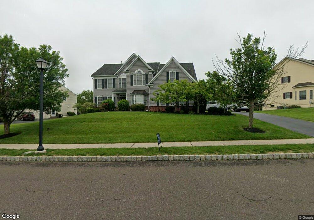
212 Cadwallader Dr Warrington, PA 18976
Estimated Value: $929,277 - $1,080,000
4
Beds
4
Baths
3,270
Sq Ft
$312/Sq Ft
Est. Value
About This Home
This home is located at 212 Cadwallader Dr, Warrington, PA 18976 and is currently estimated at $1,020,569, approximately $312 per square foot. 212 Cadwallader Dr is a home located in Bucks County with nearby schools including Kutz Elementary School, Lenape Middle School, and Central Bucks High School-West.
Ownership History
Date
Name
Owned For
Owner Type
Purchase Details
Closed on
Aug 14, 2007
Sold by
The Cutler Group Inc
Bought by
Kim Dennis B and Kim Min C
Current Estimated Value
Home Financials for this Owner
Home Financials are based on the most recent Mortgage that was taken out on this home.
Original Mortgage
$50,000
Outstanding Balance
$31,867
Interest Rate
6.7%
Mortgage Type
Credit Line Revolving
Estimated Equity
$988,702
Create a Home Valuation Report for This Property
The Home Valuation Report is an in-depth analysis detailing your home's value as well as a comparison with similar homes in the area
Home Values in the Area
Average Home Value in this Area
Purchase History
| Date | Buyer | Sale Price | Title Company |
|---|---|---|---|
| Kim Dennis B | $576,975 | None Available |
Source: Public Records
Mortgage History
| Date | Status | Borrower | Loan Amount |
|---|---|---|---|
| Open | Kim Dennis B | $50,000 | |
| Open | Kim Dennis B | $461,580 |
Source: Public Records
Tax History Compared to Growth
Tax History
| Year | Tax Paid | Tax Assessment Tax Assessment Total Assessment is a certain percentage of the fair market value that is determined by local assessors to be the total taxable value of land and additions on the property. | Land | Improvement |
|---|---|---|---|---|
| 2025 | $10,221 | $55,370 | $9,700 | $45,670 |
| 2024 | $10,221 | $55,370 | $9,700 | $45,670 |
| 2023 | $9,463 | $55,370 | $9,700 | $45,670 |
| 2022 | $9,276 | $55,370 | $9,700 | $45,670 |
| 2021 | $9,173 | $55,370 | $9,700 | $45,670 |
| 2020 | $9,173 | $55,370 | $9,700 | $45,670 |
| 2019 | $9,118 | $55,370 | $9,700 | $45,670 |
| 2018 | $9,016 | $55,370 | $9,700 | $45,670 |
| 2017 | $8,895 | $55,370 | $9,700 | $45,670 |
| 2016 | $8,867 | $55,370 | $9,700 | $45,670 |
| 2015 | -- | $55,370 | $9,700 | $45,670 |
| 2014 | -- | $55,370 | $9,700 | $45,670 |
Source: Public Records
Map
Nearby Homes
- 612 Bethel Ln Unit THE ROOSEVELT PLAN
- 612 Bethel Ln Unit THE MONROE PLAN
- 100 Fiddleleaf Ln Unit 104
- 100 Ginko St Unit 303
- 100 Claret Ct Unit 102
- 200 Beech Blvd Unit 202
- 200 Beech Blvd Unit 301
- 3159 Bristol Rd
- 2756 Pickertown Rd
- 2463 Pine Cone Rd
- 1105 Madison Cir
- 858 Elbow Ln
- 902 Eagle Ln
- 73 Brinker Dr Unit S
- 406 Primrose Place
- 430 Homestead Cir
- 623 Addison Way
- 983 Wilson Ct
- 418 Homestead Cir
- 2302 MacIs Cir
- 222 Cadwallader Dr
- 222 Cadwallader Dr
- 222 Cadwallader Dr Unit 159
- 213 Cadwallader Dr
- 210 Cadwallader Dr
- 411 Bens Run Ct
- 211 Cadwallader Dr
- 224 Cadwallader Dr
- 302 Joelle Ct
- 211 Cadwallader Rd Unit 15
- 208 Cadwallader Dr
- 412 Bens Run Ct
- 409 Bens Run Ct
- 223 Cadwallader Dr
- 225 Cadwallader Dr
- 225 Cadwallader Dr
- 226 Cadwallader Dr
- 226 Cadwallader Dr
- 207 Cadwallader Dr
- 303 Joelle Ct