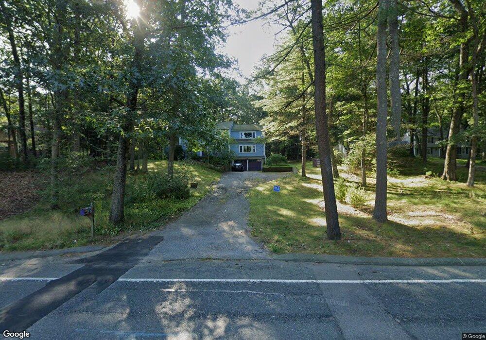
212 Eliot St Natick, MA 01760
Estimated Value: $1,140,932 - $1,300,000
3
Beds
3
Baths
2,377
Sq Ft
$524/Sq Ft
Est. Value
About This Home
This home is located at 212 Eliot St, Natick, MA 01760 and is currently estimated at $1,245,233, approximately $523 per square foot. 212 Eliot St is a home located in Middlesex County with nearby schools including Natick High School, Memorial Elementary School, and J F Kennedy Middle School.
Ownership History
Date
Name
Owned For
Owner Type
Purchase Details
Closed on
Oct 31, 2002
Sold by
Gilbert Michael J and Gilbert Halley E
Bought by
Creary Joseph P and Robinson Christine R
Current Estimated Value
Home Financials for this Owner
Home Financials are based on the most recent Mortgage that was taken out on this home.
Original Mortgage
$477,600
Outstanding Balance
$201,075
Interest Rate
6.09%
Mortgage Type
Purchase Money Mortgage
Estimated Equity
$1,044,158
Purchase Details
Closed on
Oct 29, 1999
Sold by
Brauer Rt
Bought by
Gilbert Michael J and Wolansky Halley E
Home Financials for this Owner
Home Financials are based on the most recent Mortgage that was taken out on this home.
Original Mortgage
$308,000
Interest Rate
7.78%
Mortgage Type
Purchase Money Mortgage
Create a Home Valuation Report for This Property
The Home Valuation Report is an in-depth analysis detailing your home's value as well as a comparison with similar homes in the area
Home Values in the Area
Average Home Value in this Area
Purchase History
| Date | Buyer | Sale Price | Title Company |
|---|---|---|---|
| Creary Joseph P | $597,000 | -- | |
| Gilbert Michael J | $385,000 | -- |
Source: Public Records
Mortgage History
| Date | Status | Borrower | Loan Amount |
|---|---|---|---|
| Open | Gilbert Michael J | $477,600 | |
| Previous Owner | Gilbert Michael J | $308,000 | |
| Closed | Gilbert Michael J | $38,500 |
Source: Public Records
Tax History Compared to Growth
Tax History
| Year | Tax Paid | Tax Assessment Tax Assessment Total Assessment is a certain percentage of the fair market value that is determined by local assessors to be the total taxable value of land and additions on the property. | Land | Improvement |
|---|---|---|---|---|
| 2025 | $10,259 | $857,800 | $493,500 | $364,300 |
| 2024 | $9,917 | $808,900 | $467,400 | $341,500 |
| 2023 | $9,345 | $739,300 | $430,400 | $308,900 |
| 2022 | $9,074 | $680,200 | $384,200 | $296,000 |
| 2021 | $8,698 | $639,100 | $363,900 | $275,200 |
| 2020 | $8,493 | $624,000 | $348,800 | $275,200 |
| 2019 | $7,931 | $624,000 | $348,800 | $275,200 |
| 2018 | $8,104 | $621,000 | $333,600 | $287,400 |
| 2017 | $8,295 | $614,900 | $332,800 | $282,100 |
| 2016 | $8,309 | $612,300 | $332,800 | $279,500 |
| 2015 | $8,143 | $589,200 | $332,800 | $256,400 |
Source: Public Records
Map
Nearby Homes
- 18 Phillips Pond Rd
- 91 Glen St
- 21 Harvest Moon Dr
- 104 Glen St
- 39 Indian Ridge Rd
- 39 Davis Brook Dr
- 25 Yorkshire Rd
- 15 Wyndemere Ln
- 5 Deer Path
- 94 Woodland St
- 48 Graystone Ln
- 53 Yorkshire Rd
- 16 Wayside Rd Unit 14
- 16 Wayside Rd
- 10 Sundance Way
- 8 Warren Rd
- 29 Water St
- 8 Greystone Rd
- 21 Eliot St
- 6 Ambler Ct