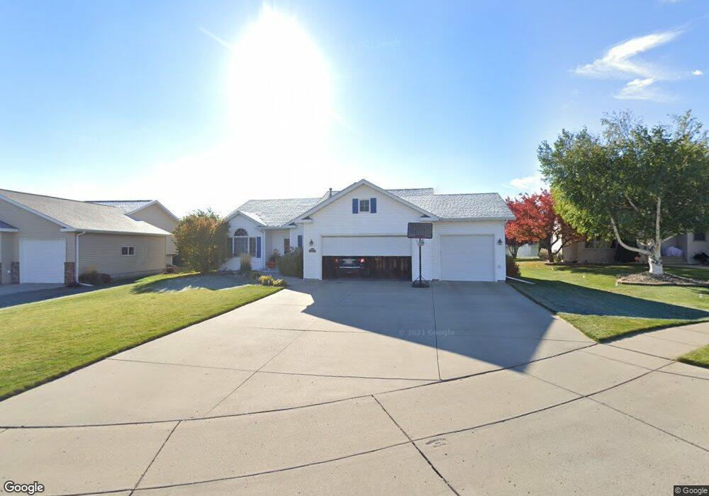
2120 Modesto Cir Bismarck, ND 58504
Cottonwood NeighborhoodEstimated Value: $451,000 - $564,000
4
Beds
4
Baths
2,881
Sq Ft
$176/Sq Ft
Est. Value
About This Home
This home is located at 2120 Modesto Cir, Bismarck, ND 58504 and is currently estimated at $505,861, approximately $175 per square foot. 2120 Modesto Cir is a home located in Burleigh County with nearby schools including Victor Solheim Elementary School, Wachter Middle School, and Bismarck High School.
Ownership History
Date
Name
Owned For
Owner Type
Purchase Details
Closed on
Oct 1, 2010
Sold by
Niemann Jeffrey V and Niemann Joan S
Bought by
Omvig Kenton T and Omvig Lisa M
Current Estimated Value
Home Financials for this Owner
Home Financials are based on the most recent Mortgage that was taken out on this home.
Original Mortgage
$200,000
Outstanding Balance
$129,323
Interest Rate
4.42%
Mortgage Type
New Conventional
Estimated Equity
$376,538
Create a Home Valuation Report for This Property
The Home Valuation Report is an in-depth analysis detailing your home's value as well as a comparison with similar homes in the area
Home Values in the Area
Average Home Value in this Area
Purchase History
| Date | Buyer | Sale Price | Title Company |
|---|---|---|---|
| Omvig Kenton T | $283,000 | -- |
Source: Public Records
Mortgage History
| Date | Status | Borrower | Loan Amount |
|---|---|---|---|
| Open | Omvig Kenton T | $200,000 |
Source: Public Records
Tax History
| Year | Tax Paid | Tax Assessment Tax Assessment Total Assessment is a certain percentage of the fair market value that is determined by local assessors to be the total taxable value of land and additions on the property. | Land | Improvement |
|---|---|---|---|---|
| 2025 | $3,613 | $239,450 | $43,000 | $196,450 |
| 2024 | $4,731 | $211,900 | $40,000 | $171,900 |
| 2023 | $5,215 | $211,900 | $40,000 | $171,900 |
| 2022 | $4,523 | $195,850 | $40,000 | $155,850 |
| 2021 | $4,326 | $177,100 | $38,000 | $139,100 |
| 2020 | $4,117 | $173,850 | $38,000 | $135,850 |
| 2019 | $4,271 | $186,800 | $0 | $0 |
| 2018 | $3,938 | $186,800 | $38,000 | $148,800 |
| 2017 | $3,535 | $186,800 | $38,000 | $148,800 |
| 2016 | $3,535 | $186,800 | $29,000 | $157,800 |
| 2014 | -- | $168,650 | $0 | $0 |
Source: Public Records
Map
Nearby Homes
- 2330 Fresno Dr
- 620 Bridgeport Dr Unit 1
- 2108 Santa Barbara Dr
- 2314 Santa Barbara Dr
- 1149 Santa fe Ave
- 10/11 Boston Dr
- 12/13 Boston Dr
- 20/21 Boston Dr
- 18/19 Boston Dr
- 16/17 Boston Dr
- 1626 S 3rd St
- 411 Live Oak Ln
- 429 Kamrose Dr
- 328 Kamrose Dr
- 335 Kamrose Dr
- 327 Kamrose Dr
- 319 Kamrose Dr
- 1561 Wichita Dr
- 221 Kamrose Dr
- 1701 Oakland Dr
- 2122 Modesto Cir
- 2118 Modesto Cir
- 2306 Fresno Dr
- 2130 S 3rd St
- 2312 Fresno Dr
- 2116 Modesto Cir
- 2108 Modesto Cir
- 2110 Modesto Cir
- 2318 Fresno Dr
- 2112 Modesto Cir
- 2114 Modesto Cir
- 2119 S 3rd St
- 2103 S 3rd St
- 2111 S 3rd St
- 547 Cottonwood Loop
- 2127 S 3rd St
- 2301 Fresno Dr
- 543 Cottonwood Loop
- 551 Cottonwood Loop
- 2034 S 3rd St
Your Personal Tour Guide
Ask me questions while you tour the home.