Estimated Value: $121,275 - $173,000
Studio
1
Bath
1,144
Sq Ft
$127/Sq Ft
Est. Value
About This Home
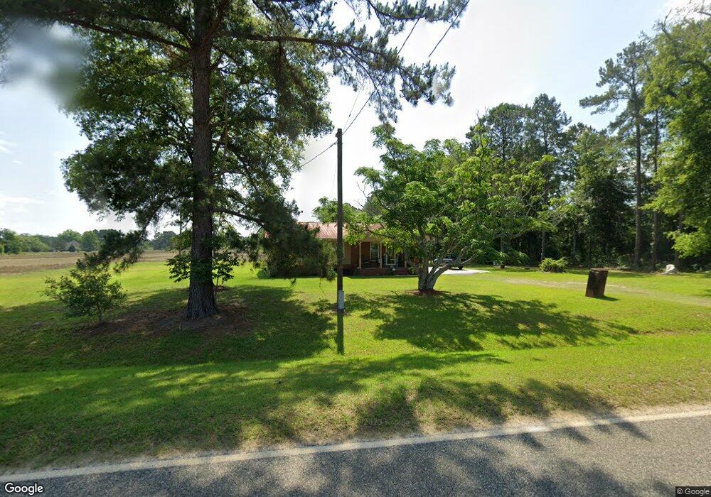
This home is located at 2120 Simmon Hill Rd, Dixie, GA 31629 and is currently estimated at $144,819, approximately $126 per square foot. 2120 Simmon Hill Rd is a home located in Brooks County with nearby schools including Quitman Elementary School and Westbrook School.
Ownership History
Date
Name
Owned For
Owner Type
Purchase Details
Closed on
Jun 13, 2019
Sold by
Brown Annette
Bought by
Sanders Ollie
Current Estimated Value
Purchase Details
Closed on
Sep 5, 2017
Sold by
Matthews Laura
Bought by
Brown Emma Annette and Sanders Ollie M
Purchase Details
Closed on
Sep 18, 2003
Sold by
Washington Ollie M and Paula Williams
Bought by
Matthews Laura
Purchase Details
Closed on
Sep 2, 2003
Sold by
Brown Emma Annette Washington
Bought by
Matthews Laura
Purchase Details
Closed on
Dec 28, 1994
Sold by
Washington Ollie T
Bought by
Williams Paula Doreen Etal
Create a Home Valuation Report for This Property
The Home Valuation Report is an in-depth analysis detailing your home's value as well as a comparison with similar homes in the area
Purchase History
| Date | Buyer | Sale Price | Title Company |
|---|---|---|---|
| Sanders Ollie | -- | -- | |
| Brown Emma Annette | -- | -- | |
| Matthews Laura | -- | -- | |
| Matthews Laura | -- | -- | |
| Williams Paula Doreen Etal | -- | -- | |
| Affidavit | -- | -- |
Source: Public Records
Tax History
| Year | Tax Paid | Tax Assessment Tax Assessment Total Assessment is a certain percentage of the fair market value that is determined by local assessors to be the total taxable value of land and additions on the property. | Land | Improvement |
|---|---|---|---|---|
| 2025 | $1,060 | $35,000 | $4,840 | $30,160 |
| 2024 | $1,060 | $35,000 | $4,840 | $30,160 |
| 2023 | $520 | $31,840 | $4,200 | $27,640 |
| 2022 | $856 | $25,160 | $4,000 | $21,160 |
| 2021 | $749 | $22,240 | $3,920 | $18,320 |
| 2020 | $618 | $22,240 | $3,920 | $18,320 |
| 2019 | $821 | $19,200 | $4,000 | $15,200 |
| 2018 | $570 | $19,520 | $4,000 | $15,520 |
| 2017 | $558 | $19,000 | $4,000 | $15,000 |
| 2016 | $602 | $19,280 | $4,000 | $15,280 |
| 2015 | -- | $19,440 | $4,000 | $15,440 |
| 2014 | -- | $20,600 | $4,000 | $16,600 |
| 2013 | -- | $20,600 | $4,000 | $16,600 |
Source: Public Records
Map
Nearby Homes
- 5199 U S 84
- Dixie Rd
- 431 Dry Lake Rd
- 9900 Ozell Rd
- 2156 County Road 78
- 804 Westlake Dr
- 1001 W Bartow St
- 901 W Boundary St
- 309 Eastlake Dr
- 800 Clifford St
- 304 W Rountree St
- 103 Victorian Way
- 807 N Court St
- 606 N Court St
- 203 W Gordon St
- 621 N Court St
- 417 N Court St
- Lot 14 Dawn Ln
- 1038-BA Church St
- 714 Morris Ave
- 2081 Simmon Hill Rd
- 117 Marable Ln
- 124 Marable Ln
- 2311 Simmon Hill Rd
- 7 Simmon Hill Rd
- 310 Burns Ln
- 310 Burns Ln
- 1149 Spencer Rd
- 1116 Spencer Rd
- 231 Mcgraw Dr
- 1258 Spencer Rd
- 1767 Simmon Hill Rd
- 361 361 McGraw Dr
- 214 Marable Ln
- 361 Mcgraw Dr
- 200 Mcgraw Dr
- 1377 Spencer Rd
- 2595 Simmon Hill Rd
- 1501 Simmon Hill Rd
- 1380 Simmon Hill Rd
Your Personal Tour Guide
Ask me questions while you tour the home.