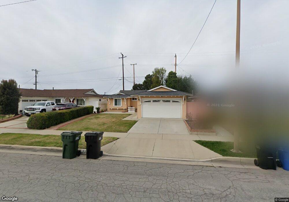
21207 New Hampshire Ave Torrance, CA 90502
West Carson NeighborhoodEstimated Value: $788,957 - $851,000
3
Beds
2
Baths
1,172
Sq Ft
$703/Sq Ft
Est. Value
About This Home
This home is located at 21207 New Hampshire Ave, Torrance, CA 90502 and is currently estimated at $824,489, approximately $703 per square foot. 21207 New Hampshire Ave is a home located in Los Angeles County with nearby schools including Van Deene Avenue Elementary School, Stephen M. White Middle School, and Nathaniel Narbonne Senior High School.
Ownership History
Date
Name
Owned For
Owner Type
Purchase Details
Closed on
Dec 3, 1998
Sold by
Linteau Albert P
Bought by
Colanta Mario and Colanta Josephine
Current Estimated Value
Home Financials for this Owner
Home Financials are based on the most recent Mortgage that was taken out on this home.
Original Mortgage
$177,422
Outstanding Balance
$40,127
Interest Rate
6.73%
Mortgage Type
VA
Estimated Equity
$784,362
Create a Home Valuation Report for This Property
The Home Valuation Report is an in-depth analysis detailing your home's value as well as a comparison with similar homes in the area
Home Values in the Area
Average Home Value in this Area
Purchase History
| Date | Buyer | Sale Price | Title Company |
|---|---|---|---|
| Colanta Mario | $190,000 | First American Title Co |
Source: Public Records
Mortgage History
| Date | Status | Borrower | Loan Amount |
|---|---|---|---|
| Open | Colanta Mario | $177,422 |
Source: Public Records
Tax History Compared to Growth
Tax History
| Year | Tax Paid | Tax Assessment Tax Assessment Total Assessment is a certain percentage of the fair market value that is determined by local assessors to be the total taxable value of land and additions on the property. | Land | Improvement |
|---|---|---|---|---|
| 2025 | $3,947 | $288,430 | $211,157 | $77,273 |
| 2024 | $3,947 | $282,775 | $207,017 | $75,758 |
| 2023 | $3,879 | $277,231 | $202,958 | $74,273 |
| 2022 | $3,697 | $271,796 | $198,979 | $72,817 |
| 2021 | $3,659 | $266,468 | $195,078 | $71,390 |
| 2019 | $3,544 | $258,566 | $189,293 | $69,273 |
| 2018 | $3,451 | $253,497 | $185,582 | $67,915 |
| 2016 | $3,291 | $243,656 | $178,377 | $65,279 |
| 2015 | $3,233 | $239,997 | $175,698 | $64,299 |
| 2014 | $3,230 | $235,297 | $172,257 | $63,040 |
Source: Public Records
Map
Nearby Homes
- 21141 Berendo Ave
- 22325 Sage Ct
- 22302 Sage Ct
- 22303 Sage Ct
- 1107 W 210th St
- 941 W Carson St Unit 106
- 21125 Normandie Ave
- 20553 S Vermont Ave Unit 1
- 20553 S Vermont Ave Unit 6
- 20545 S Vermont Ave Unit 2
- 20710 Raymond Ave
- 20616 Budlong Ave
- 21602 Figueroa St Unit 10
- 20612 Kenwood Ave
- 715 W 220th St Unit 32
- 715 W 220th St Unit 47
- 1291 Bonnet Way
- 20518 Raymond Ave
- 1145 Milton St
- 20813 Normandie Ave
- 21203 New Hampshire Ave
- 21213 New Hampshire Ave
- 21133 New Hampshire Ave
- 21217 New Hampshire Ave
- 21200 Broadwell Ave
- 21148 Broadwell Ave
- 1000 W 212th St
- 21127 New Hampshire Ave
- 21223 New Hampshire Ave
- 21206 New Hampshire Ave
- 21202 New Hampshire Ave
- 21204 Broadwell Ave
- 21212 New Hampshire Ave
- 21132 New Hampshire Ave
- 21216 New Hampshire Ave
- 21144 Broadwell Ave
- 21123 New Hampshire Ave
- 21227 New Hampshire Ave
- 21201 Broadwell Ave
- 21126 New Hampshire Ave