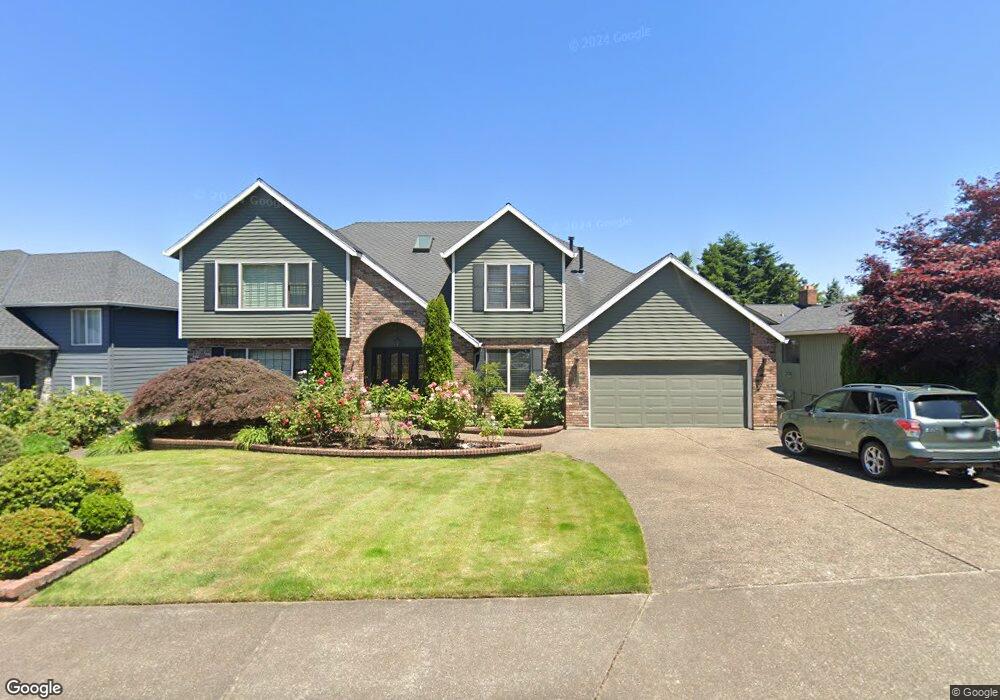
21220 Serango Dr West Linn, OR 97068
Rosemont Summit NeighborhoodEstimated Value: $1,150,000 - $1,300,000
5
Beds
4
Baths
4,808
Sq Ft
$251/Sq Ft
Est. Value
About This Home
This home is located at 21220 Serango Dr, West Linn, OR 97068 and is currently estimated at $1,208,873, approximately $251 per square foot. 21220 Serango Dr is a home located in Clackamas County with nearby schools including Bolton Primary School, West Linn High School, and Clackamas Academy of Industrial Sciences (CAIS).
Ownership History
Date
Name
Owned For
Owner Type
Purchase Details
Closed on
Apr 11, 2019
Sold by
Dupont Peggy L and Baker Carolyn S
Bought by
Baker Carolyn S and Dupont Peggy L
Current Estimated Value
Purchase Details
Closed on
May 11, 2012
Sold by
Legendre Robert J and Legendre Roberta L
Bought by
Dupont Peggy L and Baker Carolyn S
Home Financials for this Owner
Home Financials are based on the most recent Mortgage that was taken out on this home.
Original Mortgage
$200,000
Interest Rate
3.48%
Mortgage Type
New Conventional
Purchase Details
Closed on
Jun 12, 2001
Sold by
Sakach William and Sakach Peggy
Bought by
Legendre Robert J and Legendre Roberta
Home Financials for this Owner
Home Financials are based on the most recent Mortgage that was taken out on this home.
Original Mortgage
$275,000
Interest Rate
7.14%
Create a Home Valuation Report for This Property
The Home Valuation Report is an in-depth analysis detailing your home's value as well as a comparison with similar homes in the area
Home Values in the Area
Average Home Value in this Area
Purchase History
| Date | Buyer | Sale Price | Title Company |
|---|---|---|---|
| Baker Carolyn S | -- | None Available | |
| Dupont Peggy L | $700,000 | Fidelity Natl Title Of Or | |
| Legendre Robert J | $384,900 | Pacific Nw Title |
Source: Public Records
Mortgage History
| Date | Status | Borrower | Loan Amount |
|---|---|---|---|
| Previous Owner | Dupont Peggy L | $200,000 | |
| Previous Owner | Legendre Robert J | $275,000 |
Source: Public Records
Tax History Compared to Growth
Tax History
| Year | Tax Paid | Tax Assessment Tax Assessment Total Assessment is a certain percentage of the fair market value that is determined by local assessors to be the total taxable value of land and additions on the property. | Land | Improvement |
|---|---|---|---|---|
| 2025 | $13,841 | $718,232 | -- | -- |
| 2024 | $13,323 | $697,313 | -- | -- |
| 2023 | $13,323 | $677,003 | $0 | $0 |
| 2022 | $12,576 | $657,285 | $0 | $0 |
| 2021 | $11,849 | $638,141 | $0 | $0 |
| 2020 | $11,734 | $619,555 | $0 | $0 |
| 2019 | $11,250 | $601,510 | $0 | $0 |
| 2018 | $10,710 | $583,990 | $0 | $0 |
| 2017 | $10,103 | $566,981 | $0 | $0 |
| 2016 | $9,672 | $550,467 | $0 | $0 |
| 2015 | $9,286 | $534,434 | $0 | $0 |
| 2014 | $8,788 | $518,868 | $0 | $0 |
Source: Public Records
Map
Nearby Homes
- 4050 Serango Ct
- 20930 Fawn Ct Unit 26
- 5219 Summit St
- 2583 Pimlico Dr
- 2700 Underhill Ln Unit 1
- 2488 Tulane St
- 5128 Firwood Dr
- 1470 Rosemont Rd
- 4020 Ridge Ln
- 6403 Tompkins Ct
- 6345 Caufield St
- 20120 Larkspur Ln Unit 85
- 2343 Appaloosa Way
- 2764 Ridge Ln
- 1954 Buck St
- 20080 Larkspur Ln Unit 50
- 4057 Heron Dr
- 5062 Prospect St
- 4973 Summit St
- 20070 Larkspur Ln Unit 61
- 21170 Serango Dr
- 21240 Serango Dr
- 21150 Serango Dr
- 21260 Serango Dr
- 5530 Summit St
- 5540 Summit St
- 21235 Serango Dr
- 21255 Serango Dr
- 21215 Serango Dr
- 21175 Serango Dr
- 21130 Serango Dr
- 21280 Serango Dr
- 21265 Serango Dr
- 21151 Serango Dr
- 4341 Causey Way
- 4030 Serango Ct
- 5560 Summit St
- 21070 Serango Dr
- 21305 Serango Dr
- 4361 Causey Way