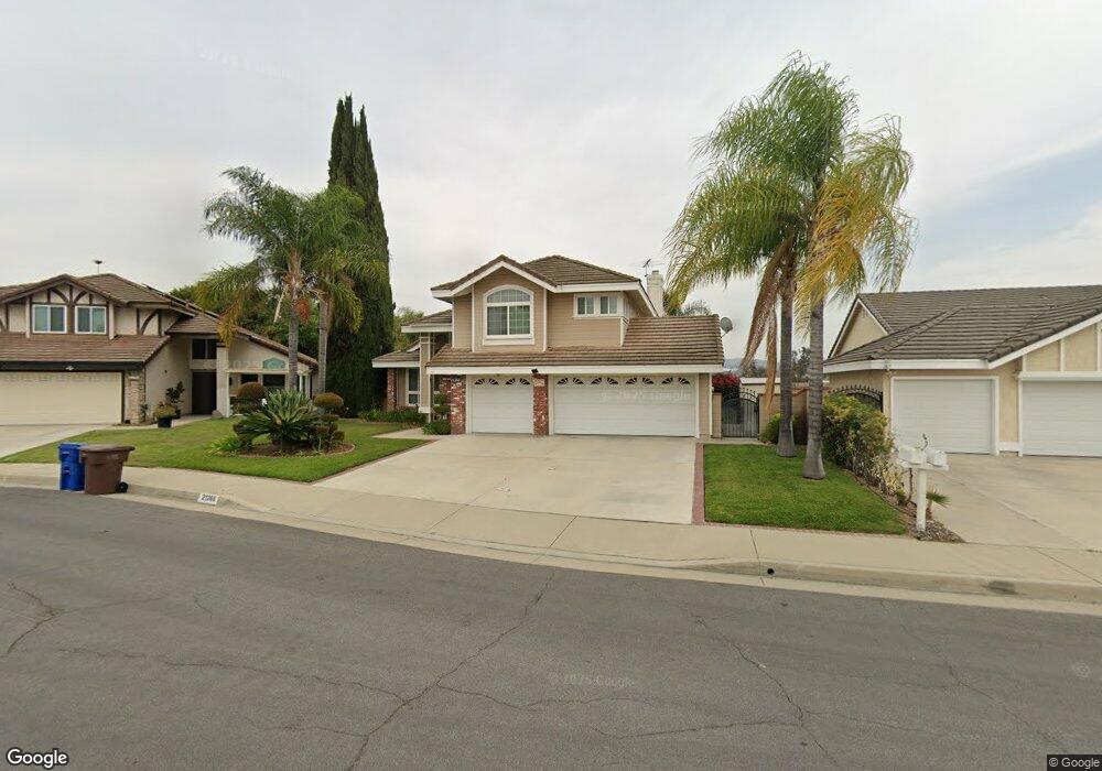
21266 Sundance St Walnut, CA 91789
Estimated Value: $1,165,187 - $1,387,000
5
Beds
3
Baths
2,197
Sq Ft
$597/Sq Ft
Est. Value
About This Home
This home is located at 21266 Sundance St, Walnut, CA 91789 and is currently estimated at $1,311,297, approximately $596 per square foot. 21266 Sundance St is a home located in Los Angeles County with nearby schools including Vejar Elementary School, Suzanne Middle School, and Walnut High School.
Ownership History
Date
Name
Owned For
Owner Type
Purchase Details
Closed on
Sep 2, 2015
Sold by
Kim Paul S and Kim Jaein
Bought by
Iskandar Susan E and The Paul & Jaein Kim Life Esta
Current Estimated Value
Purchase Details
Closed on
Apr 2, 2003
Sold by
Kim Paul S and Kim Jaein
Bought by
Kim Paul S and Kim Jaein
Home Financials for this Owner
Home Financials are based on the most recent Mortgage that was taken out on this home.
Original Mortgage
$188,000
Interest Rate
5.73%
Create a Home Valuation Report for This Property
The Home Valuation Report is an in-depth analysis detailing your home's value as well as a comparison with similar homes in the area
Home Values in the Area
Average Home Value in this Area
Purchase History
| Date | Buyer | Sale Price | Title Company |
|---|---|---|---|
| Iskandar Susan E | -- | None Available | |
| Kim Paul S | -- | Chicago Title Co |
Source: Public Records
Mortgage History
| Date | Status | Borrower | Loan Amount |
|---|---|---|---|
| Closed | Kim Paul S | $188,000 |
Source: Public Records
Tax History
| Year | Tax Paid | Tax Assessment Tax Assessment Total Assessment is a certain percentage of the fair market value that is determined by local assessors to be the total taxable value of land and additions on the property. | Land | Improvement |
|---|---|---|---|---|
| 2025 | $6,226 | $467,682 | $170,145 | $297,537 |
| 2024 | $6,226 | $458,512 | $166,809 | $291,703 |
| 2023 | $6,085 | $449,523 | $163,539 | $285,984 |
| 2022 | $5,966 | $440,710 | $160,333 | $280,377 |
| 2021 | $5,854 | $432,070 | $157,190 | $274,880 |
| 2019 | $5,682 | $419,257 | $152,529 | $266,728 |
| 2018 | $5,431 | $411,038 | $149,539 | $261,499 |
| 2016 | $5,051 | $395,079 | $143,733 | $251,346 |
| 2015 | $5,064 | $389,145 | $141,574 | $247,571 |
| 2014 | $5,084 | $381,523 | $138,801 | $242,722 |
Source: Public Records
Map
Nearby Homes
- 350 Foxboro Dr
- 351 Spur Trail Ave
- 21529 Magnolia St
- 708 Silver Valley Trail
- 0 Gartel Dr
- 22046 Florence Cir
- 221 Roma Ct
- 226 Roma Ct
- 22060 Florence Cir
- 21819 E Chestnut Ct
- 805 Silver Valley Trail
- 22049 Portofino Dr
- 21002 Cornerstone Dr
- 22097 Portofino Dr
- 22045 Tuscany Ct
- 22058 Manarola Way
- 22092 Portofino Dr
- 22060 Manarola Way
- 22055 Tuscany Ct
- 22100 Portofino Dr
- 21260 Sundance St
- 21270 Sundance St
- 359 Foxboro Dr
- 405 Foxboro Dr
- 21272 Sundance St
- 345 Foxboro Dr
- 21259 Sundance St
- 411 Foxboro Dr
- 21265 Sundance St
- 21271 Sundance St
- 21251 Sundance St
- 419 Foxboro Dr
- 388 Windemere Ln
- 368 Windemere Ln
- 21332 Spring St
- 21245 Sundance St
- 21324 Spring St
- 21388 Spring St
- 21262 Greenbrook Dr
- 364 Windemere Ln
Your Personal Tour Guide
Ask me questions while you tour the home.