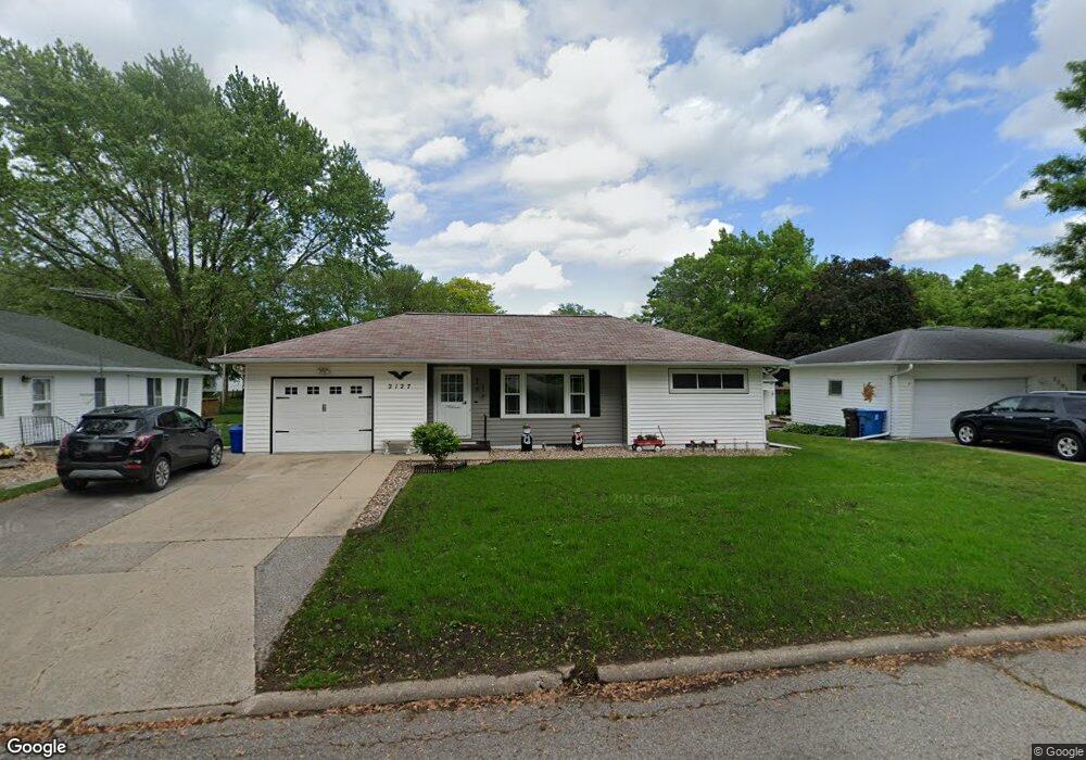
2127 W 8th St Waterloo, IA 50702
Liberty Park NeighborhoodEstimated Value: $158,000 - $167,000
2
Beds
2
Baths
1,038
Sq Ft
$156/Sq Ft
Est. Value
About This Home
This home is located at 2127 W 8th St, Waterloo, IA 50702 and is currently estimated at $161,422, approximately $155 per square foot. 2127 W 8th St is a home located in Black Hawk County with nearby schools including Kittrell Elementary School, Hoover Middle School, and West High School.
Ownership History
Date
Name
Owned For
Owner Type
Purchase Details
Closed on
Aug 10, 2023
Sold by
Meron Kathy
Bought by
Landau Jane
Current Estimated Value
Purchase Details
Closed on
Feb 18, 2020
Sold by
Landau Jane and Estate Of Betty Flood
Bought by
Landau Jane and Meron Kathy
Purchase Details
Closed on
Feb 17, 2020
Sold by
Landau Jane and Meron Kathy
Bought by
Landau Jane and Meron Kathy
Create a Home Valuation Report for This Property
The Home Valuation Report is an in-depth analysis detailing your home's value as well as a comparison with similar homes in the area
Home Values in the Area
Average Home Value in this Area
Purchase History
| Date | Buyer | Sale Price | Title Company |
|---|---|---|---|
| Landau Jane | -- | None Listed On Document | |
| Landau Jane | -- | None Listed On Document | |
| Landau Jane | -- | None Available | |
| Landau Jane | -- | None Available |
Source: Public Records
Tax History
| Year | Tax Paid | Tax Assessment Tax Assessment Total Assessment is a certain percentage of the fair market value that is determined by local assessors to be the total taxable value of land and additions on the property. | Land | Improvement |
|---|---|---|---|---|
| 2025 | $2,856 | $167,220 | $27,300 | $139,920 |
| 2024 | $2,856 | $155,570 | $27,300 | $128,270 |
| 2023 | $2,452 | $155,570 | $27,300 | $128,270 |
| 2022 | $2,576 | $120,490 | $27,300 | $93,190 |
| 2021 | $2,486 | $120,490 | $27,300 | $93,190 |
| 2020 | $2,174 | $109,740 | $21,450 | $88,290 |
| 2019 | $2,174 | $109,740 | $21,450 | $88,290 |
| 2018 | $2,178 | $109,740 | $21,450 | $88,290 |
| 2017 | $2,250 | $109,740 | $21,450 | $88,290 |
| 2016 | $2,216 | $109,740 | $21,450 | $88,290 |
| 2015 | $2,216 | $109,740 | $21,450 | $88,290 |
| 2014 | $2,146 | $104,830 | $21,450 | $83,380 |
Source: Public Records
Map
Nearby Homes
- 922 E Mitchell Ave
- 1103 Easton Ave
- 1107 E Mitchell Ave
- 819 Easton Ave
- 814 E Mitchell Ave
- 1141 E Mitchell Ave
- 1150 Easton Ave
- 2425 Randolph St
- 2527 Randolph St
- 2547 W 9th St
- 1809 Baltimore St
- 1171 Liberty Ave
- 1219 Hammond Ave
- 1002 E Ridgeway Ave
- 812 Hawthorne Ave
- 1433 Liberty Ave
- 1115 Hawthorne Ave
- 2506 Laurel St
- 1191 Lindner Dr
- 1017 Forest Ave
- 2119 W 8th St
- 2201 W 8th St
- 2209 W 8th St
- 2126 W 9th St
- 2120 W 9th St
- 937 Cornwall Ave
- 936 Cornwall Ave
- 2206 W 9th St
- 2110 W 9th St
- 933 Cornwall Ave
- 2217 W 8th St
- 2200 W 9th St
- 936 Bourland Ave
- 2210 W 9th St
- 928 Cornwall Ave
- 925 Cornwall Ave
- 932 Bourland Ave
- 2223 W 8th St
- 2100 W 9th St
- 928 Bourland Ave
Your Personal Tour Guide
Ask me questions while you tour the home.