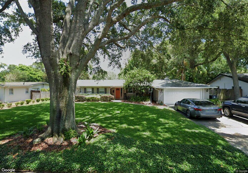
2128 Fosgate Dr Winter Park, FL 32789
Estimated Value: $625,286 - $846,000
4
Beds
2
Baths
1,704
Sq Ft
$427/Sq Ft
Est. Value
About This Home
This home is located at 2128 Fosgate Dr, Winter Park, FL 32789 and is currently estimated at $726,822, approximately $426 per square foot. 2128 Fosgate Dr is a home located in Orange County with nearby schools including Audubon Park School, Winter Park High, and Central Florida Leadership Academy Charter.
Ownership History
Date
Name
Owned For
Owner Type
Purchase Details
Closed on
Dec 12, 2008
Sold by
Shaffer Robin L
Bought by
Austin Ian A and Austin Heather O
Current Estimated Value
Home Financials for this Owner
Home Financials are based on the most recent Mortgage that was taken out on this home.
Original Mortgage
$283,882
Interest Rate
6.1%
Mortgage Type
FHA
Purchase Details
Closed on
Aug 30, 2001
Sold by
Henry L Abbott M and Virginia M Abbott M
Bought by
Shaffer Robin L
Home Financials for this Owner
Home Financials are based on the most recent Mortgage that was taken out on this home.
Original Mortgage
$157,500
Interest Rate
7.08%
Mortgage Type
New Conventional
Create a Home Valuation Report for This Property
The Home Valuation Report is an in-depth analysis detailing your home's value as well as a comparison with similar homes in the area
Home Values in the Area
Average Home Value in this Area
Purchase History
| Date | Buyer | Sale Price | Title Company |
|---|---|---|---|
| Austin Ian A | $310,000 | None Available | |
| Shaffer Robin L | $175,000 | -- |
Source: Public Records
Mortgage History
| Date | Status | Borrower | Loan Amount |
|---|---|---|---|
| Previous Owner | Austin Ian A | $283,882 | |
| Previous Owner | Shaffer Robin L | $159,300 | |
| Previous Owner | Shaffer Robin L | $20,000 | |
| Previous Owner | Shaffer Robin L | $157,500 |
Source: Public Records
Tax History Compared to Growth
Tax History
| Year | Tax Paid | Tax Assessment Tax Assessment Total Assessment is a certain percentage of the fair market value that is determined by local assessors to be the total taxable value of land and additions on the property. | Land | Improvement |
|---|---|---|---|---|
| 2025 | $3,394 | $254,767 | -- | -- |
| 2024 | $3,249 | $254,767 | -- | -- |
| 2023 | $3,249 | $240,376 | $0 | $0 |
| 2022 | $2,995 | $233,375 | $0 | $0 |
| 2021 | $2,953 | $226,578 | $0 | $0 |
| 2020 | $2,836 | $223,450 | $0 | $0 |
| 2019 | $5,110 | $313,222 | $190,000 | $123,222 |
| 2018 | $2,904 | $214,353 | $0 | $0 |
| 2017 | $2,871 | $274,317 | $165,000 | $109,317 |
| 2016 | $2,809 | $272,278 | $165,000 | $107,278 |
| 2015 | $2,876 | $264,739 | $154,000 | $110,739 |
| 2014 | $2,900 | $259,531 | $171,000 | $88,531 |
Source: Public Records
Map
Nearby Homes
- 2129 Fosgate Dr
- 1981 Blue Ridge Rd
- 640 Arjay Way
- 2823 Wright Ave
- 2260 Mulbry Dr
- 2905 Parkland Dr
- 3856 Lower Park Rd Unit 4
- 2979 Upper Park Rd
- 3632 Upper Union Rd
- 1268 Preserve Point Dr
- 2128 Sycamore Dr
- 1408 Chapman Cir
- 1429 Chapman Cir
- 2098 Osprey Ave
- 3025 Northwood Blvd
- 3018 Northwood Blvd
- 620 Virginia Dr
- 2825 Mulford Ave
- 3704 Lower Union Rd
- 2614 Parkland Dr
- 2204 Fosgate Dr
- 2120 Fosgate Dr
- 2210 Fosgate Dr
- 2203 Fosgate Dr
- 2121 Fosgate Dr
- 2211 Fosgate Dr
- 2218 Fosgate Dr
- 2104 Fosgate Dr
- 2218 Drive
- 2113 Fosgate Dr
- 2219 Fosgate Dr
- 2126 Howard Dr
- 2202 Howard Dr
- 2118 Howard Dr
- 2208 Howard Dr
- 2026 Fosgate Dr
- 2226 Fosgate Dr
- 665 Randy Ln
- 2110 Howard Dr
- 2216 Howard Dr