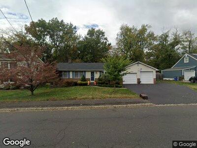
2129 W Broad St Scotch Plains, NJ 07076
Estimated Value: $532,946 - $1,099,000
--
Bed
--
Bath
1,496
Sq Ft
$534/Sq Ft
Est. Value
About This Home
This home is located at 2129 W Broad St, Scotch Plains, NJ 07076 and is currently estimated at $798,737, approximately $533 per square foot. 2129 W Broad St is a home located in Union County with nearby schools including William J. McGinn Elementary School, Terrill Middle School, and Scotch Plains-Fanwood High School.
Ownership History
Date
Name
Owned For
Owner Type
Purchase Details
Closed on
Apr 19, 2011
Sold by
Kickenweitz Richard
Bought by
Kickenweitz Ellen
Current Estimated Value
Home Financials for this Owner
Home Financials are based on the most recent Mortgage that was taken out on this home.
Original Mortgage
$238,000
Interest Rate
4.82%
Mortgage Type
New Conventional
Create a Home Valuation Report for This Property
The Home Valuation Report is an in-depth analysis detailing your home's value as well as a comparison with similar homes in the area
Home Values in the Area
Average Home Value in this Area
Purchase History
| Date | Buyer | Sale Price | Title Company |
|---|---|---|---|
| Kickenweitz Ellen | $121,333 | Chicago Title Insurance Co |
Source: Public Records
Mortgage History
| Date | Status | Borrower | Loan Amount |
|---|---|---|---|
| Closed | Kickenweitz Ellen | $232,900 | |
| Closed | Kickenweitz Ellen | $238,000 |
Source: Public Records
Tax History Compared to Growth
Tax History
| Year | Tax Paid | Tax Assessment Tax Assessment Total Assessment is a certain percentage of the fair market value that is determined by local assessors to be the total taxable value of land and additions on the property. | Land | Improvement |
|---|---|---|---|---|
| 2024 | $14,253 | $124,800 | $33,000 | $91,800 |
| 2023 | $14,253 | $124,800 | $33,000 | $91,800 |
| 2022 | $14,084 | $124,800 | $33,000 | $91,800 |
| 2021 | $14,060 | $124,800 | $33,000 | $91,800 |
| 2020 | $13,993 | $124,800 | $33,000 | $91,800 |
| 2019 | $13,889 | $124,800 | $33,000 | $91,800 |
| 2018 | $13,656 | $124,800 | $33,000 | $91,800 |
| 2017 | $13,352 | $124,800 | $33,000 | $91,800 |
| 2016 | $13,095 | $124,800 | $33,000 | $91,800 |
| 2015 | $12,881 | $124,800 | $33,000 | $91,800 |
| 2014 | $12,456 | $124,800 | $33,000 | $91,800 |
Source: Public Records
Map
Nearby Homes
- 119 Lamberts Mill Rd
- 770 Austin St
- 2042 W Broad St
- 731 1st St
- 717 1st St
- 210 Hazel Ave
- 2221 Elizabeth Ave
- 834 Shackamaxon Dr
- 520 Dorian Ct
- 530 Hort St
- 2212 Shady Ln
- 2381 Whittier Ave
- 2397 Channing Ave
- 1661 Cooper Rd
- 56 Rambling Dr
- 527 Coleman Place
- 1700 King St
- 6 Shady Ln
- 654 North Ave W
- 23 Beech Ave
- 2129 W Broad St
- 2123 W Broad St
- 2135 W Broad St
- 2119 W Broad St
- 2143 W Broad St
- 1314 Hetfield Ave
- 2128 W Broad St
- 2132 W Broad St
- 1306 Hetfield Ave
- 2140 W Broad St
- 2120 W Broad St
- 1300 Hetfield Ave
- 55 Berkeley Terrace
- 2154 W Broad St
- 1323 Hetfield Ave
- 30 Fieldcrest Dr
- 28 Fieldcrest Dr
- 1315 Hetfield Ave
- 1311 Hetfield Ave
- 11 Oxford Rd