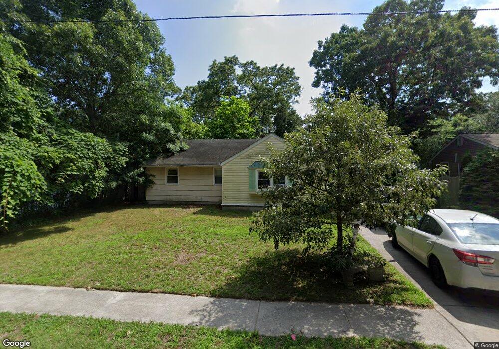
213 Davis Ave Linwood, NJ 08221
Estimated Value: $381,510 - $498,000
--
Bed
--
Bath
1,634
Sq Ft
$278/Sq Ft
Est. Value
About This Home
This home is located at 213 Davis Ave, Linwood, NJ 08221 and is currently estimated at $454,378, approximately $278 per square foot. 213 Davis Ave is a home located in Atlantic County with nearby schools including Seaview Elementary School, Belhaven Middle School, and Mainland Regional High School.
Ownership History
Date
Name
Owned For
Owner Type
Purchase Details
Closed on
Mar 4, 1998
Sold by
Duffy Mary G
Bought by
Kelly Patricia Grace
Current Estimated Value
Purchase Details
Closed on
Jan 20, 1998
Sold by
Hanlon John J and Hanlon Cathy L
Bought by
Duffy Mary G
Purchase Details
Closed on
May 3, 1996
Sold by
Hanlon Cathy L
Bought by
Hanlon John J and Hanlon Cathy L
Home Financials for this Owner
Home Financials are based on the most recent Mortgage that was taken out on this home.
Original Mortgage
$110,000
Interest Rate
7%
Purchase Details
Closed on
Apr 19, 1993
Sold by
Venters William B
Bought by
Hanlon Cathy L
Create a Home Valuation Report for This Property
The Home Valuation Report is an in-depth analysis detailing your home's value as well as a comparison with similar homes in the area
Home Values in the Area
Average Home Value in this Area
Purchase History
| Date | Buyer | Sale Price | Title Company |
|---|---|---|---|
| Kelly Patricia Grace | -- | -- | |
| Duffy Mary G | $154,900 | Lawrence Abstract Company | |
| Hanlon John J | -- | Congress Title Corp | |
| Hanlon Cathy L | $138,000 | -- |
Source: Public Records
Mortgage History
| Date | Status | Borrower | Loan Amount |
|---|---|---|---|
| Previous Owner | Hanlon John J | $110,000 |
Source: Public Records
Tax History Compared to Growth
Tax History
| Year | Tax Paid | Tax Assessment Tax Assessment Total Assessment is a certain percentage of the fair market value that is determined by local assessors to be the total taxable value of land and additions on the property. | Land | Improvement |
|---|---|---|---|---|
| 2025 | $8,450 | $221,500 | $102,500 | $119,000 |
| 2024 | $8,450 | $221,500 | $102,500 | $119,000 |
| 2023 | $8,058 | $221,500 | $102,500 | $119,000 |
| 2022 | $8,058 | $221,500 | $102,500 | $119,000 |
| 2021 | $7,987 | $221,500 | $102,500 | $119,000 |
| 2020 | $7,877 | $221,500 | $102,500 | $119,000 |
| 2019 | $7,708 | $221,500 | $102,500 | $119,000 |
| 2018 | $7,535 | $221,500 | $102,500 | $119,000 |
| 2017 | $7,385 | $221,500 | $102,500 | $119,000 |
| 2016 | $7,137 | $221,500 | $102,500 | $119,000 |
| 2015 | $7,143 | $221,500 | $102,500 | $119,000 |
| 2014 | $6,894 | $222,400 | $102,500 | $119,900 |
Source: Public Records
Map
Nearby Homes
- 110 W Poplar Ave
- 104 W Poplar Ave
- 309 Haines Ave
- 605 Shore Rd
- 803 Shore Rd
- 301 Wabash Ave
- 500 Davis Ave
- 901 Oak Ave
- 105 W Edgewood Ave
- 550 G-16 Central Ave
- 1050 Shore Rd
- 550 Central Ave Unit B1
- 550 Central Ave Unit G-16 Constitution Ct
- 550 Central Ave Unit E-14
- 550 Central Ave Unit I-7
- 2 Sandy Ct
- 1011 New Rd
- 911 Bartlett Ave
- 622 Central Ave
- 1005 Bartlett Ave