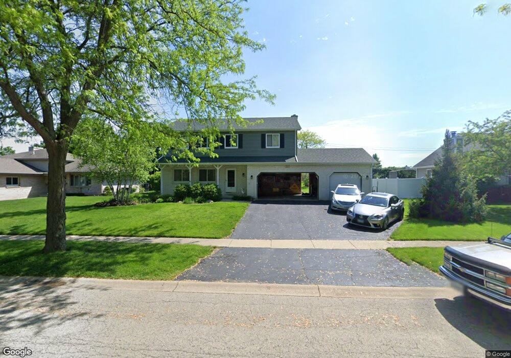
213 Deerpath Dr Unit 2 Oswego, IL 60543
Northwest Oswego NeighborhoodEstimated Value: $366,000 - $409,373
4
Beds
3
Baths
2,211
Sq Ft
$177/Sq Ft
Est. Value
About This Home
This home is located at 213 Deerpath Dr Unit 2, Oswego, IL 60543 and is currently estimated at $391,593, approximately $177 per square foot. 213 Deerpath Dr Unit 2 is a home located in Kendall County with nearby schools including Fox Chase Elementary School, Traughber Junior High School, and Oswego High School.
Ownership History
Date
Name
Owned For
Owner Type
Purchase Details
Closed on
Jun 3, 1999
Sold by
Williams Ricky E and Williams Sarah S
Bought by
Trybek Anthony M and Trybek Donna
Current Estimated Value
Home Financials for this Owner
Home Financials are based on the most recent Mortgage that was taken out on this home.
Original Mortgage
$153,000
Interest Rate
7.69%
Purchase Details
Closed on
Aug 31, 1993
Bought by
Williams Rick E
Create a Home Valuation Report for This Property
The Home Valuation Report is an in-depth analysis detailing your home's value as well as a comparison with similar homes in the area
Home Values in the Area
Average Home Value in this Area
Purchase History
| Date | Buyer | Sale Price | Title Company |
|---|---|---|---|
| Trybek Anthony M | $175,000 | -- | |
| Williams Ricky E | -- | -- | |
| Williams Rick E | $148,700 | -- |
Source: Public Records
Mortgage History
| Date | Status | Borrower | Loan Amount |
|---|---|---|---|
| Previous Owner | Trybek Anthony M | $153,000 | |
| Closed | Williams Rick E | -- |
Source: Public Records
Tax History
| Year | Tax Paid | Tax Assessment Tax Assessment Total Assessment is a certain percentage of the fair market value that is determined by local assessors to be the total taxable value of land and additions on the property. | Land | Improvement |
|---|---|---|---|---|
| 2024 | $8,979 | $117,577 | $14,485 | $103,092 |
| 2023 | $8,155 | $104,979 | $12,933 | $92,046 |
| 2022 | $8,155 | $96,311 | $11,865 | $84,446 |
| 2021 | $8,021 | $91,725 | $11,300 | $80,425 |
| 2020 | $8,014 | $90,817 | $11,188 | $79,629 |
| 2019 | $7,919 | $88,498 | $11,188 | $77,310 |
| 2018 | $7,655 | $87,010 | $11,000 | $76,010 |
| 2017 | $7,213 | $76,357 | $6,623 | $69,734 |
| 2016 | $6,995 | $73,253 | $17,007 | $56,246 |
| 2015 | $6,545 | $65,994 | $15,322 | $50,672 |
| 2014 | -- | $62,259 | $14,455 | $47,804 |
| 2013 | -- | $62,888 | $14,601 | $48,287 |
Source: Public Records
Map
Nearby Homes
- 123 Fox Chase Dr S
- 404 Beaver Ct Unit 3
- 116 River Mist Dr
- 2110 State Route 31
- 135 River Mist Dr Unit 2
- 133 River Mist Dr Unit 3
- 2240 State Route 31
- 505 Parkland Ct
- 1415 State Route 31
- 303 Fox Chase Dr N
- 125 Presidential Blvd Unit 3248
- 2300 Light Rd Unit 209
- 2600 Light Rd Unit 210
- 2600 Light Rd Unit 207
- 187 Eisenhower Dr
- 435 Fawn Dr
- 316 Ash Grove Ln
- 238 Cooney Way
- 239 Cooney Way
- 403 Tanya Ln
- 211 Deerpath Dr
- 215 Deerpath Dr
- 209 Deerpath Dr
- 217 Deerpath Dr Unit 2
- 214 Deerpath Dr
- 212 Deerpath Dr Unit 2
- 216 Deerpath Dr Unit 2
- 210 Deerpath Dr
- 413 Badger Ln Unit 5
- 207 Deerpath Dr
- 219 Deerpath Dr
- 411 Badger Ln
- 415 Badger Ln
- 218 Whitetail Crossing
- 417 Badger Ln Unit 5
- 409 Badger Ln
- 208 Deerpath Dr
- 226 Whitetail Crossing
- 205 Deerpath Dr
- 221 Deerpath Dr
Your Personal Tour Guide
Ask me questions while you tour the home.