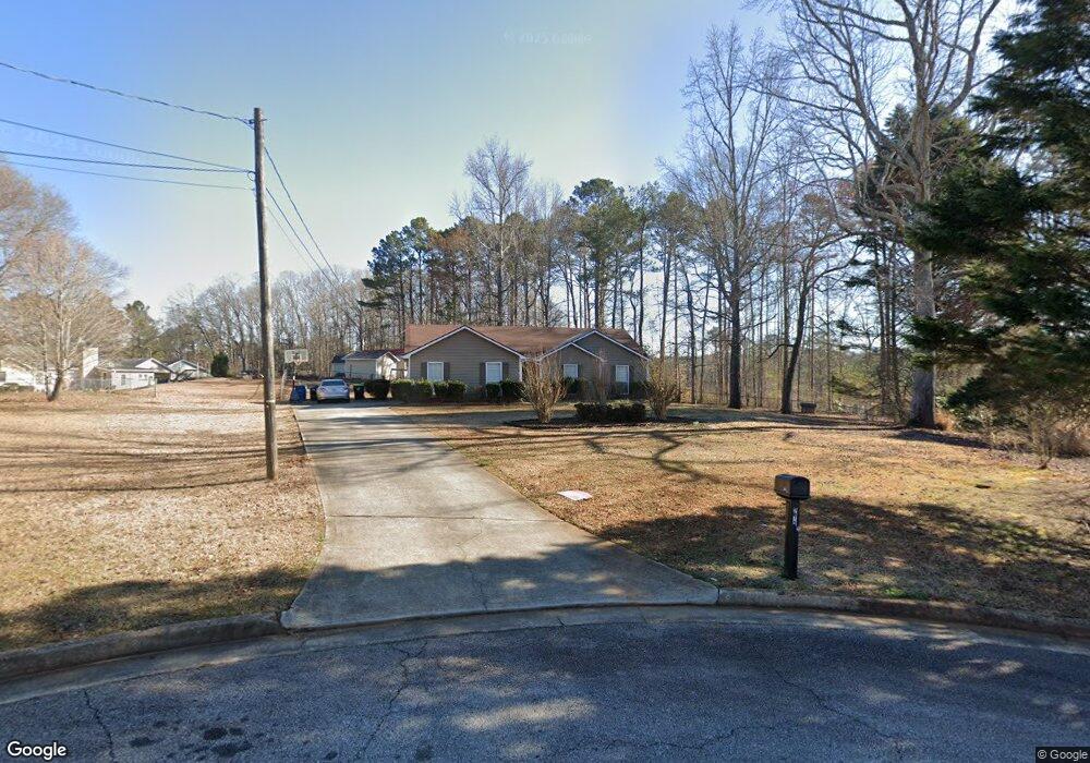
213 Forest Place Unit 2 Stockbridge, GA 30281
Estimated Value: $228,000 - $252,000
3
Beds
2
Baths
1,424
Sq Ft
$170/Sq Ft
Est. Value
About This Home
This home is located at 213 Forest Place Unit 2, Stockbridge, GA 30281 and is currently estimated at $241,786, approximately $169 per square foot. 213 Forest Place Unit 2 is a home located in Henry County with nearby schools including Austin Road Elementary School, Austin Road Middle School, and Woodland High School.
Ownership History
Date
Name
Owned For
Owner Type
Purchase Details
Closed on
Feb 26, 2003
Sold by
Oliver Phillip M
Bought by
Corbettt Lakeesha M
Current Estimated Value
Home Financials for this Owner
Home Financials are based on the most recent Mortgage that was taken out on this home.
Original Mortgage
$109,250
Outstanding Balance
$46,550
Interest Rate
5.88%
Mortgage Type
New Conventional
Estimated Equity
$195,236
Create a Home Valuation Report for This Property
The Home Valuation Report is an in-depth analysis detailing your home's value as well as a comparison with similar homes in the area
Home Values in the Area
Average Home Value in this Area
Purchase History
| Date | Buyer | Sale Price | Title Company |
|---|---|---|---|
| Corbettt Lakeesha M | $115,000 | -- |
Source: Public Records
Mortgage History
| Date | Status | Borrower | Loan Amount |
|---|---|---|---|
| Open | Corbettt Lakeesha M | $109,250 |
Source: Public Records
Tax History Compared to Growth
Tax History
| Year | Tax Paid | Tax Assessment Tax Assessment Total Assessment is a certain percentage of the fair market value that is determined by local assessors to be the total taxable value of land and additions on the property. | Land | Improvement |
|---|---|---|---|---|
| 2025 | $2,675 | $99,080 | $12,000 | $87,080 |
| 2024 | $2,675 | $91,600 | $12,000 | $79,600 |
| 2023 | $2,186 | $95,880 | $10,000 | $85,880 |
| 2022 | $2,009 | $67,040 | $10,000 | $57,040 |
| 2021 | $1,646 | $51,680 | $10,000 | $41,680 |
| 2020 | $1,563 | $48,160 | $6,000 | $42,160 |
| 2019 | $1,499 | $45,440 | $6,000 | $39,440 |
| 2018 | $1,454 | $43,920 | $6,000 | $37,920 |
| 2016 | $1,101 | $34,720 | $6,000 | $28,720 |
| 2015 | $925 | $29,680 | $6,000 | $23,680 |
| 2014 | $901 | $28,880 | $4,800 | $24,080 |
Source: Public Records
Map
Nearby Homes
- 80 Sandy Dr
- 176 Fairoaks Cir
- 106 Garden Trail
- 25 Mendy Ln
- 6733 Highway 155 N
- 130 Fairview Dr
- 116 Kalsum Trail
- 4241 Hearn Rd
- 120 Bunnie Trail
- 460 Ward Rd
- 510 Ward Rd Unit 1
- 203 Farmbrook Pkwy
- 429 Saint Surrey Way
- 0 Kingsbrook Dr Unit 19 LOTS 10399843
- 204 Benefield Ct
- 500 Saint Sambar Dr
- 313 Ashborough Place
- 5520 Hearn Rd
- 209 Forest Place
- 216 Forest Place
- 440 Manor Estates Dr
- 444 Manor Estates Dr
- 436 Manor Estates Dr Unit 2
- 205 Forest Place
- 212 Forest Place
- 208 Forest Place
- 201 Forest Place Unit 2
- 0 Austin Oaks Dr Unit 224 8223391
- 0 Austin Oaks Dr Unit 8273256
- 0 Austin Oaks Dr Unit 3261673
- 0 Austin Oaks Dr Unit 3282910
- 0 Austin Oaks Dr Unit 7055132
- 0 Austin Oaks Dr Unit 7640116
- 0 Austin Oaks Dr Unit 8054488
- 0 Austin Oaks Dr Unit 8157182
- 0 Austin Oaks Dr Unit 8311721
- 0 Austin Oaks Dr Unit 8676569
- 204 Forest Place