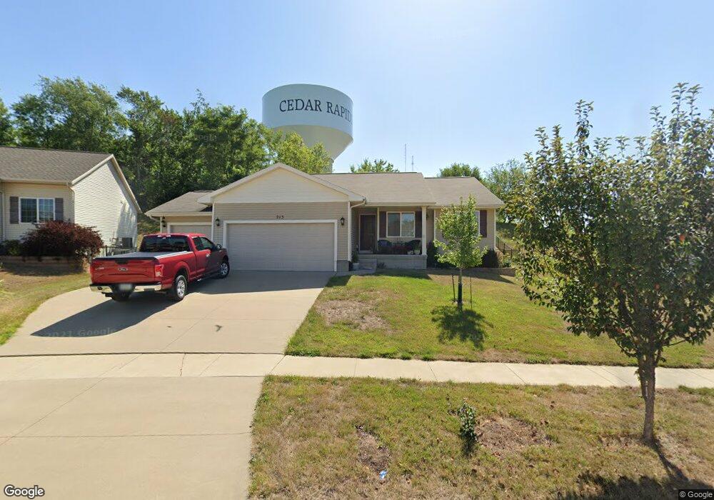
213 Gas Light Ct SW Cedar Rapids, IA 52404
Lincolnway Village NeighborhoodEstimated Value: $309,000 - $341,000
3
Beds
2
Baths
1,347
Sq Ft
$245/Sq Ft
Est. Value
About This Home
This home is located at 213 Gas Light Ct SW, Cedar Rapids, IA 52404 and is currently estimated at $329,876, approximately $244 per square foot. 213 Gas Light Ct SW is a home located in Linn County with nearby schools including Prairie Heights Elementary School, Prairie Crest Elementary School, and Prairie View Elementary School.
Ownership History
Date
Name
Owned For
Owner Type
Purchase Details
Closed on
May 15, 2012
Sold by
Jerrys Homes Inc
Bought by
Harper Shawn R
Current Estimated Value
Home Financials for this Owner
Home Financials are based on the most recent Mortgage that was taken out on this home.
Original Mortgage
$193,171
Outstanding Balance
$133,776
Interest Rate
3.89%
Mortgage Type
VA
Estimated Equity
$196,100
Create a Home Valuation Report for This Property
The Home Valuation Report is an in-depth analysis detailing your home's value as well as a comparison with similar homes in the area
Home Values in the Area
Average Home Value in this Area
Purchase History
| Date | Buyer | Sale Price | Title Company |
|---|---|---|---|
| Harper Shawn R | $187,000 | None Available |
Source: Public Records
Mortgage History
| Date | Status | Borrower | Loan Amount |
|---|---|---|---|
| Open | Harper Shawn R | $193,171 |
Source: Public Records
Tax History Compared to Growth
Tax History
| Year | Tax Paid | Tax Assessment Tax Assessment Total Assessment is a certain percentage of the fair market value that is determined by local assessors to be the total taxable value of land and additions on the property. | Land | Improvement |
|---|---|---|---|---|
| 2025 | $5,098 | $308,100 | $87,500 | $220,600 |
| 2024 | $5,342 | $295,100 | $82,800 | $212,300 |
| 2023 | $5,342 | $295,100 | $82,800 | $212,300 |
| 2022 | $4,910 | $253,400 | $71,000 | $182,400 |
| 2021 | $5,210 | $238,300 | $66,200 | $172,100 |
| 2020 | $5,210 | $240,700 | $66,200 | $174,500 |
| 2019 | $4,736 | $222,900 | $48,400 | $174,500 |
| 2018 | $4,600 | $222,900 | $48,400 | $174,500 |
| 2017 | $4,195 | $204,600 | $32,800 | $171,800 |
| 2016 | $4,195 | $197,200 | $32,800 | $164,400 |
| 2015 | $4,067 | $192,317 | $32,818 | $159,499 |
| 2014 | $3,880 | $187,000 | $32,818 | $154,182 |
| 2013 | $3,572 | $187,000 | $32,818 | $154,182 |
Source: Public Records
Map
Nearby Homes
- 6620 Preston Terrace Ct SW
- 51 Oklahoma Ave SW
- 62 Oklahoma Ave SW
- 5655 Deerwood St SW
- 49 Devonwood Ave SW
- 5750 J St SW
- 5600 Klinger St SW
- 7006 Colpepper Dr SW
- 6812 Artesa Bell Dr SW
- 142 Brighton Cir SW
- 0 6th St & 76th Ave SW Unit 202505956
- 6612 Artesa Bell Dr SW
- 7113 Chenango Ln SW
- 8515 Aldridge Dr SW
- 137 Woodstone Ln SW
- 107 Woodstone Ln SW
- 121 Woodstone Ln SW
- 160 Bethany Loop SW Unit A
- 160 Bethany Loop SW Unit C
- 160 Bethany Loop SW Unit B
- 207 Gas Light Ct SW
- 201 Gas Light Ct SW
- 208 Gas Light Ct SW
- 119 Gas Light Ct SW
- 214 Gas Light Ct SW
- 202 Gas Light Ct SW
- 7013 Rolling Ridge Dr SW
- 7007 Rolling Ridge Dr SW
- 7001 Rolling Ridge Dr SW
- 120 Gas Light Ct SW
- 7103 Rolling Ridge Dr SW
- 113 Gas Light Ct SW
- 6935 Rolling Ridge Ct SW
- 7109 Rolling Ridge Dr SW
- 6929 Rolling Ridge Ct SW
- 7115 Rolling Ridge Dr SW
- 6923 Rolling Ridge Ct SW
- 107 Gas Light Ct SW
- 114 Gas Light Ct SW
- 108 Gas Light Ct SW