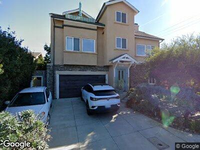
213 Normandy Ln Unit 15 Carlsbad, CA 92008
Estimated Value: $1,939,389 - $4,245,000
4
Beds
3
Baths
2,072
Sq Ft
$1,541/Sq Ft
Est. Value
About This Home
This home is located at 213 Normandy Ln Unit 15, Carlsbad, CA 92008 and is currently estimated at $3,193,597, approximately $1,541 per square foot. 213 Normandy Ln Unit 15 is a home located in San Diego County with nearby schools including Buena Vista Elementary, Carlsbad High School, and Sage Creek High.
Ownership History
Date
Name
Owned For
Owner Type
Purchase Details
Closed on
Aug 15, 1997
Sold by
Yoder Patricia A
Bought by
Myers John P and Myers Cynthia J
Current Estimated Value
Home Financials for this Owner
Home Financials are based on the most recent Mortgage that was taken out on this home.
Original Mortgage
$105,000
Interest Rate
7.43%
Purchase Details
Closed on
Oct 4, 1995
Sold by
Yoder Carrol E
Bought by
Myers John P and Myers Cynthia J
Create a Home Valuation Report for This Property
The Home Valuation Report is an in-depth analysis detailing your home's value as well as a comparison with similar homes in the area
Home Values in the Area
Average Home Value in this Area
Purchase History
| Date | Buyer | Sale Price | Title Company |
|---|---|---|---|
| Myers John P | -- | Commonwealth Land Title Co |
Source: Public Records
Mortgage History
| Date | Status | Borrower | Loan Amount |
|---|---|---|---|
| Closed | Myers John P | $385,579 | |
| Closed | Myers John P | $417,000 | |
| Closed | Myers John P | $500,000 | |
| Closed | Myers John P | $421,000 | |
| Closed | Myers John P | $105,000 |
Source: Public Records
Tax History Compared to Growth
Tax History
| Year | Tax Paid | Tax Assessment Tax Assessment Total Assessment is a certain percentage of the fair market value that is determined by local assessors to be the total taxable value of land and additions on the property. | Land | Improvement |
|---|---|---|---|---|
| 2024 | $4,040 | $378,403 | $156,751 | $221,652 |
| 2023 | $4,017 | $370,984 | $153,678 | $217,306 |
| 2022 | $3,954 | $363,711 | $150,665 | $213,046 |
| 2021 | $3,924 | $356,580 | $147,711 | $208,869 |
| 2020 | $3,897 | $352,925 | $146,197 | $206,728 |
| 2019 | $3,826 | $346,006 | $143,331 | $202,675 |
| 2018 | $3,666 | $339,222 | $140,521 | $198,701 |
| 2017 | $90 | $332,571 | $137,766 | $194,805 |
| 2016 | $3,459 | $326,051 | $135,065 | $190,986 |
| 2015 | $3,444 | $321,155 | $133,037 | $188,118 |
| 2014 | $3,387 | $314,865 | $130,431 | $184,434 |
Source: Public Records
Map
Nearby Homes
- 2333 Ocean St
- 79 St Malo Unit 79
- 2511 State St
- 2677 Garfield St
- 2677 State St Unit 301
- 2648 State St Unit E
- 2646 State St Unit D
- 2687 State St
- 2747 Ocean St
- 580 Laguna Dr
- 2778 Carlsbad Blvd Unit 201
- 2662 Roosevelt St
- 2664 Roosevelt St
- 2672 Roosevelt St
- 2682 Roosevelt St
- 58 Saint Malo Beach
- 2049 S Pacific St
- 3075 Carlsbad Blvd Unit week 37
- 3328 "A" Roosevelt St
- 2475 Jefferson St
- 213 Normandy Ln Unit 15
- 202 Pacific Ave
- 222 Pacific Ave Unit A
- 222 Pacific Ave
- 2424 Garfield St
- 219 Normandy Ln
- 226 Normandy Ln
- 224 Normandy Ln Unit 26
- 230 Pacific Ave
- 2485 Garfield St
- 221 Normandy Ln
- 164 Pacific Ave
- 2390 Ocean St
- 240 Pacific Ave
- 228 Normandy Ln
- 2380-82 Ocean St
- 2382 Ocean St Unit B
- 2382 Ocean St
- 2455 Garfield St
- 2445 Garfield St