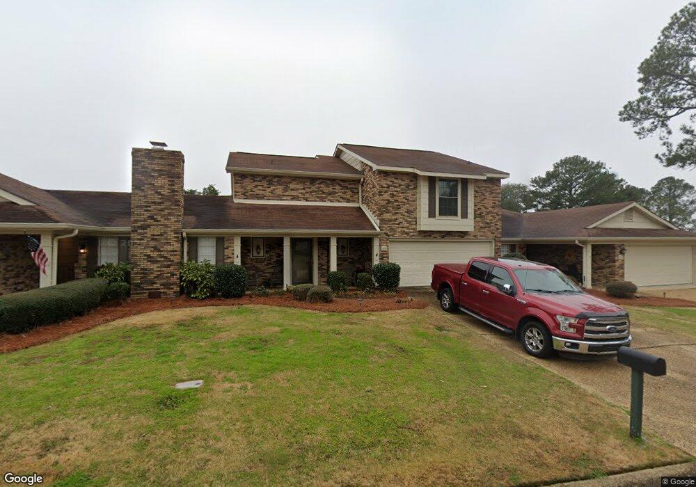
213 Old Oak Cir Unit 213 Brandon, MS 39042
Estimated Value: $205,000 - $223,000
3
Beds
3
Baths
1,741
Sq Ft
$123/Sq Ft
Est. Value
About This Home
This home is located at 213 Old Oak Cir Unit 213, Brandon, MS 39042 and is currently estimated at $213,362, approximately $122 per square foot. 213 Old Oak Cir Unit 213 is a home located in Rankin County with nearby schools including Rouse Elementary School, Brandon Elementary School, and Stonebridge Elementary School.
Ownership History
Date
Name
Owned For
Owner Type
Purchase Details
Closed on
Mar 4, 2019
Sold by
Petyak James J
Bought by
Petyak Michael J
Current Estimated Value
Purchase Details
Closed on
Jun 30, 2014
Sold by
Joan B Joan B
Bought by
Petyak James J and Petyak Rosann
Home Financials for this Owner
Home Financials are based on the most recent Mortgage that was taken out on this home.
Original Mortgage
$30,000
Interest Rate
3.28%
Mortgage Type
New Conventional
Purchase Details
Closed on
Nov 28, 2005
Sold by
Murdoff Gerald D and Murdoff Jacqueline L
Bought by
Moreno Joan B
Create a Home Valuation Report for This Property
The Home Valuation Report is an in-depth analysis detailing your home's value as well as a comparison with similar homes in the area
Home Values in the Area
Average Home Value in this Area
Purchase History
| Date | Buyer | Sale Price | Title Company |
|---|---|---|---|
| Petyak Michael J | -- | -- | |
| Petyak James J | -- | -- | |
| Moreno Joan B | -- | Title & Escrow Services, Inc |
Source: Public Records
Mortgage History
| Date | Status | Borrower | Loan Amount |
|---|---|---|---|
| Previous Owner | Petyak James J | $30,000 |
Source: Public Records
Tax History Compared to Growth
Tax History
| Year | Tax Paid | Tax Assessment Tax Assessment Total Assessment is a certain percentage of the fair market value that is determined by local assessors to be the total taxable value of land and additions on the property. | Land | Improvement |
|---|---|---|---|---|
| 2024 | $1,675 | $15,131 | $0 | $0 |
| 2023 | $413 | $11,892 | $0 | $0 |
| 2022 | $409 | $11,892 | $0 | $0 |
| 2021 | $409 | $11,892 | $0 | $0 |
| 2020 | $409 | $11,892 | $0 | $0 |
| 2019 | $417 | $10,667 | $0 | $0 |
| 2018 | $411 | $10,667 | $0 | $0 |
| 2017 | $411 | $10,667 | $0 | $0 |
| 2016 | $341 | $10,323 | $0 | $0 |
| 2015 | $341 | $10,323 | $0 | $0 |
| 2014 | $335 | $10,323 | $0 | $0 |
| 2013 | -- | $10,323 | $0 | $0 |
Source: Public Records
Map
Nearby Homes
- 168 Pleasant Grove Dr
- 30 Crossgates Dr
- 426 Lakebend Place
- 69 Terrapin Dr
- 189 Lakebend Cir
- 11 Terrapin Hill Rd S
- 192 Lakebend Cir
- 79 Terrapin Dr
- 623 Corbett Dr
- 0 Cross Park Dr
- 225 Burnham Rd
- 22 Fox Glen Cove
- 26 Woodgate Dr
- 60 Summit Ridge Dr
- 117 Springtree Dr
- Lot C Park Place Cove
- Lot B Park Place Cove
- 70 Crossgates Dr
- 28 Rockford Ct
- 123 Woodgate Dr
- 213 Old Oak Cir
- 211 Old Oak Cir
- 215 Old Oak Cir
- 188 Pleasant Grove Dr
- 186 Pleasant Grove Dr
- 217 Old Oak Cir
- 184 Pleasant Grove Dr
- 144 Pleasant Grove Dr
- 190 Pleasant Grove Dr
- 146 Pleasant Grove Dr
- 219 Old Oak Cir
- 148 Pleasant Grove Dr
- 142 Pleasant Grove Dr
- 111 Longbranch Dr
- 150 Pleasant Grove Dr
- 182 Pleasant Grove Dr
- 180 Pleasant Grove Dr
- 140 Pleasant Grove Dr
- 206 Old Oak Cir
- 225 Old Oak Cir