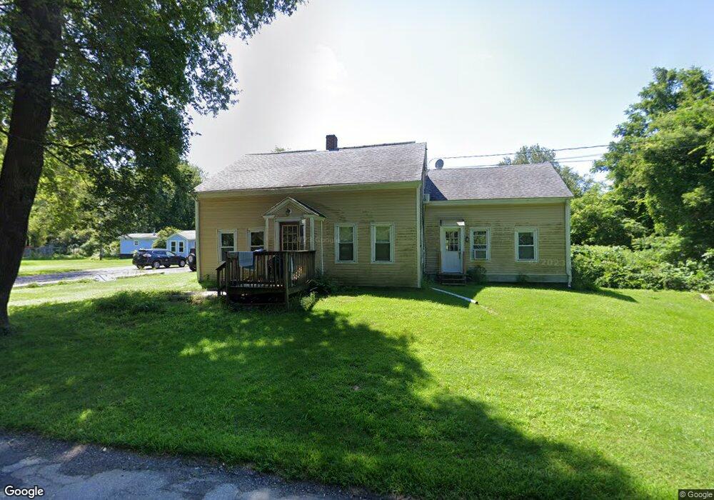
213 Porter Plain Rd Thompson, CT 06277
Estimated Value: $382,381 - $446,000
4
Beds
2
Baths
1,910
Sq Ft
$218/Sq Ft
Est. Value
About This Home
This home is located at 213 Porter Plain Rd, Thompson, CT 06277 and is currently estimated at $417,095, approximately $218 per square foot. 213 Porter Plain Rd is a home located in Windham County with nearby schools including Mary R. Fisher Elementary School, Thompson Middle School, and Tourtellotte Memorial High School.
Ownership History
Date
Name
Owned For
Owner Type
Purchase Details
Closed on
May 14, 2024
Sold by
Lyon Talia and Gaboury Deborah A
Bought by
Gaboury Ft and Lyon
Current Estimated Value
Create a Home Valuation Report for This Property
The Home Valuation Report is an in-depth analysis detailing your home's value as well as a comparison with similar homes in the area
Home Values in the Area
Average Home Value in this Area
Purchase History
| Date | Buyer | Sale Price | Title Company |
|---|---|---|---|
| Gaboury Ft | -- | None Available | |
| Gaboury Ft | -- | None Available | |
| Gaboury Ft | -- | None Available | |
| Lyon Talia | -- | None Available | |
| Lyon Talia | -- | None Available |
Source: Public Records
Tax History
| Year | Tax Paid | Tax Assessment Tax Assessment Total Assessment is a certain percentage of the fair market value that is determined by local assessors to be the total taxable value of land and additions on the property. | Land | Improvement |
|---|---|---|---|---|
| 2025 | $4,155 | $218,700 | $50,500 | $168,200 |
| 2024 | $3,845 | $136,800 | $33,400 | $103,400 |
| 2023 | $3,557 | $136,800 | $33,400 | $103,400 |
| 2022 | $3,423 | $136,800 | $33,400 | $103,400 |
| 2021 | $3,413 | $136,800 | $33,400 | $103,400 |
| 2020 | $3,315 | $136,800 | $33,400 | $103,400 |
| 2019 | $2,978 | $107,300 | $34,800 | $72,500 |
| 2018 | $2,978 | $107,300 | $34,800 | $72,500 |
| 2017 | $2,796 | $107,300 | $34,800 | $72,500 |
| 2016 | $2,796 | $107,300 | $34,800 | $72,500 |
| 2015 | $2,661 | $107,300 | $34,800 | $72,500 |
| 2014 | $2,639 | $115,400 | $42,400 | $73,000 |
Source: Public Records
Map
Nearby Homes
- 597 E Thompson Rd Unit Lot 10C
- 117 New Rd
- 121 New Rd
- 0 Porter Plain Rd
- 2 Mary Rd
- 1350 Thompson Rd
- 24 Cooper Rd
- 13 S Point Rd
- 16 Hilltop Dr
- 171 Upper Gore Rd
- 151 Brandy Hill Rd
- 53-55 Point Pleasant Rd
- 361 Pasay Rd
- 0 Thompson Rd
- 27 Ash St
- 14 Indian Run Dr
- 69 Sunset Hill Rd
- 10 Indian Point Rd
- 125 Birch Island Rd
- 0 Wilsonville Rd Unit 24140220
- 223 Porter Plain Rd
- 200 Porter Plain Rd
- 203 Porter Plain Rd
- 233 Porter Plain Rd
- 190 Porter Plain Rd
- 191 Porter Plain Rd
- 248 Porter Plain Rd
- 245 Porter Plain Rd
- 172 Porter Plain Rd
- 177 Porter Plain Rd
- 169 Porter Plain Rd
- 510 E Thompson Rd
- 340 Sand Dam Rd
- 324 Sand Dam Rd
- 354 Sand Dam Rd
- 362 Sand Dam Rd
- 370 Sand Dam Rd
- 145 Porter Plain Rd
- 273 Porter Plain Rd
- 306 Sand Dam Rd
Your Personal Tour Guide
Ask me questions while you tour the home.