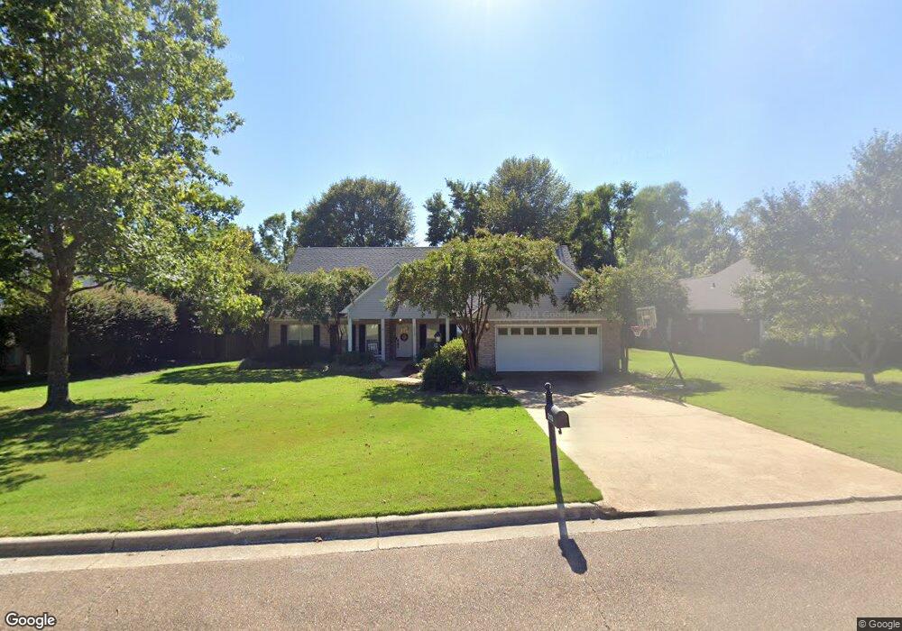
213 Powers Dr Oxford, MS 38655
Estimated Value: $365,000 - $468,000
3
Beds
2
Baths
2,599
Sq Ft
$166/Sq Ft
Est. Value
About This Home
This home is located at 213 Powers Dr, Oxford, MS 38655 and is currently estimated at $430,223, approximately $165 per square foot. 213 Powers Dr is a home located in Lafayette County with nearby schools including Bramlett Elementary School, Della Davidson Elementary School, and Central Elementary School.
Ownership History
Date
Name
Owned For
Owner Type
Purchase Details
Closed on
Mar 8, 2019
Sold by
Baker Allen B and Baker Brandy Michelle
Bought by
Thomas Scott K and Thomas Carley J
Current Estimated Value
Home Financials for this Owner
Home Financials are based on the most recent Mortgage that was taken out on this home.
Original Mortgage
$228,920
Outstanding Balance
$201,260
Interest Rate
4.4%
Mortgage Type
New Conventional
Estimated Equity
$228,963
Create a Home Valuation Report for This Property
The Home Valuation Report is an in-depth analysis detailing your home's value as well as a comparison with similar homes in the area
Home Values in the Area
Average Home Value in this Area
Purchase History
| Date | Buyer | Sale Price | Title Company |
|---|---|---|---|
| Thomas Scott K | -- | None Available |
Source: Public Records
Mortgage History
| Date | Status | Borrower | Loan Amount |
|---|---|---|---|
| Open | Thomas Scott K | $228,920 |
Source: Public Records
Tax History Compared to Growth
Tax History
| Year | Tax Paid | Tax Assessment Tax Assessment Total Assessment is a certain percentage of the fair market value that is determined by local assessors to be the total taxable value of land and additions on the property. | Land | Improvement |
|---|---|---|---|---|
| 2024 | $1,876 | $21,701 | $0 | $0 |
| 2023 | $1,876 | $21,701 | $0 | $0 |
| 2022 | $2,524 | $21,701 | $0 | $0 |
| 2021 | $630 | $21,701 | $0 | $0 |
| 2020 | $536 | $19,614 | $0 | $0 |
| 2019 | $1,028 | $29,421 | $0 | $0 |
| 2018 | $1,028 | $29,421 | $0 | $0 |
| 2017 | $1,028 | $29,421 | $0 | $0 |
| 2016 | $469 | $18,366 | $0 | $0 |
| 2015 | -- | $18,366 | $0 | $0 |
| 2014 | -- | $18,366 | $0 | $0 |
Source: Public Records
Map
Nearby Homes
- 303 Ward Cove
- 405 Whitney Cove
- 202 Powers Dr
- 121 Peyton Cir
- 326 Russell Dr
- 201 Tanner Dr
- 477 Pea Ridge Rd
- 465 Pea Ridge Rd
- 457 Pea Ridge Rd
- 290 Highway 7s
- 3416 Baker Ln
- 3420 Baker Ln
- 3401 Southern Way
- 3418 Baker Ln
- 3422 Baker Ln
- 3403 Southern Way
- 3405 Southern Way
- 4927 S Lamar Blvd
- 638 Cottage Grove Dr
- 636 Cottage Grove Dr