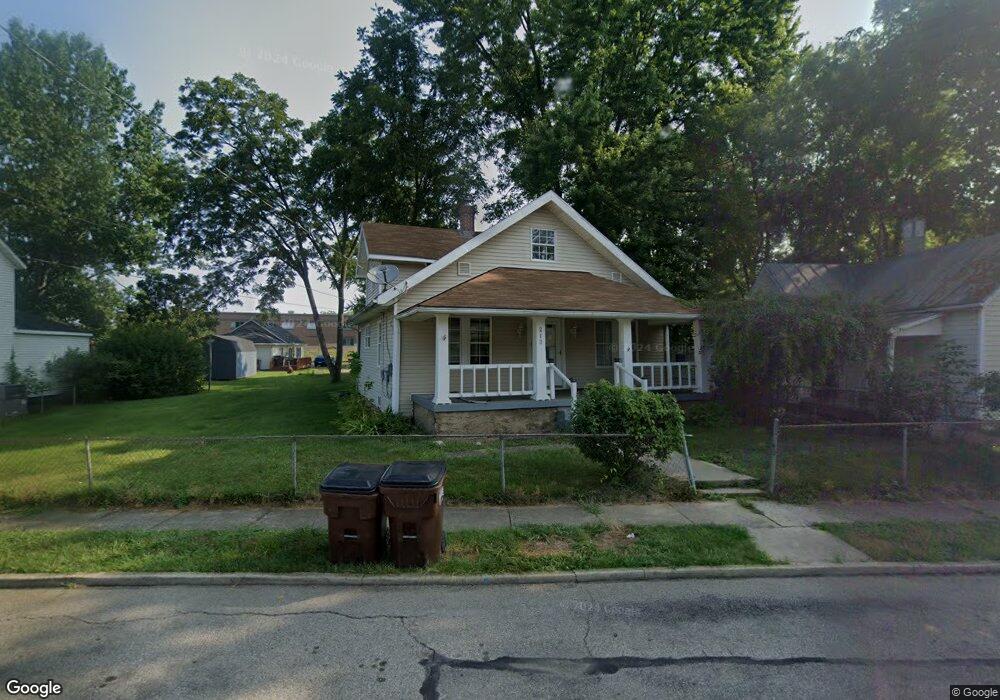
213 Roberts Ave Franklin, OH 45005
Estimated Value: $111,000 - $128,348
3
Beds
1
Bath
1,193
Sq Ft
$102/Sq Ft
Est. Value
About This Home
This home is located at 213 Roberts Ave, Franklin, OH 45005 and is currently estimated at $121,337, approximately $101 per square foot. 213 Roberts Ave is a home located in Warren County with nearby schools including Franklin High School.
Ownership History
Date
Name
Owned For
Owner Type
Purchase Details
Closed on
Mar 16, 2023
Sold by
Burt William T
Bought by
Overton Joe J
Current Estimated Value
Home Financials for this Owner
Home Financials are based on the most recent Mortgage that was taken out on this home.
Original Mortgage
$86,400
Outstanding Balance
$83,271
Interest Rate
6.09%
Mortgage Type
New Conventional
Estimated Equity
$38,066
Create a Home Valuation Report for This Property
The Home Valuation Report is an in-depth analysis detailing your home's value as well as a comparison with similar homes in the area
Home Values in the Area
Average Home Value in this Area
Purchase History
| Date | Buyer | Sale Price | Title Company |
|---|---|---|---|
| Overton Joe J | $90,000 | Wave Title |
Source: Public Records
Mortgage History
| Date | Status | Borrower | Loan Amount |
|---|---|---|---|
| Open | Overton Joe J | $86,400 | |
| Closed | Overton Joe J | $4,500 |
Source: Public Records
Tax History
| Year | Tax Paid | Tax Assessment Tax Assessment Total Assessment is a certain percentage of the fair market value that is determined by local assessors to be the total taxable value of land and additions on the property. | Land | Improvement |
|---|---|---|---|---|
| 2025 | $1,721 | $36,590 | $7,110 | $29,480 |
| 2024 | $1,721 | $36,590 | $7,110 | $29,480 |
| 2023 | $1,473 | $28,091 | $4,032 | $24,059 |
| 2022 | $931 | $28,091 | $4,032 | $24,059 |
| 2021 | $876 | $28,091 | $4,032 | $24,059 |
| 2020 | $705 | $22,295 | $3,199 | $19,096 |
| 2019 | $622 | $22,295 | $3,199 | $19,096 |
| 2018 | $607 | $22,295 | $3,199 | $19,096 |
| 2017 | $654 | $21,119 | $3,077 | $18,043 |
| 2016 | $668 | $21,119 | $3,077 | $18,043 |
| 2015 | $334 | $21,119 | $3,077 | $18,043 |
| 2014 | $718 | $21,120 | $3,080 | $18,040 |
| 2013 | $604 | $24,430 | $3,560 | $20,870 |
Source: Public Records
Map
Nearby Homes
- 218 Roberts Ave
- 139 E 6th St
- 1200 Riley Blvd
- 7189 Shaker Rd
- 0 Kathy Ln Unit 1834240
- 0 Kathy Ln Unit 930066
- 627 S River St
- 0 E 4th St
- 1117 S Main St
- 5684 Olive Rd
- 388 Thomas Dr
- 202 E 2nd St
- 309 Oxford Rd
- 210 N Riley Blvd
- 205 Oxford Rd
- 5 S River St
- 760 David Blvd
- 747 David Blvd
- 410 Park Ave
- 409 Millard Dr
- 215 Roberts Ave
- 211 Roberts Ave
- 219 Roberts Ave
- 739 Harrison Ave
- 209 Roberts Ave
- 210 Roberts Ave
- 737 Harrison Ave
- 207 Roberts Ave
- 212 Roberts Ave
- 208 Roberts Ave
- 214 Roberts Ave
- 216 Roberts Ave
- 200 Roberts Ave
- 740 Clark St
- 742 Clark St
- 806 Clark St
- 220 Roberts Ave
- 738 Clark St
- 738 Harrison Ave
- 740 Harrison Ave
Your Personal Tour Guide
Ask me questions while you tour the home.