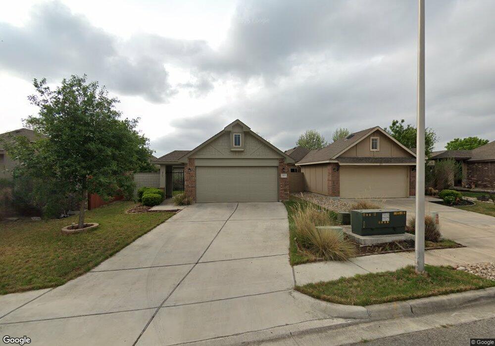
213 Rock Bluff Ln San Marcos, TX 78666
Blanco River District NeighborhoodEstimated Value: $289,140 - $354,000
--
Bed
--
Bath
1,565
Sq Ft
$204/Sq Ft
Est. Value
About This Home
This home is located at 213 Rock Bluff Ln, San Marcos, TX 78666 and is currently estimated at $319,785, approximately $204 per square foot. 213 Rock Bluff Ln is a home with nearby schools including Blanco Vista Elementary School, Laura B Wallace Middle School, and Jack C Hays High School.
Ownership History
Date
Name
Owned For
Owner Type
Purchase Details
Closed on
Feb 27, 2014
Sold by
Pacesetter Homes Llc
Bought by
Nevarez James D and Nevarez Amber
Current Estimated Value
Home Financials for this Owner
Home Financials are based on the most recent Mortgage that was taken out on this home.
Original Mortgage
$195,918
Outstanding Balance
$149,229
Interest Rate
4.47%
Mortgage Type
New Conventional
Estimated Equity
$170,556
Create a Home Valuation Report for This Property
The Home Valuation Report is an in-depth analysis detailing your home's value as well as a comparison with similar homes in the area
Home Values in the Area
Average Home Value in this Area
Purchase History
| Date | Buyer | Sale Price | Title Company |
|---|---|---|---|
| Nevarez James D | -- | None Available |
Source: Public Records
Mortgage History
| Date | Status | Borrower | Loan Amount |
|---|---|---|---|
| Open | Nevarez James D | $195,918 |
Source: Public Records
Tax History Compared to Growth
Tax History
| Year | Tax Paid | Tax Assessment Tax Assessment Total Assessment is a certain percentage of the fair market value that is determined by local assessors to be the total taxable value of land and additions on the property. | Land | Improvement |
|---|---|---|---|---|
| 2025 | $5,737 | $312,670 | $81,420 | $231,250 |
| 2024 | $5,737 | $317,164 | $88,500 | $254,370 |
| 2023 | $6,245 | $288,331 | $88,500 | $252,630 |
| 2022 | $6,177 | $262,119 | $75,000 | $252,510 |
| 2021 | $6,014 | $238,290 | $54,600 | $183,690 |
| 2020 | $5,632 | $223,180 | $54,600 | $168,580 |
| 2019 | $6,440 | $239,390 | $31,500 | $207,890 |
| 2018 | $6,204 | $230,000 | $31,500 | $198,500 |
| 2017 | $5,821 | $221,340 | $31,500 | $189,840 |
| 2016 | $5,469 | $207,970 | $31,500 | $176,470 |
| 2015 | $4,649 | $189,570 | $31,500 | $158,070 |
Source: Public Records
Map
Nearby Homes
- 234 Rock Bluff Ln
- 226 Pincea Place
- 126 Preston Trail
- 3210 Jacob Ln
- 2836 Jacob Ln
- 318 Leather Oak Loop
- 105 Leather Oak Loop
- 214 Alford St
- 235 Hay Barn
- 228 Durata
- 814 Jesse Trail
- 134 Friendship Oak Dr
- 106 Mossycup Dr
- 107 Friendship Oak Dr
- 660 Blue Oak Blvd
- 130 Farm House Rd
- 634 Irvin Dr
- 3105 Brand Iron Dr
- 120 Witchhazel Way
- 102 Wainscot Oak Way
- 217 Rock Bluff Ln
- 209 Rock Bluff Ln
- 221 Rock Bluff Ln
- 205 Rock Bluff Ln
- 225 Rock Bluff Ln
- 201 Rock Bluff Ln
- 133 Rock Bluff Ln
- 229 Rock Bluff Ln
- 129 Rock Bluff Ln
- 218 Rock Bluff Ln
- 222 Rock Bluff Ln
- 166 Preston Trail
- 233 Rock Bluff Ln
- 226 Rock Bluff Ln
- 125 Rock Bluff Ln
- 217 Pincea Place
- 221 Pincea Place
- 162 Preston Trail
- 230 Rock Bluff Ln
- 213 Pincea Place