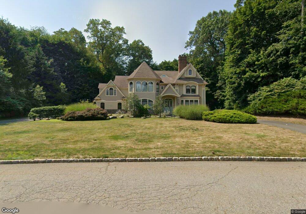
213 Stokes Farm Rd Franklin Lakes, NJ 07417
Estimated Value: $2,507,000 - $3,053,295
--
Bed
--
Bath
6,977
Sq Ft
$402/Sq Ft
Est. Value
About This Home
This home is located at 213 Stokes Farm Rd, Franklin Lakes, NJ 07417 and is currently estimated at $2,807,074, approximately $402 per square foot. 213 Stokes Farm Rd is a home located in Bergen County with nearby schools including High Mountain Road Elementary School, Franklin Avenue Middle School, and Ramapo High School.
Ownership History
Date
Name
Owned For
Owner Type
Purchase Details
Closed on
Mar 27, 2024
Sold by
Blanchfield Michael
Bought by
Michael F Blanchfield Revocable Living Trust and Blanchfield
Current Estimated Value
Purchase Details
Closed on
Feb 13, 1995
Sold by
Urban Farms Inc
Bought by
Blanchfield Michael and Blanchfield Carol
Create a Home Valuation Report for This Property
The Home Valuation Report is an in-depth analysis detailing your home's value as well as a comparison with similar homes in the area
Home Values in the Area
Average Home Value in this Area
Purchase History
| Date | Buyer | Sale Price | Title Company |
|---|---|---|---|
| Michael F Blanchfield Revocable Living Trust | -- | None Listed On Document | |
| Michael F Blanchfield Revocable Living Trust | -- | None Listed On Document | |
| Blanchfield Michael | $420,000 | -- |
Source: Public Records
Tax History Compared to Growth
Tax History
| Year | Tax Paid | Tax Assessment Tax Assessment Total Assessment is a certain percentage of the fair market value that is determined by local assessors to be the total taxable value of land and additions on the property. | Land | Improvement |
|---|---|---|---|---|
| 2025 | $32,125 | $1,788,700 | $503,600 | $1,285,100 |
| 2024 | $30,945 | $1,788,700 | $503,600 | $1,285,100 |
| 2023 | $29,907 | $1,788,700 | $503,600 | $1,285,100 |
| 2022 | $30,157 | $1,788,700 | $503,600 | $1,285,100 |
| 2021 | $29,478 | $1,788,700 | $503,600 | $1,285,100 |
| 2020 | $29,478 | $1,788,700 | $503,600 | $1,285,100 |
| 2019 | $29,370 | $1,788,700 | $503,600 | $1,285,100 |
| 2018 | $29,066 | $1,788,700 | $503,600 | $1,285,100 |
| 2017 | $29,263 | $1,788,700 | $503,600 | $1,285,100 |
| 2016 | $29,353 | $1,788,700 | $503,600 | $1,285,100 |
| 2015 | $28,351 | $1,788,700 | $503,600 | $1,285,100 |
| 2014 | $27,868 | $1,788,700 | $503,600 | $1,285,100 |
Source: Public Records
Map
Nearby Homes
- 847 Apache Rd
- 587 High Mountain Rd
- 865 Olentangy Rd
- 907 Scioto Dr
- 912 Cherokee Ln
- 740 Van Houten Ave
- 620 Grandview Terrace
- 951 Scioto Dr
- 6 Northwood Dr
- 510 Sicomac Ave
- 311 Algonquin Rd
- 212 Seminole Ln
- 259 Indian Trail Dr
- 732 Terrace Heights
- 223 Terrace Rd
- 340 Indian Trail Dr
- 240 Ottowa Ln
- 356 Indian Trail Dr
- 265 Terrace Rd
- 707 Black Hawk Ln
- 209 Stokes Farm Rd
- 694 Yuma Ct
- 217 Stokes Farm Rd
- 302 Water View Dr
- 686 Yuma Ct
- 645 High Mountain Rd
- 221 Stokes Farm Rd
- 205 Stokes Farm Rd
- 301 Water View Dr
- 306 Water View Dr
- 210 Stokes Farm Rd
- 693 Yuma Ct
- 643 High Mountain Rd
- 685 Yuma Ct
- 218 Stokes Farm Rd
- 201 Stokes Farm Rd
- 668 High Mountain Rd
- 676 High Mountain Rd
- 660 High Mountain Rd
- 222 Stokes Farm Rd