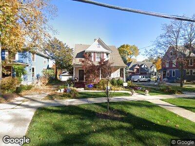
213 Vincent Place Elgin, IL 60123
Grant Park NeighborhoodEstimated Value: $317,086 - $367,000
3
Beds
1
Bath
1,924
Sq Ft
$176/Sq Ft
Est. Value
About This Home
This home is located at 213 Vincent Place, Elgin, IL 60123 and is currently estimated at $338,772, approximately $176 per square foot. 213 Vincent Place is a home located in Kane County with nearby schools including Highland Elementary School, Kimball Middle School, and Larkin High School.
Ownership History
Date
Name
Owned For
Owner Type
Purchase Details
Closed on
Jan 4, 2021
Sold by
Tepleton Jean S and Shartow Jean I
Bought by
Templeton Jean S and The Jean Templeton Living Trus
Current Estimated Value
Purchase Details
Closed on
Aug 16, 1995
Sold by
Templeton Jean S
Bought by
Crosby John J and Crosby Karen M
Create a Home Valuation Report for This Property
The Home Valuation Report is an in-depth analysis detailing your home's value as well as a comparison with similar homes in the area
Home Values in the Area
Average Home Value in this Area
Purchase History
| Date | Buyer | Sale Price | Title Company |
|---|---|---|---|
| Templeton Jean S | -- | Attorney | |
| Crosby John J | -- | -- |
Source: Public Records
Mortgage History
| Date | Status | Borrower | Loan Amount |
|---|---|---|---|
| Open | Templeton Jean S | $170,600 | |
| Closed | Templeton Jean S | $181,000 | |
| Closed | Templeton Jean S | $45,000 | |
| Closed | Templeton Jean S | $200,000 | |
| Closed | Templeston Jeans | $163,990 | |
| Closed | Templeton Jean S | $163,800 | |
| Closed | Templeton Jean S | $28,000 |
Source: Public Records
Tax History Compared to Growth
Tax History
| Year | Tax Paid | Tax Assessment Tax Assessment Total Assessment is a certain percentage of the fair market value that is determined by local assessors to be the total taxable value of land and additions on the property. | Land | Improvement |
|---|---|---|---|---|
| 2023 | $6,357 | $90,572 | $17,314 | $73,258 |
| 2022 | $6,220 | $82,736 | $15,937 | $66,799 |
| 2021 | $5,920 | $77,352 | $14,900 | $62,452 |
| 2020 | $5,732 | $73,844 | $14,224 | $59,620 |
| 2019 | $5,542 | $70,341 | $13,549 | $56,792 |
| 2018 | $5,464 | $66,266 | $12,764 | $53,502 |
| 2017 | $5,312 | $62,646 | $12,067 | $50,579 |
| 2016 | $5,025 | $58,119 | $11,195 | $46,924 |
| 2015 | -- | $53,271 | $10,261 | $43,010 |
| 2014 | -- | $52,613 | $10,134 | $42,479 |
| 2013 | -- | $54,000 | $10,401 | $43,599 |
Source: Public Records
Map
Nearby Homes
- 30 Lynch St
- Lot N Alfred Ave
- 433 N Worth Ave
- 624 South St
- 114 Mallery Ave
- 209 N Melrose Ave
- 118 Jewett St
- 6 N Melrose Ave
- 4 N Melrose Ave
- 507 Wing Park Blvd
- 425 N Melrose Ave
- 1220 Demmond St
- 315 Vandalia St
- 221 Heine Ave
- 333 Gertrude St Unit 333
- 50 S Grove Ave Unit 510
- 170 S Clifton Ave
- 362 Heine Ave
- 70 S Weston Ave
- Lot 305 Wyrenwood Cir
- 213 Vincent Place
- 217 Vincent Place
- 814 W Highland Ave Unit 16
- 225 Vincent Place
- 216 Hamilton Ave
- 220 Hamilton Ave
- 806 W Highland Ave
- 226 Hamilton Ave
- 856 W Highland Ave
- 214 Vincent Place
- 228 Hamilton Ave
- 220 Vincent Place
- 855 Mill St
- 864 W Highland Ave
- 788 W Highland Ave
- 250 Hamilton Ave
- 820 Mill St
- 816 Mill St
- 221 Hamilton Ave
- 863 Mill St