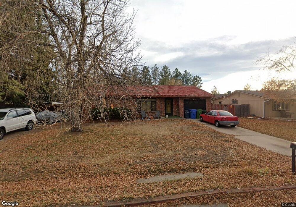
2131 Primrose Dr Fort Collins, CO 80526
Estimated Value: $434,293 - $520,000
3
Beds
1
Bath
1,107
Sq Ft
$415/Sq Ft
Est. Value
About This Home
This home is located at 2131 Primrose Dr, Fort Collins, CO 80526 and is currently estimated at $459,823, approximately $415 per square foot. 2131 Primrose Dr is a home located in Larimer County with nearby schools including Olander Elementary School, Blevins Middle School, and Rocky Mountain High School.
Ownership History
Date
Name
Owned For
Owner Type
Purchase Details
Closed on
Nov 18, 2010
Sold by
Garcia Bernice M
Bought by
Ruegge Robert H
Current Estimated Value
Purchase Details
Closed on
May 5, 1970
Sold by
Allied Mortgage Investments Inc
Bought by
Garcia Bernice M
Purchase Details
Closed on
May 10, 1968
Sold by
Peterson G Frederic G and Peterson Mildred A
Bought by
Allied Mortgage Investments Inc
Purchase Details
Closed on
Dec 3, 1965
Sold by
Sparks Robert Allen and Sparks Donna Beth
Bought by
Peterson G Frederic G and Peterson Mildred A
Purchase Details
Closed on
May 11, 1965
Sold by
Fitzpatrick Peterson G and Fitzpatrick Mildred A
Bought by
Sparks Robert Allen and Sparks Donna Beth
Create a Home Valuation Report for This Property
The Home Valuation Report is an in-depth analysis detailing your home's value as well as a comparison with similar homes in the area
Home Values in the Area
Average Home Value in this Area
Purchase History
| Date | Buyer | Sale Price | Title Company |
|---|---|---|---|
| Ruegge Robert H | -- | None Available | |
| Garcia Bernice M | $14,000 | -- | |
| Allied Mortgage Investments Inc | -- | -- | |
| Peterson G Frederic G | -- | -- | |
| Sparks Robert Allen | $2,500 | -- |
Source: Public Records
Tax History Compared to Growth
Tax History
| Year | Tax Paid | Tax Assessment Tax Assessment Total Assessment is a certain percentage of the fair market value that is determined by local assessors to be the total taxable value of land and additions on the property. | Land | Improvement |
|---|---|---|---|---|
| 2025 | $2,648 | $30,894 | $3,216 | $27,678 |
| 2024 | $2,520 | $30,894 | $3,216 | $27,678 |
| 2022 | $2,117 | $22,073 | $3,336 | $18,737 |
| 2021 | $1,466 | $22,708 | $3,432 | $19,276 |
| 2020 | $1,685 | $24,875 | $3,432 | $21,443 |
| 2019 | $1,692 | $24,875 | $3,432 | $21,443 |
| 2018 | $974 | $17,712 | $3,456 | $14,256 |
| 2017 | $971 | $17,712 | $3,456 | $14,256 |
| 2016 | $606 | $13,063 | $3,821 | $9,242 |
| 2015 | $602 | $13,060 | $3,820 | $9,240 |
| 2014 | $556 | $12,010 | $2,950 | $9,060 |
Source: Public Records
Map
Nearby Homes
- 2 County Road 19
- 2025 Cheshire St
- 3136 Birmingham Dr
- 2013 Bronson St
- 1819 Birmingham Dr
- 3525 Auntie Stone St Unit 8
- 3366 Liverpool St
- 2415 Dalton Dr
- 3717 S Taft Hill Rd Unit 279
- 3717 S Taft Hill Rd Unit 111
- 2800 S Taft Hill Rd
- 3712 Mead St
- 1631 Enfield St
- 3622 Capitol Dr
- 3502 Big Ben Dr Unit C
- 1601 W Swallow Rd Unit 1
- 1601 W Swallow Rd Unit 9
- 1601 W Swallow Rd
- 1531 W Swallow Rd Unit 25
- 1531 W Swallow Rd Unit 28
- 2137 Primrose Dr
- 2125 Primrose Dr
- 2143 Primrose Dr
- 2138 Primrose Dr
- 2138 Primrose Dr Unit 1
- 2134 Primrose Dr
- 2115 Primrose Dr
- 2126 Primrose Dr
- 3315 S Taft Hill Rd
- 2142 Primrose Dr
- 2201 Primrose Dr
- 3223 S Taft Hill Rd
- 2200 Primrose Dr
- 2205 Primrose Dr
- 2206 Primrose Dr
- 3315 Milfred Ln
- 2213 Primrose Dr
- 3311 Milfred Ln
- 2214 Primrose Dr
- 2217 Primrose Dr