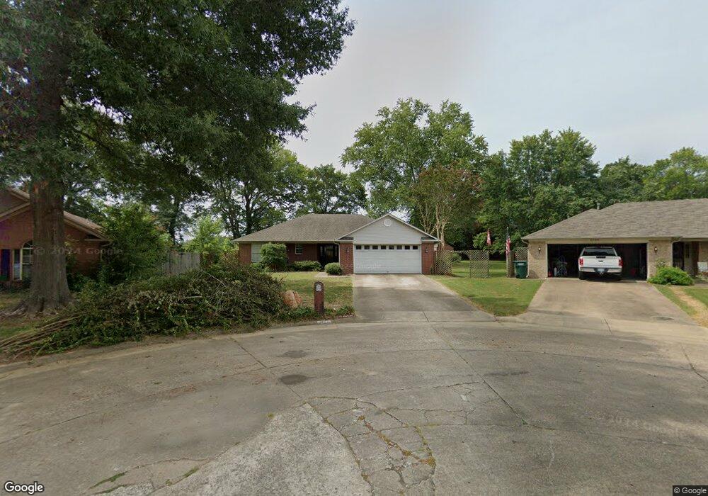
2135 Apache Trail Conway, AR 72032
Estimated Value: $204,000 - $229,799
Studio
2
Baths
1,509
Sq Ft
$146/Sq Ft
Est. Value
About This Home
This home is located at 2135 Apache Trail, Conway, AR 72032 and is currently estimated at $219,700, approximately $145 per square foot. 2135 Apache Trail is a home located in Faulkner County with nearby schools including Preston & Florence Mattison Elementary School, Bob Courtway Middle School, and Conway Junior High School.
Ownership History
Date
Name
Owned For
Owner Type
Purchase Details
Closed on
Oct 30, 2017
Sold by
Garner Cecil L and Garner Carol J
Bought by
Ferris Kim
Current Estimated Value
Home Financials for this Owner
Home Financials are based on the most recent Mortgage that was taken out on this home.
Original Mortgage
$105,000
Outstanding Balance
$87,610
Interest Rate
3.78%
Mortgage Type
New Conventional
Estimated Equity
$132,090
Purchase Details
Closed on
Mar 10, 1994
Bought by
Garner
Purchase Details
Closed on
Nov 3, 1993
Bought by
Long
Create a Home Valuation Report for This Property
The Home Valuation Report is an in-depth analysis detailing your home's value as well as a comparison with similar homes in the area
Home Values in the Area
Average Home Value in this Area
Purchase History
| Date | Buyer | Sale Price | Title Company |
|---|---|---|---|
| Ferris Kim | $135,000 | Waco Title Company | |
| Garner | $79,900 | -- | |
| Long | $14,000 | -- |
Source: Public Records
Mortgage History
| Date | Status | Borrower | Loan Amount |
|---|---|---|---|
| Open | Ferris Kim | $105,000 |
Source: Public Records
Tax History
| Year | Tax Paid | Tax Assessment Tax Assessment Total Assessment is a certain percentage of the fair market value that is determined by local assessors to be the total taxable value of land and additions on the property. | Land | Improvement |
|---|---|---|---|---|
| 2025 | $1,348 | $37,470 | $5,600 | $31,870 |
| 2024 | $1,348 | $37,470 | $5,600 | $31,870 |
| 2023 | $1,409 | $31,710 | $5,600 | $26,110 |
| 2022 | $973 | $31,710 | $5,600 | $26,110 |
| 2021 | $912 | $31,710 | $5,600 | $26,110 |
| 2020 | $851 | $24,220 | $3,800 | $20,420 |
| 2019 | $851 | $24,220 | $3,800 | $20,420 |
| 2018 | $876 | $24,220 | $3,800 | $20,420 |
| 2017 | $624 | $24,220 | $3,800 | $20,420 |
| 2016 | $624 | $19,240 | $3,800 | $15,440 |
| 2015 | $974 | $24,720 | $3,800 | $20,920 |
| 2014 | $624 | $24,720 | $3,800 | $20,920 |
Source: Public Records
Map
Nearby Homes
- 360 Navaho Trail
- 1906 Arrowhead Ln
- 137 Union Rd
- 7 Ginger Dr
- 0 Hidden Valley Rd Unit 26009095
- 24 Lots Hays Add
- 82 Addi Ln
- 54 Middle Rd
- 13 Martha Ln
- 000 E German Ln
- 00 Caskay Dr
- 440 Bernard Dr
- 22 Southerland Rd
- 1012 Woodside Dr
- 2365 E Oak St
- 9 Olivia Ln
- 2415 E Oak St
- 2485 E Oak St
- 119 Middle Rd
- 2.2 Acres Amity Rd
- 2125 Apache Trail
- 2145 Apache Trail
- 2155 Apache Trail
- 2003 Wiggle Worm Rd
- 2007 Wiggle Worm Rd
- 2001 Wiggle Worm Rd
- 2160 Apache Trail
- 2175 Apache Trail
- 2004 Wiggle Worm Rd
- 2006 Wiggle Worm Rd
- 2002 Wiggle Worm Rd
- 2011 Wiggle Worm Rd
- 2180 Apache Trail
- 2185 Apache Trail
- 0 Apache Trail
- 1915 Wiggle Worm Rd
- 350 Navaho Trail
- 353 Choctaw Trail
- 2190 Apache Trail
- 2195 Apache Trail
Your Personal Tour Guide
Ask me questions while you tour the home.