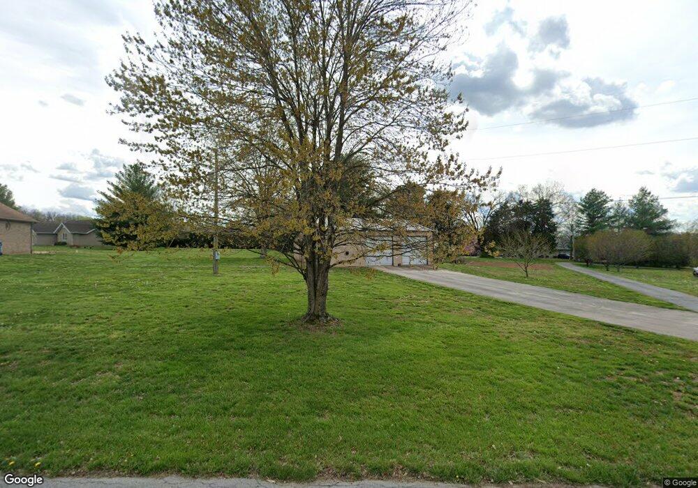
2135 S Spring Dr Springfield, MO 65809
Southeast Springfield NeighborhoodEstimated Value: $394,000 - $470,000
3
Beds
3
Baths
2,080
Sq Ft
$205/Sq Ft
Est. Value
About This Home
This home is located at 2135 S Spring Dr, Springfield, MO 65809 and is currently estimated at $426,721, approximately $205 per square foot. 2135 S Spring Dr is a home located in Greene County with nearby schools including Logan-Rogersville Primary School, Logan-Rogersville Elementary School, and Logan-Rogersville Upper Elementary School.
Ownership History
Date
Name
Owned For
Owner Type
Purchase Details
Closed on
Sep 13, 2010
Sold by
Old Missouri Bank
Bought by
Spencer Gilbert G and Spencer Sandra K
Current Estimated Value
Home Financials for this Owner
Home Financials are based on the most recent Mortgage that was taken out on this home.
Original Mortgage
$166,250
Outstanding Balance
$108,443
Interest Rate
4.51%
Mortgage Type
New Conventional
Estimated Equity
$318,278
Purchase Details
Closed on
Jul 27, 2010
Sold by
Orchard Jerry D and Orchard Marie L
Bought by
Old Missouri Bank
Home Financials for this Owner
Home Financials are based on the most recent Mortgage that was taken out on this home.
Original Mortgage
$166,250
Outstanding Balance
$108,443
Interest Rate
4.51%
Mortgage Type
New Conventional
Estimated Equity
$318,278
Create a Home Valuation Report for This Property
The Home Valuation Report is an in-depth analysis detailing your home's value as well as a comparison with similar homes in the area
Home Values in the Area
Average Home Value in this Area
Purchase History
| Date | Buyer | Sale Price | Title Company |
|---|---|---|---|
| Spencer Gilbert G | -- | None Available | |
| Old Missouri Bank | $45,984 | None Available |
Source: Public Records
Mortgage History
| Date | Status | Borrower | Loan Amount |
|---|---|---|---|
| Open | Spencer Gilbert G | $166,250 |
Source: Public Records
Tax History Compared to Growth
Tax History
| Year | Tax Paid | Tax Assessment Tax Assessment Total Assessment is a certain percentage of the fair market value that is determined by local assessors to be the total taxable value of land and additions on the property. | Land | Improvement |
|---|---|---|---|---|
| 2025 | $2,600 | $46,090 | $6,970 | $39,120 |
| 2024 | $2,541 | $42,910 | $8,610 | $34,300 |
| 2023 | $2,411 | $42,910 | $8,610 | $34,300 |
| 2022 | $2,318 | $40,190 | $8,610 | $31,580 |
| 2021 | $2,316 | $40,190 | $8,610 | $31,580 |
| 2020 | $2,380 | $40,190 | $8,610 | $31,580 |
| 2019 | $2,372 | $40,190 | $8,610 | $31,580 |
| 2018 | $2,051 | $37,700 | $8,610 | $29,090 |
| 2017 | $2,031 | $37,490 | $8,610 | $28,880 |
| 2016 | $2,013 | $37,490 | $8,610 | $28,880 |
| 2015 | $2,011 | $37,490 | $8,610 | $28,880 |
| 2014 | $1,822 | $35,820 | $8,610 | $27,210 |
Source: Public Records
Map
Nearby Homes
- 6431 E Ridgeline Dr
- 1318 S Farm Road 205
- 1410 S Briar Ave
- Tract 3 S Farm Road 199
- 5116 E Crown Park Ln
- 2808 S Farm Road 219
- Lot 13 A S Markham Ct
- 5147 E Crown Park Ln
- 2149 S Cedar Hill Ave
- 2173 S Pin Oak Dr
- 2907 S Ridgewood Ln
- Lot 12 S Markham Ct
- 2925 S Ridgewood Ln
- 5035 Stonegate Ct
- 3562 State Highway J
- 2370 S Bonnie Lee Ln
- 2488 S Timberwood Ln
- Lot 10 Farm Road 134
- Lot 7 Farm Road 134
- Lot 11 Farm Road 134
- 2171 S Hillside Dr
- 2139 S Hillside Dr
- 2174 S Hillside Dr
- 2152 S Hillside Dr
- 2126 S Hillside Dr
- 2105 S Spring Dr
- 0 S Spring Dr Unit 11110330
- 0 S Spring Dr Unit 11210801
- 0 S Spring Dr Unit 11210796
- 2107 S Hillside Dr
- 2076 S Spring Dr
- 2095 S Spring Dr
- 2098 S Hillside Dr
- 2298 S State Highway J
- 2187 S State Highway J
- 2095 S Hillside Dr
- 2121 S Spring Dr
- 2052 S Hillside Dr
- 6096 E Farm Road 152
- 2034 S Spring Dr
