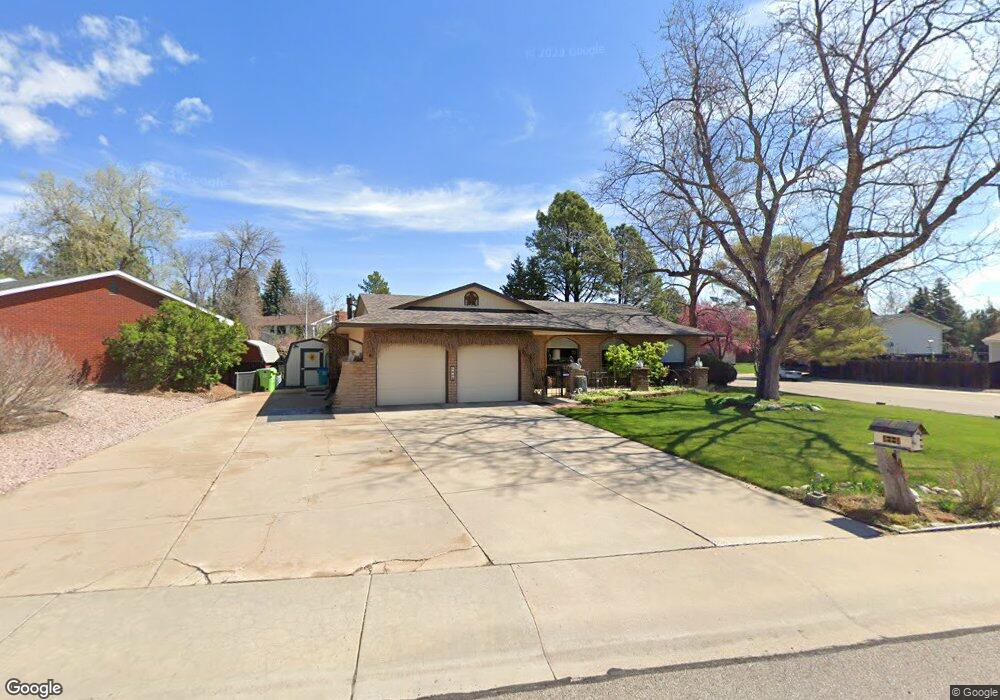
2136 Dover Dr Fort Collins, CO 80526
Estimated Value: $641,294 - $684,000
3
Beds
3
Baths
1,902
Sq Ft
$350/Sq Ft
Est. Value
About This Home
This home is located at 2136 Dover Dr, Fort Collins, CO 80526 and is currently estimated at $664,824, approximately $349 per square foot. 2136 Dover Dr is a home located in Larimer County with nearby schools including Bennett Elementary School, Blevins Middle School, and Rocky Mountain High School.
Ownership History
Date
Name
Owned For
Owner Type
Purchase Details
Closed on
Dec 27, 2019
Sold by
Rubel Louis Paul and Rubel Kay Jarita
Bought by
Rubel Family Trust
Current Estimated Value
Purchase Details
Closed on
Apr 27, 1997
Sold by
Day Samuel S and Day Barbara J
Bought by
Rubel Louis Paul and Rubel Kay Jarita
Home Financials for this Owner
Home Financials are based on the most recent Mortgage that was taken out on this home.
Original Mortgage
$70,000
Interest Rate
7.93%
Purchase Details
Closed on
May 1, 1995
Sold by
Williams Richard R
Bought by
Day Samuel S
Purchase Details
Closed on
Sep 1, 1993
Sold by
United States Of America V A
Bought by
Williams Richard R
Purchase Details
Closed on
May 1, 1992
Sold by
Weyerhaeuser Mortgage Co
Bought by
United States Of America V A
Create a Home Valuation Report for This Property
The Home Valuation Report is an in-depth analysis detailing your home's value as well as a comparison with similar homes in the area
Purchase History
| Date | Buyer | Sale Price | Title Company |
|---|---|---|---|
| Rubel Family Trust | -- | None Available | |
| Rubel Louis Paul | $178,500 | -- | |
| Day Samuel S | $150,000 | -- | |
| Williams Richard R | $149,900 | -- | |
| United States Of America V A | $139,100 | -- |
Source: Public Records
Mortgage History
| Date | Status | Borrower | Loan Amount |
|---|---|---|---|
| Previous Owner | Rubel Louis Paul | $70,000 |
Source: Public Records
Tax History
| Year | Tax Paid | Tax Assessment Tax Assessment Total Assessment is a certain percentage of the fair market value that is determined by local assessors to be the total taxable value of land and additions on the property. | Land | Improvement |
|---|---|---|---|---|
| 2025 | $3,402 | $41,269 | $2,813 | $38,456 |
| 2024 | $3,237 | $45,841 | $3,015 | $42,826 |
| 2022 | $2,735 | $35,918 | $3,128 | $32,790 |
| 2021 | $2,764 | $36,952 | $3,218 | $33,734 |
| 2020 | $3,072 | $39,983 | $3,218 | $36,765 |
| 2019 | $3,085 | $39,983 | $3,218 | $36,765 |
| 2018 | $2,022 | $29,390 | $3,240 | $26,150 |
| 2017 | $2,015 | $29,390 | $3,240 | $26,150 |
| 2016 | $1,541 | $24,835 | $3,582 | $21,253 |
| 2015 | $1,529 | $24,830 | $3,580 | $21,250 |
| 2014 | $1,227 | $21,410 | $3,580 | $17,830 |
Source: Public Records
Map
Nearby Homes
- 2231 Berkshire Dr
- 2248 Charolais Dr
- 2114 Water Blossom Ln
- 2156 Water Blossom Ln
- 1456 Edgewood Ct
- 2312 Moss Rose Ln
- 2367 Northbrook Dr
- 1539 Haymarket St
- 1705 Heatheridge Rd Unit F103
- 1705 Heatheridge Rd Unit E101
- 1705 Heatheridge Rd Unit K206
- 1705 Heatheridge Rd Unit H105
- 1705 Heatheridge Rd Unit G302
- 1705 Heatheridge Rd Unit M204
- 1705 Heatheridge Rd Unit C204
- 1705 Heatheridge Rd Unit G301
- 1705 Heatheridge Rd Unit L105
- 1705 Heatheridge Rd Unit L103
- 1505 W Prospect Rd
- 1225 W Prospect Rd Unit W93
- 2130 Dover Dr
- 1844 Manchester Dr
- 2200 Dover Dr
- 2118 Dover Dr
- 2137 Dover Dr
- 2107 Manchester Cir
- 2131 Dover Dr
- 1845 Manchester Dr
- 2125 Dover Dr
- 2206 Dover Dr
- 2201 Dover Dr
- 2112 Dover Dr
- 2119 Dover Dr
- 1841 Manchester Dr
- 2101 Manchester Cir
- 2148 Sheffield Dr
- 2142 Sheffield Dr
- 2113 Dover Dr
- 2207 Dover Dr
- 2212 Dover Dr
Your Personal Tour Guide
Ask me questions while you tour the home.