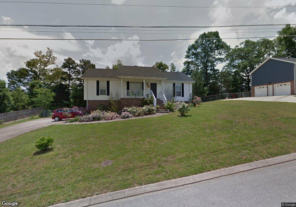
2136 N Fork Dr Soddy Daisy, TN 37379
Estimated Value: $304,842 - $335,000
3
Beds
3
Baths
1,600
Sq Ft
$198/Sq Ft
Est. Value
About This Home
This home is located at 2136 N Fork Dr, Soddy Daisy, TN 37379 and is currently estimated at $317,211, approximately $198 per square foot. 2136 N Fork Dr is a home located in Hamilton County with nearby schools including Loftis Middle School.
Ownership History
Date
Name
Owned For
Owner Type
Purchase Details
Closed on
May 5, 2006
Sold by
Keef Robert W and Keef Emily G
Bought by
Keith Patricia A
Current Estimated Value
Home Financials for this Owner
Home Financials are based on the most recent Mortgage that was taken out on this home.
Original Mortgage
$128,250
Outstanding Balance
$73,766
Interest Rate
6.28%
Mortgage Type
Fannie Mae Freddie Mac
Estimated Equity
$243,445
Purchase Details
Closed on
Mar 11, 2003
Sold by
Crowe Jeremy S and Crowe Pamela T
Bought by
Keef Robert W and Keef Emily G
Home Financials for this Owner
Home Financials are based on the most recent Mortgage that was taken out on this home.
Original Mortgage
$113,007
Interest Rate
5.88%
Mortgage Type
FHA
Purchase Details
Closed on
Mar 23, 1999
Sold by
Greene Paul D and Greene Heather S
Bought by
Hud
Purchase Details
Closed on
Nov 21, 1996
Sold by
Watkins James E and Watkins Virginia J
Bought by
Greene Paul D and Greene Heather S
Home Financials for this Owner
Home Financials are based on the most recent Mortgage that was taken out on this home.
Original Mortgage
$89,650
Interest Rate
7.83%
Mortgage Type
FHA
Create a Home Valuation Report for This Property
The Home Valuation Report is an in-depth analysis detailing your home's value as well as a comparison with similar homes in the area
Home Values in the Area
Average Home Value in this Area
Purchase History
| Date | Buyer | Sale Price | Title Company |
|---|---|---|---|
| Keith Patricia A | $135,000 | None Available | |
| Keef Robert W | $113,900 | Realty Title & Escrow Co Inc | |
| Hud | $104,000 | -- | |
| Greene Paul D | $89,200 | First Title |
Source: Public Records
Mortgage History
| Date | Status | Borrower | Loan Amount |
|---|---|---|---|
| Open | Keith Patricia A | $128,250 | |
| Previous Owner | Keef Robert W | $113,007 | |
| Previous Owner | Greene Paul D | $89,650 |
Source: Public Records
Tax History Compared to Growth
Tax History
| Year | Tax Paid | Tax Assessment Tax Assessment Total Assessment is a certain percentage of the fair market value that is determined by local assessors to be the total taxable value of land and additions on the property. | Land | Improvement |
|---|---|---|---|---|
| 2024 | $980 | $43,800 | $0 | $0 |
| 2023 | $989 | $43,800 | $0 | $0 |
| 2022 | $989 | $43,800 | $0 | $0 |
| 2021 | $989 | $43,800 | $0 | $0 |
| 2020 | $967 | $34,650 | $0 | $0 |
| 2019 | $967 | $34,650 | $0 | $0 |
| 2018 | $967 | $34,650 | $0 | $0 |
| 2017 | $967 | $34,650 | $0 | $0 |
| 2016 | $877 | $0 | $0 | $0 |
| 2015 | $877 | $31,400 | $0 | $0 |
| 2014 | $877 | $0 | $0 | $0 |
Source: Public Records
Map
Nearby Homes
- 2031 Millard Rd
- 2109 Millard Rd
- 11111 Hixson Pike
- 1818 Millard Rd
- 9429 Hackberry Ln
- 9802 Shoreline Heights Dr
- 1848 Coffee Tree Ln
- 2522 W Wind Dr
- 1724 Magnum Ln
- 9955 Rolling Wind Dr
- 2228 Lakesite Dr
- 2316 Lakesite Dr
- 10160 Hunters Hollow Dr
- 10166 Hunters Hollow Dr
- 9901 Breeze Hill Ln
- 2119 Collins Ln
- 10041 Rolling Wind Dr
- 2316 Green Valley Rd
- 2107 Port Royal Dr
- 2033 Angler Dr
- 2132 N Fork Dr
- 2140 N Fork Dr
- 2137 N Fork Dr
- 2133 N Fork Dr
- 2130 N Fork Dr
- 2129 N Fork Dr
- 2148 N Fork Dr
- 2143 N Fork Dr
- 2126 N Fork Dr
- 2125 N Fork Dr
- 2124 N Fork Dr
- 2211 N Fork Dr
- 9600 Demetra Ln
- 2120 N Fork Dr
- 2208 N Fork Dr
- 2217 N Fork Dr
- 9602 Demetra Ln
- 2219 N Fork Dr
- 2037 Bass Bay Ln
- 2118 N Fork Dr