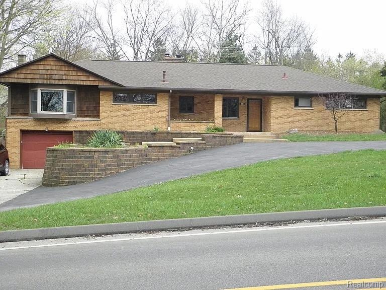
2136 Newport Rd Ann Arbor, MI 48103
Barton Plateau and Huron River Heights NeighborhoodEstimated payment $4,976/month
Highlights
- Fireplace in Primary Bedroom
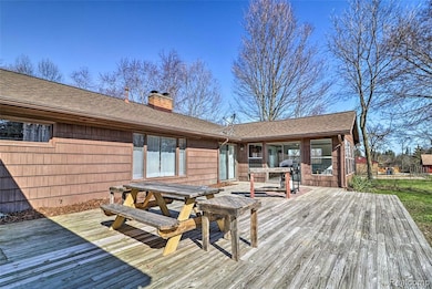
- Deck
- No HOA
- Wines Elementary School Rated A
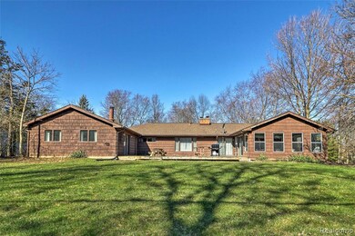
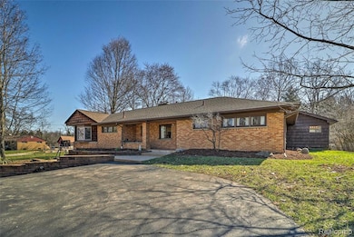
- Ranch Style House
- 1 Car Direct Access Garage
About This Home
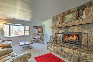
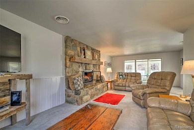
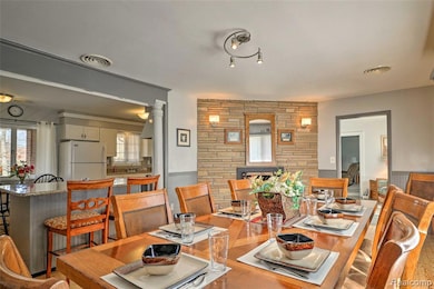
Welcome to this charming NW Ann Arbor home in the desirable country-like setting of Newport Road! Nestled on a spacious lot surrounded by mature trees, this property blends privacy with convenience—just minutes from downtown, parks, and top-rated schools. The home offers a warm and inviting layout with abundant natural light, separated bedroom and living spaces, some wood floors. Thoughtful updates including baseboard heat, insulation and new plank flooring in the game room. Enjoy a comfortable family room with a cozy fireplace, a lovely kitchen with granite countertops, and generously sized master bedroom. The master en suite has a new shower, vanity and whirlpool tub. The bonus room could be configured for a number of uses. Outside, the expansive yard provides space for gardening, playing, or relaxing on the deck. It’s an ideal location near the Huron River and easy access to shopping, dining, and the U of M.
Home Details
Home Type
- Single Family
Est. Annual Taxes
Year Built
- Built in 1950
Lot Details
- 0.5 Acre Lot
- Lot Dimensions are 104x209
Home Design
- Ranch Style House
- Brick Exterior Construction
- Slab Foundation
- Asphalt Roof
Interior Spaces
- 2,965 Sq Ft Home
- Gas Fireplace
- Entrance Foyer
- Family Room with Fireplace
- Living Room with Fireplace
Kitchen
- Self-Cleaning Oven
- Gas Cooktop
- Range Hood
- Recirculated Exhaust Fan
- Microwave
- Dishwasher
Bedrooms and Bathrooms
- 4 Bedrooms
- Fireplace in Primary Bedroom
- Soaking Tub
Laundry
- Dryer
- Washer
Parking
- 1 Car Direct Access Garage
- Garage Door Opener
Outdoor Features
- Deck
- Patio
- Porch
Location
- Ground Level
Utilities
- Forced Air Heating and Cooling System
- Heating System Uses Natural Gas
- Natural Gas Water Heater
- High Speed Internet
- Cable TV Available
Listing and Financial Details
- Assessor Parcel Number 090918400159
Community Details
Overview
- No Home Owners Association
- Bowens Ann Arbor City Subdivision
Amenities
- Laundry Facilities
Map
Home Values in the Area
Average Home Value in this Area
Tax History
| Year | Tax Paid | Tax Assessment Tax Assessment Total Assessment is a certain percentage of the fair market value that is determined by local assessors to be the total taxable value of land and additions on the property. | Land | Improvement |
|---|---|---|---|---|
| 2025 | $13,181 | $283,100 | $0 | $0 |
| 2024 | $11,074 | $288,000 | $0 | $0 |
| 2023 | $10,225 | $280,700 | $0 | $0 |
| 2022 | $12,376 | $233,300 | $0 | $0 |
| 2021 | $12,026 | $250,100 | $0 | $0 |
| 2020 | $11,648 | $236,100 | $0 | $0 |
| 2019 | $11,110 | $239,500 | $239,500 | $0 |
| 2018 | $10,901 | $216,900 | $0 | $0 |
| 2017 | $10,516 | $209,900 | $0 | $0 |
| 2016 | $8,438 | $165,600 | $0 | $0 |
| 2015 | $7,609 | $165,105 | $0 | $0 |
| 2014 | $7,609 | $159,946 | $0 | $0 |
| 2013 | -- | $159,946 | $0 | $0 |
Property History
| Date | Event | Price | List to Sale | Price per Sq Ft |
|---|---|---|---|---|
| 09/30/2025 09/30/25 | For Sale | $719,000 | -- | $242 / Sq Ft |
Purchase History
| Date | Type | Sale Price | Title Company |
|---|---|---|---|
| Land Contract | $388,000 | None Available | |
| Interfamily Deed Transfer | -- | Title Source Inc | |
| Warranty Deed | $200,000 | Capital Title Ins Agency |
Mortgage History
| Date | Status | Loan Amount | Loan Type |
|---|---|---|---|
| Closed | $388,000 | Seller Take Back | |
| Closed | $332,000 | Stand Alone Refi Refinance Of Original Loan |
Source: Realcomp
MLS Number: 20251039027
APN: 09-18-400-159
Disclaimer: Certain information contained herein is derived from information provided by parties other than Homes.com. All information provided is deemed reliable, but is not guaranteed to be accurate and should be independently verified.
![]() IDX provided courtesy of Realcomp II Ltd. via Ten-X and MLS
IDX provided courtesy of Realcomp II Ltd. via Ten-X and MLS
Copyright 2025 Realcomp II Ltd. Shareholders
IDX information is provided exclusively for consumers' personal, noncommercial use and may not be used for any purpose other than to identify prospective properties consumers may be interested in purchasing. The accuracy of all information, regardless of source, is not guaranteed or warranted. All information should be independently verified.
Listing Information presented by local MLS brokerage: Ten-X, local REALTOR®- Arlene Richardson - (888)-952-6393
- 2108 Newport Rd Unit Parcel 2108
- 2108 Newport Rd
- 2134 Overlook Ct
- 2374 Newport Rd
- 2174 Overlook Ct Unit 326
- 1610 Saunders Crescent
- 1514 Argyle Crescent
- 1431 Hatcher Crescent
- 1797 Miller Ave
- 244 Barton Shore Dr
- 1785 Miller Ave
- 601 Cressfield Ln
- 1006 Duncan St
- 1132 Longshore Dr Unit 2
- 916 Brooks St
- 915 Westwood Ave
- 822 Brooks St
- 2277 W Huron River Dr
- 827 Westwood Ave
- 1328 Miller Ave
- 1649 N Maple Rd
- 1052 N Maple Rd
- 629 Brooks St
- 1015 N Maple Rd
- 1525 Arborview Blvd
- 603 Gott St
- 603 Gott St
- 415 N 7th St Unit 415 N. 7th Ann Arbor
- 1280 Kuehnle Ct
- 210 Bucholz Ct
- 2230-2250 Dexter Ave
- 1103 Ravenwood Ave Unit Entire House
- 508 Miller Ave
- 122 Allen Dr Unit 2
- 122 Allen Dr Unit 1
- 892 Rose Dr
- 934 W Huron St
- 2 Glendale Dr
- 910 W Huron St
- 121 W Kingsley St Unit 502
