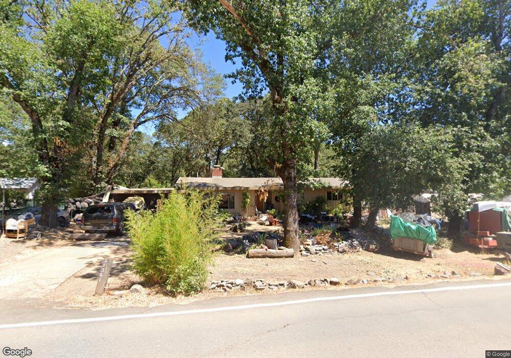
21361 Locust St Willits, CA 95490
Estimated Value: $322,247 - $409,000
3
Beds
2
Baths
1,380
Sq Ft
$254/Sq Ft
Est. Value
About This Home
This home is located at 21361 Locust St, Willits, CA 95490 and is currently estimated at $350,312, approximately $253 per square foot. 21361 Locust St is a home located in Mendocino County with nearby schools including Blosser Lane Elementary School, Brookside Elementary School, and Baechtel Grove Middle School.
Ownership History
Date
Name
Owned For
Owner Type
Purchase Details
Closed on
Dec 23, 2015
Sold by
Carol Martha and Ragan Ronald J
Bought by
Kluth Stanley William and Kluth Barbara Jean
Current Estimated Value
Home Financials for this Owner
Home Financials are based on the most recent Mortgage that was taken out on this home.
Original Mortgage
$185,000
Outstanding Balance
$146,741
Interest Rate
3.96%
Mortgage Type
New Conventional
Estimated Equity
$203,571
Purchase Details
Closed on
Jul 16, 2013
Sold by
Luft Martha C and Ragan Ronald J
Bought by
Carol Martha and Ragan Ronald J
Create a Home Valuation Report for This Property
The Home Valuation Report is an in-depth analysis detailing your home's value as well as a comparison with similar homes in the area
Home Values in the Area
Average Home Value in this Area
Purchase History
| Date | Buyer | Sale Price | Title Company |
|---|---|---|---|
| Kluth Stanley William | $265,000 | Redwood Empire Title Co Mend | |
| Carol Martha | -- | None Available |
Source: Public Records
Mortgage History
| Date | Status | Borrower | Loan Amount |
|---|---|---|---|
| Open | Kluth Stanley William | $185,000 |
Source: Public Records
Tax History
| Year | Tax Paid | Tax Assessment Tax Assessment Total Assessment is a certain percentage of the fair market value that is determined by local assessors to be the total taxable value of land and additions on the property. | Land | Improvement |
|---|---|---|---|---|
| 2025 | $2,764 | $248,590 | $71,024 | $177,566 |
| 2023 | $2,764 | $238,939 | $68,267 | $170,672 |
| 2022 | $2,634 | $234,255 | $66,929 | $167,326 |
| 2021 | $2,614 | $229,663 | $65,617 | $164,046 |
| 2020 | $2,547 | $227,308 | $64,945 | $162,363 |
| 2019 | $2,542 | $222,852 | $63,672 | $159,180 |
| 2018 | $2,379 | $218,484 | $62,424 | $156,060 |
| 2017 | $2,327 | $214,200 | $61,200 | $153,000 |
| 2016 | $2,308 | $210,000 | $60,000 | $150,000 |
| 2015 | $1,658 | $150,083 | $37,521 | $112,562 |
| 2014 | $1,636 | $147,144 | $36,786 | $110,358 |
Source: Public Records
Map
Nearby Homes
- 454 Della Ave
- 490 Della Ave
- 1242 Poplar Ave
- 0 Poplar Ave Unit 324037613
- 21441 Pineview Dr
- 1407 Brothers Ln
- 1581 S Main St
- 1051 S Main St
- 1750 S Main St Unit 37
- 316 S Main St
- 308 Coast St
- 372 S Lenore Ave
- 252 Margie Dr
- 0 Catherine Ln
- 84 School St
- 350 Creekside Dr
- 450 Grove St
- 0 Muir Mill Rd
- 25331 Sherwood Rd
- 25201 Sherwood Rd
- 21381 Locust St
- 21448 Locust St
- 21401 Locust St
- 21431 Locust St
- 21400 Locust St
- 21300 Locust St
- 21301 Locust St
- 21451 Locust St
- 21275 Locust St
- 21455 Locust St
- 21441 Locust St
- 21041 Locust St
- 21460 Locust St
- 21250 Locust St
- 21461 Locust St
- 21251 Locust St
- 297 Holly St
- 21460 Eva Clair St
- 21481 Locust St
- 21441 Eva Clair St
Your Personal Tour Guide
Ask me questions while you tour the home.