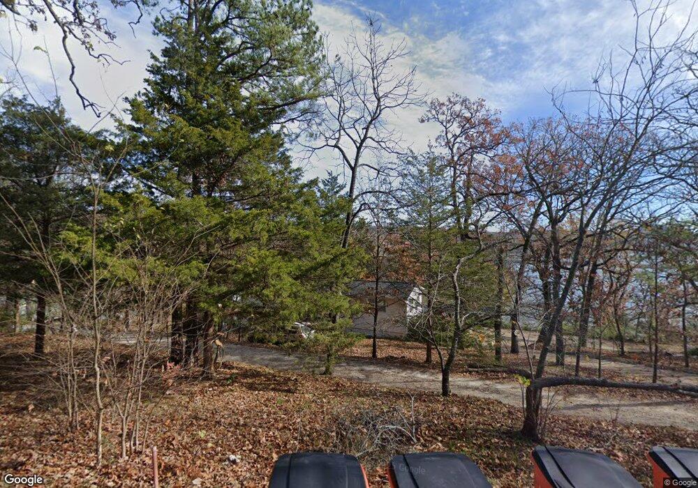
21370 High Dive Rd Shell Knob, MO 65747
Estimated Value: $236,076 - $412,000
2
Beds
2
Baths
1,895
Sq Ft
$162/Sq Ft
Est. Value
About This Home
This home is located at 21370 High Dive Rd, Shell Knob, MO 65747 and is currently estimated at $307,019, approximately $162 per square foot. 21370 High Dive Rd is a home with nearby schools including Shell Knob Elementary School.
Ownership History
Date
Name
Owned For
Owner Type
Purchase Details
Closed on
Sep 14, 2021
Sold by
Caddell Sharon K
Bought by
Caddell Sharon K
Current Estimated Value
Home Financials for this Owner
Home Financials are based on the most recent Mortgage that was taken out on this home.
Original Mortgage
$52,300
Outstanding Balance
$39,921
Interest Rate
2.1%
Mortgage Type
New Conventional
Estimated Equity
$267,098
Purchase Details
Closed on
Aug 15, 2005
Sold by
Caddell Gary W and Caddell Sharon K
Bought by
Hemme Paul
Create a Home Valuation Report for This Property
The Home Valuation Report is an in-depth analysis detailing your home's value as well as a comparison with similar homes in the area
Purchase History
| Date | Buyer | Sale Price | Title Company |
|---|---|---|---|
| Caddell Sharon K | -- | Asbury Land Title Inc | |
| Hemme Paul | -- | None Available |
Source: Public Records
Mortgage History
| Date | Status | Borrower | Loan Amount |
|---|---|---|---|
| Open | Caddell Sharon K | $52,300 |
Source: Public Records
Tax History
| Year | Tax Paid | Tax Assessment Tax Assessment Total Assessment is a certain percentage of the fair market value that is determined by local assessors to be the total taxable value of land and additions on the property. | Land | Improvement |
|---|---|---|---|---|
| 2025 | $4,110 | $16,017 | $1,577 | $14,440 |
| 2024 | $6 | $13,053 | $1,577 | $11,476 |
| 2023 | $638 | $13,053 | $1,577 | $11,476 |
| 2022 | $638 | $13,053 | $1,577 | $11,476 |
| 2020 | $642 | $13,053 | $1,577 | $11,476 |
| 2018 | $632 | $12,654 | $1,786 | $10,868 |
| 2017 | $554 | $12,654 | $1,786 | $10,868 |
| 2016 | $580 | $12,882 | $1,615 | $11,267 |
| 2015 | -- | $12,882 | $1,615 | $11,267 |
| 2014 | -- | $12,882 | $1,615 | $11,267 |
| 2012 | -- | $0 | $0 | $0 |
Source: Public Records
Map
Nearby Homes
- 21461 Needles Eye Rd
- 21277 Needles Eye Rd
- 26032 State Highway 39
- 26094 State Highway 39
- 20615 Table Rock Ridge Rd
- 6 Lots Needles Eye Rd
- Tbd Needles Eye Rd
- Lot142 143 Needles Eye Rd
- 25620 Hillcrest Dr
- 24886 State Highway 39
- 21791 Mill Creek Dr
- 22008 Ice House Ln
- 21380 Access Rd
- 21992 Knob Hill Ln
- Lot 11 Mountain View Pkwy
- 21942 Mill Creek Cir
- 22009 Mill Creek Way
- .25M/L Farm Road 2210
- 26359 State Highway Yy
- 26386 State Highway Yy
- 25558 Farm Road 2212
- 25696 Farm Road 2212
- 0 High Dive Rd
- 25792 Farm Road 2212
- 25664 Farm Road 2212
- 1410 S Madison Ave
- 25703 Farm Road 2212
- 25675 Farm Road 2212
- 25661 Farm Road 2212
- 25611 Farm Road 2212
- 2443 S Marlan Ave
- 000 Farm Road 2212 High Dive Unit Lots 29&30
- 0 Loma Vistal Ln
- 21428 Loma Vista Ln
- 21427 Loma Vista Ln
- 21279 High Dive Rd
- 21280 High Dive Rd
- 0 Tbd Summer Unit 30345837
- 0 Tbd Summer Unit 30345833
- 21424 Brick Ln
Your Personal Tour Guide
Ask me questions while you tour the home.
