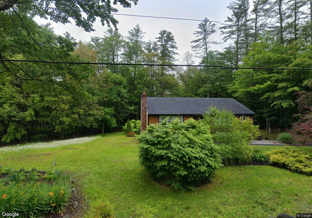
214 Clothespin Bridge Rd Webster, NH 03303
Estimated Value: $389,079 - $522,000
3
Beds
1
Bath
1,629
Sq Ft
$283/Sq Ft
Est. Value
About This Home
This home is located at 214 Clothespin Bridge Rd, Webster, NH 03303 and is currently estimated at $460,270, approximately $282 per square foot. 214 Clothespin Bridge Rd is a home located in Merrimack County with nearby schools including Webster Elementary School, Merrimack Valley Middle School, and Merrimack Valley High School.
Ownership History
Date
Name
Owned For
Owner Type
Purchase Details
Closed on
Apr 30, 2007
Sold by
Goodard Philip W and Goodard Shirley C
Bought by
Bizarro William G
Current Estimated Value
Home Financials for this Owner
Home Financials are based on the most recent Mortgage that was taken out on this home.
Original Mortgage
$120,000
Interest Rate
6.18%
Mortgage Type
Purchase Money Mortgage
Purchase Details
Closed on
Nov 26, 1997
Sold by
Druding Charles H and Druding Judith A
Bought by
Kelly Cynthia and Kelly Kevin
Home Financials for this Owner
Home Financials are based on the most recent Mortgage that was taken out on this home.
Original Mortgage
$84,509
Interest Rate
7.26%
Create a Home Valuation Report for This Property
The Home Valuation Report is an in-depth analysis detailing your home's value as well as a comparison with similar homes in the area
Home Values in the Area
Average Home Value in this Area
Purchase History
| Date | Buyer | Sale Price | Title Company |
|---|---|---|---|
| Bizarro William G | $50,700 | -- | |
| Kelly Cynthia | $85,000 | -- |
Source: Public Records
Mortgage History
| Date | Status | Borrower | Loan Amount |
|---|---|---|---|
| Open | Kelly Cynthia | $113,000 | |
| Closed | Kelly Cynthia | $120,000 | |
| Closed | Kelly Cynthia | $120,000 | |
| Previous Owner | Kelly Cynthia | $84,509 |
Source: Public Records
Tax History Compared to Growth
Tax History
| Year | Tax Paid | Tax Assessment Tax Assessment Total Assessment is a certain percentage of the fair market value that is determined by local assessors to be the total taxable value of land and additions on the property. | Land | Improvement |
|---|---|---|---|---|
| 2024 | $4,914 | $316,400 | $101,900 | $214,500 |
| 2023 | $4,708 | $316,400 | $101,900 | $214,500 |
| 2022 | $4,497 | $196,800 | $61,900 | $134,900 |
| 2021 | $4,387 | $196,800 | $61,900 | $134,900 |
| 2020 | $4,557 | $195,300 | $61,900 | $133,400 |
| 2019 | $4,555 | $195,300 | $61,900 | $133,400 |
| 2018 | $4,237 | $196,700 | $61,900 | $134,800 |
| 2017 | $3,949 | $171,900 | $41,400 | $130,500 |
| 2016 | $3,949 | $171,900 | $41,400 | $130,500 |
| 2015 | $4,139 | $171,900 | $41,400 | $130,500 |
| 2014 | $3,923 | $172,900 | $41,400 | $131,500 |
| 2013 | $3,583 | $164,900 | $41,400 | $123,500 |
Source: Public Records
Map
Nearby Homes
- 7 Cashell Ln
- 10 Call Rd
- 110 Pearson Hill Rd
- 122 Centennial Dr
- Map 6, Lot 38 Chadwick Hill Rd
- 29 Centennial Dr
- 17 Centennial Dr
- Map 10 Dr
- 490 Deer Meadow Rd
- 298 Battle St
- 67 New Hampshire Dr
- 00 Deer Meadow Rd Unit 26
- 231 Mutton Rd
- 220 Couchtown Rd
- 293 Queen St
- 106 Stacey Dr
- 155 Pamela Dr
- 95 Blackwater Rd
- 19 Bailey Dr
- 222 Daniel Webster Hwy
- 212 Clothespin Bridge Rd
- 264 Clothespin Bridge Rd
- 240 Clothespin Bridge Rd
- 208 Clothespin Bridge Rd
- 268 Clothespin Bridge Rd
- 101 Clothespin Bridge Rd
- 278 Clothespin Bridge Rd
- 204 Clothespin Bridge Rd
- 200 Clothespin Bridge Rd
- 15 Cashell Ln
- 196 Clothespin Bridge Rd
- 17 Cashell Ln
- 776 Battle St
- 762 Battle St
- 192 Clothespin Bridge Rd
- 23 Cashell Ln
- 201 Clothespin Bridge Rd
- 756 Battle St
- 1265 Pleasant St
- 786 Battle St