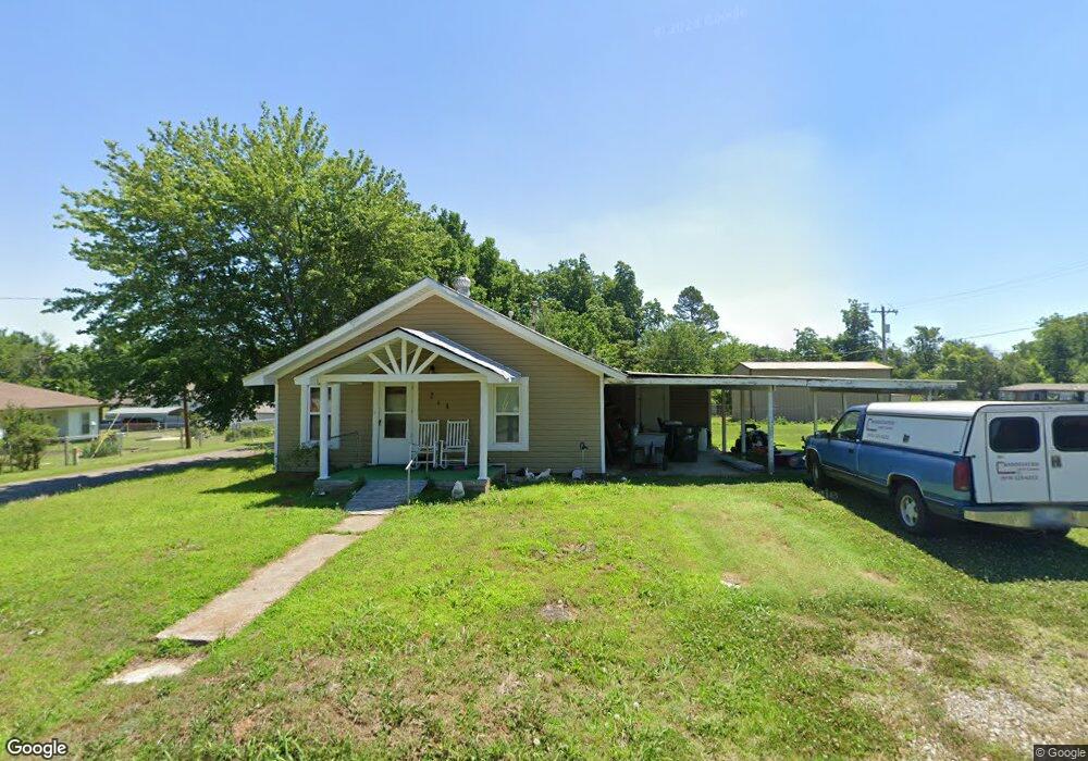
214 N Howerton Ave Cushing, OK 74023
Estimated Value: $90,000 - $130,000
3
Beds
2
Baths
1,020
Sq Ft
$108/Sq Ft
Est. Value
About This Home
This home is located at 214 N Howerton Ave, Cushing, OK 74023 and is currently estimated at $110,225, approximately $108 per square foot. 214 N Howerton Ave is a home with nearby schools including Cushing Upper Elementary School, Cushing Lower Elementary School, and Cushing High School.
Ownership History
Date
Name
Owned For
Owner Type
Purchase Details
Closed on
Jul 9, 2010
Sold by
Skinner John R and Skinner Kymberly D
Bought by
Reed David A and Reed Bennie J
Current Estimated Value
Home Financials for this Owner
Home Financials are based on the most recent Mortgage that was taken out on this home.
Original Mortgage
$31,200
Outstanding Balance
$20,634
Interest Rate
4.78%
Mortgage Type
Future Advance Clause Open End Mortgage
Estimated Equity
$89,591
Purchase Details
Closed on
Apr 28, 2008
Sold by
Skinner Jimmie A
Bought by
Skinnr John R and Skinnr Kymberly D
Create a Home Valuation Report for This Property
The Home Valuation Report is an in-depth analysis detailing your home's value as well as a comparison with similar homes in the area
Home Values in the Area
Average Home Value in this Area
Purchase History
| Date | Buyer | Sale Price | Title Company |
|---|---|---|---|
| Reed David A | $20,000 | -- | |
| Skinnr John R | -- | None Available |
Source: Public Records
Mortgage History
| Date | Status | Borrower | Loan Amount |
|---|---|---|---|
| Open | Reed David A | $31,200 |
Source: Public Records
Tax History Compared to Growth
Tax History
| Year | Tax Paid | Tax Assessment Tax Assessment Total Assessment is a certain percentage of the fair market value that is determined by local assessors to be the total taxable value of land and additions on the property. | Land | Improvement |
|---|---|---|---|---|
| 2025 | $332 | $3,740 | $244 | $3,496 |
| 2024 | $302 | $3,562 | $271 | $3,291 |
| 2023 | $302 | $3,393 | $469 | $2,924 |
| 2022 | $275 | $3,231 | $525 | $2,706 |
| 2021 | $255 | $3,077 | $538 | $2,539 |
| 2020 | $240 | $2,931 | $430 | $2,501 |
| 2019 | $239 | $2,792 | $827 | $1,965 |
| 2018 | $232 | $2,792 | $827 | $1,965 |
| 2017 | $229 | $2,792 | $827 | $1,965 |
| 2016 | $236 | $2,792 | $827 | $1,965 |
| 2015 | $266 | $3,068 | $705 | $2,363 |
| 2014 | $264 | $3,068 | $705 | $2,363 |
Source: Public Records
Map
Nearby Homes
- 1301 E Ash St
- 1224 E Cherry St
- 1217 E Cherry St
- 112 S Highland Ave
- 1417 E Oak St
- 1236 E Main St
- 1436 E Moses St
- 1232 E 3rd St
- 1435 E Oak St
- 1427 E Broadway St
- 1436 E Broadway St
- 1439 E Moses St
- 1002 E Cherry St
- 847 E Moses St
- 508 S Michigan Ave
- 919 E 2nd St
- 1003 E 4th St
- 1129 E Vine St
- 911 E 3rd St
- 1113 E 6th St
- 203 N Howerton Ave
- 1205 E Ash St
- 1149 E Oak St
- 202 N Howerton Ave
- 1207 E Ash St
- 1205 E Oak St
- 1147 E Oak St
- 1142 E Moses St
- 1212 E Moses St
- 1217 E Ash St
- 1207 E Oak St
- 1138 E Moses St
- 1133 E Oak St
- 1202 E Oak St
- 1136 E Moses St
- 1204 E Oak St
- 1209 E Oak St
- 1149 E Moses St
- 1209 E Moses St
- 1130 E Moses St