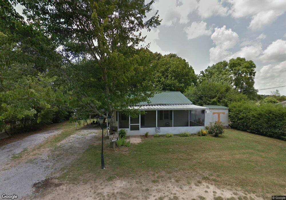
214 Vine Cir Loretto, TN 38469
Estimated Value: $83,283 - $135,000
Studio
1
Bath
720
Sq Ft
$153/Sq Ft
Est. Value
About This Home
This home is located at 214 Vine Cir, Loretto, TN 38469 and is currently estimated at $110,321, approximately $153 per square foot. 214 Vine Cir is a home located in Lawrence County with nearby schools including South Lawrence Elementary School, Lawrenceburg Public Elementary School, and Ingram Sowell Elementary School.
Ownership History
Date
Name
Owned For
Owner Type
Purchase Details
Closed on
Feb 2, 2026
Sold by
Newton Kenneth
Bought by
Pettus Robert
Current Estimated Value
Purchase Details
Closed on
Jul 5, 2017
Sold by
Foust Virginia Nichole
Bought by
Newton Kenneth D
Purchase Details
Closed on
Dec 6, 2007
Sold by
Mitchell Larry G
Bought by
Moore Bill H
Purchase Details
Closed on
Oct 14, 1994
Bought by
Mitchell Noal H and Mitchell Elizabeth
Purchase Details
Closed on
Jan 27, 1989
Bought by
Brownlow Oakley H and Brownlow Ida
Purchase Details
Closed on
Jan 17, 1989
Bought by
Shedd Jerry
Purchase Details
Closed on
Jul 22, 1988
Bought by
Mckenzie Banking Co
Purchase Details
Closed on
Jan 1, 1978
Create a Home Valuation Report for This Property
The Home Valuation Report is an in-depth analysis detailing your home's value as well as a comparison with similar homes in the area
Purchase History
| Date | Buyer | Sale Price | Title Company |
|---|---|---|---|
| Pettus Robert | -- | None Listed On Document | |
| Newton Kenneth D | $16,000 | None Available | |
| Moore Bill H | $10,000 | -- | |
| Mitchell Noal H | $16,500 | -- | |
| Brownlow Oakley H | $11,500 | -- | |
| Shedd Jerry | $8,000 | -- | |
| Mckenzie Banking Co | -- | -- | |
| -- | $10,000 | -- |
Source: Public Records
Tax History
| Year | Tax Paid | Tax Assessment Tax Assessment Total Assessment is a certain percentage of the fair market value that is determined by local assessors to be the total taxable value of land and additions on the property. | Land | Improvement |
|---|---|---|---|---|
| 2025 | $435 | $15,450 | $1,250 | $14,200 |
| 2024 | $362 | $15,450 | $1,250 | $14,200 |
| 2023 | $362 | $15,450 | $1,250 | $14,200 |
| 2022 | $362 | $15,450 | $1,250 | $14,200 |
| 2021 | $202 | $6,025 | $1,000 | $5,025 |
| 2020 | $202 | $6,025 | $1,000 | $5,025 |
| 2019 | $202 | $6,025 | $1,000 | $5,025 |
| 2018 | $199 | $6,025 | $1,000 | $5,025 |
| 2017 | $193 | $6,025 | $1,000 | $5,025 |
| 2016 | $193 | $6,025 | $1,000 | $5,025 |
| 2015 | $176 | $6,025 | $1,000 | $5,025 |
| 2014 | -- | $5,550 | $1,000 | $4,550 |
Source: Public Records
Map
Nearby Homes
- 219 Vine Cir
- 308 Spring St
- 211 Church St
- 402 N Military St
- 205 Dixon Rd E
- 200 Church St
- 502 N Main St
- 202 Vine St
- 205 Dixon Branch Rd
- 130 Beartown Rd
- 518 2nd Ave S
- 716 Brenda Ave
- 530 S Military St
- 110 Kitty Meyer Ln
- 734 N Military St
- 105 McGee Ln
- 0 Fairway Cir Unit RTC2891039
- 176 Beartown Rd
- 99 Busby Rd
- 188 Beartown Rd
Your Personal Tour Guide
Ask me questions while you tour the home.