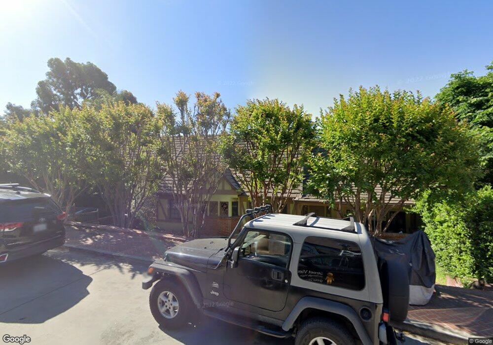
2141 Cedarhurst Dr Los Angeles, CA 90027
Los Feliz NeighborhoodEstimated Value: $2,509,000 - $2,802,000
4
Beds
3
Baths
2,777
Sq Ft
$966/Sq Ft
Est. Value
About This Home
This home is located at 2141 Cedarhurst Dr, Los Angeles, CA 90027 and is currently estimated at $2,682,230, approximately $965 per square foot. 2141 Cedarhurst Dr is a home located in Los Angeles County with nearby schools including Franklin Avenue Elementary, Thomas Starr King Middle School Film and Media Magnet, and John Marshall Senior High.
Ownership History
Date
Name
Owned For
Owner Type
Purchase Details
Closed on
Jul 27, 2010
Sold by
Jolliffe Diane Beth
Bought by
Mauceri Mark and Mauceri Rita
Current Estimated Value
Home Financials for this Owner
Home Financials are based on the most recent Mortgage that was taken out on this home.
Original Mortgage
$960,000
Outstanding Balance
$634,009
Interest Rate
4.52%
Mortgage Type
Stand Alone First
Estimated Equity
$2,048,221
Create a Home Valuation Report for This Property
The Home Valuation Report is an in-depth analysis detailing your home's value as well as a comparison with similar homes in the area
Home Values in the Area
Average Home Value in this Area
Purchase History
| Date | Buyer | Sale Price | Title Company |
|---|---|---|---|
| Mauceri Mark | $1,200,000 | Equity Title Los Angeles |
Source: Public Records
Mortgage History
| Date | Status | Borrower | Loan Amount |
|---|---|---|---|
| Open | Mauceri Mark | $960,000 |
Source: Public Records
Tax History Compared to Growth
Tax History
| Year | Tax Paid | Tax Assessment Tax Assessment Total Assessment is a certain percentage of the fair market value that is determined by local assessors to be the total taxable value of land and additions on the property. | Land | Improvement |
|---|---|---|---|---|
| 2025 | $18,693 | $1,537,399 | $1,229,925 | $307,474 |
| 2024 | $18,693 | $1,507,255 | $1,205,809 | $301,446 |
| 2023 | $18,334 | $1,477,702 | $1,182,166 | $295,536 |
| 2022 | $17,489 | $1,448,729 | $1,158,987 | $289,742 |
| 2021 | $17,275 | $1,420,323 | $1,136,262 | $284,061 |
| 2019 | $16,813 | $1,378,198 | $1,102,561 | $275,637 |
| 2018 | $16,694 | $1,351,176 | $1,080,943 | $270,233 |
| 2016 | $15,967 | $1,298,711 | $1,038,970 | $259,741 |
| 2015 | $15,736 | $1,279,204 | $1,023,364 | $255,840 |
| 2014 | $15,835 | $1,254,147 | $1,003,318 | $250,829 |
Source: Public Records
Map
Nearby Homes
- 4310 Cedarhurst Cir
- 4320 Cedarhurst Cir
- 2255 Talmadge St
- 4311 Finley Ave
- 4343 Finley Ave Unit 35
- 4228 Los Nietos Dr
- 4437 Avocado St Unit 101
- 4321 Los Feliz Blvd Unit 1
- 4411 Los Feliz Blvd Unit 901
- 4411 Los Feliz Blvd Unit 702
- 4411 Los Feliz Blvd Unit 1105
- 4411 Los Feliz Blvd Unit 508
- 4455 Los Feliz Blvd Unit 907
- 4411 Los Feliz Blvd Unit 306
- 4171 Holly Knoll Dr
- 4141 Los Feliz Blvd
- 3234 Lowry Rd
- 2220 Richland Ave
- 4189 Holly Knoll Dr
- 2240 Hillhurst Ave
- 4313 Ambrose Ave
- 2131 Cedarhurst Dr
- 4319 Ambrose Ave
- 2147 Cedarhurst Dr
- 4307 Ambrose Ave
- 4327 Ambrose Ave
- 2146 Cedarhurst Dr
- 2130 Cedarhurst Dr
- 4303 Ambrose Ave
- 2153 Cedarhurst Dr
- 2123 Cedarhurst Dr
- 2128 Cedarhurst Dr
- 4312 Ambrose Ave
- 4300 Ambrose Ave
- 4331 Ambrose Ave
- 4318 Ambrose Ave
- 2243 Ben Lomond Dr
- 2241 Ben Lomond Dr
- 2159 Cedarhurst Dr
- 4306 Ambrose Ave