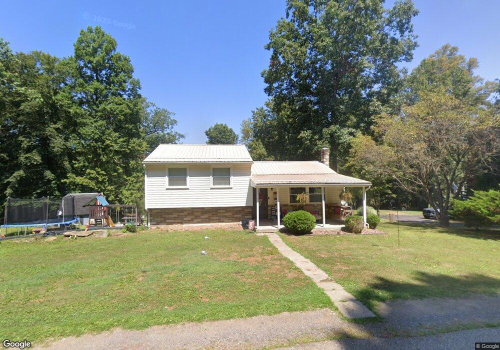
2141 Shady Ln Kittanning, PA 16201
North Buffalo Township NeighborhoodEstimated Value: $159,000 - $210,065
3
Beds
1
Bath
1,040
Sq Ft
$186/Sq Ft
Est. Value
About This Home
This home is located at 2141 Shady Ln, Kittanning, PA 16201 and is currently estimated at $193,266, approximately $185 per square foot. 2141 Shady Ln is a home with nearby schools including West Hills Intermediate School, West Hills Primary School, and Grace Christian School.
Ownership History
Date
Name
Owned For
Owner Type
Purchase Details
Closed on
Jun 6, 2019
Sold by
Wolfe David R
Bought by
Crissman Brady J and Crissman Bailey A
Current Estimated Value
Home Financials for this Owner
Home Financials are based on the most recent Mortgage that was taken out on this home.
Original Mortgage
$140,507
Outstanding Balance
$124,276
Interest Rate
4.4%
Mortgage Type
FHA
Estimated Equity
$68,990
Purchase Details
Closed on
Aug 17, 2006
Sold by
Wolfe David R and Anthony Paula D
Bought by
Wolfe David R and Wolfe Paula D
Home Financials for this Owner
Home Financials are based on the most recent Mortgage that was taken out on this home.
Original Mortgage
$40,000
Interest Rate
6.71%
Mortgage Type
New Conventional
Purchase Details
Closed on
Aug 21, 1998
Bought by
Galbraith Kay Louise
Purchase Details
Closed on
Jun 20, 1997
Bought by
Galbraith Kay Louise
Purchase Details
Closed on
Jul 28, 1978
Create a Home Valuation Report for This Property
The Home Valuation Report is an in-depth analysis detailing your home's value as well as a comparison with similar homes in the area
Home Values in the Area
Average Home Value in this Area
Purchase History
| Date | Buyer | Sale Price | Title Company |
|---|---|---|---|
| Crissman Brady J | $143,100 | None Available | |
| Wolfe David R | -- | None Available | |
| Galbraith Kay Louise | -- | -- | |
| Galbraith Kay Louise | -- | -- | |
| -- | $7,500 | -- |
Source: Public Records
Mortgage History
| Date | Status | Borrower | Loan Amount |
|---|---|---|---|
| Open | Crissman Brady J | $140,507 | |
| Previous Owner | Wolfe David R | $40,000 |
Source: Public Records
Tax History Compared to Growth
Tax History
| Year | Tax Paid | Tax Assessment Tax Assessment Total Assessment is a certain percentage of the fair market value that is determined by local assessors to be the total taxable value of land and additions on the property. | Land | Improvement |
|---|---|---|---|---|
| 2025 | $3,724 | $41,910 | $23,040 | $18,870 |
| 2024 | $3,514 | $41,910 | $23,040 | $18,870 |
| 2023 | $2,761 | $41,910 | $23,040 | $18,870 |
| 2022 | $2,761 | $41,910 | $23,040 | $18,870 |
| 2021 | $2,728 | $41,910 | $23,040 | $18,870 |
| 2020 | $2,728 | $41,910 | $23,040 | $18,870 |
| 2019 | $2,728 | $41,910 | $23,040 | $18,870 |
| 2018 | $2,733 | $32,920 | $5,965 | $26,955 |
| 2017 | $2,713 | $41,910 | $23,040 | $18,870 |
| 2016 | $2,713 | $41,910 | $23,040 | $18,870 |
| 2015 | $2,063 | $41,910 | $23,040 | $18,870 |
| 2014 | $2,063 | $41,910 | $23,040 | $18,870 |
Source: Public Records
Map
Nearby Homes
- 728 Ferne Dr
- 514 Southern Ave
- 217 Briar Hill Rd
- 208 Briar Hill Rd
- 228 Arthur St
- 226 Ridge Ave
- 349 Franklin Ave
- 238 Allegheny Ave
- 418 Pine Hill Rd
- 156 S Jefferson St
- 114 S Mckean St
- 509 N Jefferson St
- 143 N Grant Ave
- 203-205 Maple St
- 435 1/2 Reesman Dr Unit 2
- 139 Oak Ave
- 136 Queen St
- 536 1/2 Butler Rd
- 614 Woodward Ave
- 414 North Ave