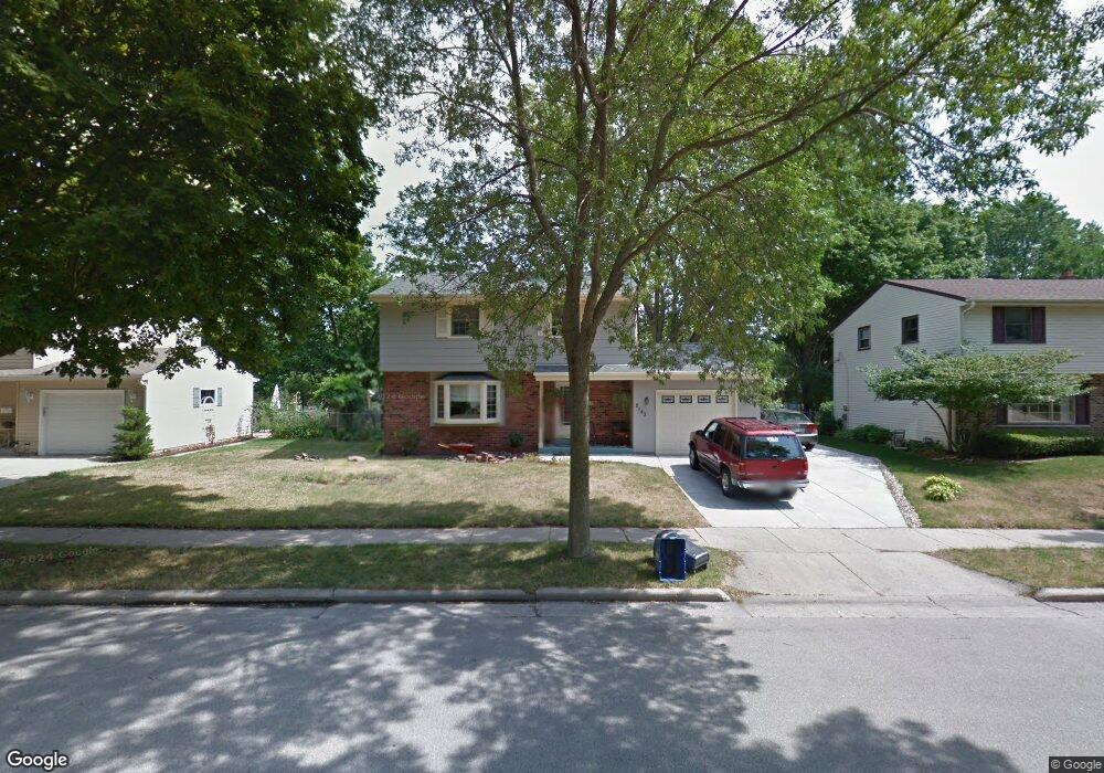
2143 Empire Dr Waukesha, WI 53186
Estimated Value: $360,000 - $399,000
4
Beds
2
Baths
1,740
Sq Ft
$220/Sq Ft
Est. Value
About This Home
This home is located at 2143 Empire Dr, Waukesha, WI 53186 and is currently estimated at $383,216, approximately $220 per square foot. 2143 Empire Dr is a home located in Waukesha County with nearby schools including John F. Miller School, Banting Elementary School, and Horning Middle School.
Ownership History
Date
Name
Owned For
Owner Type
Purchase Details
Closed on
Jun 26, 2015
Sold by
Gulotta Ronald G
Bought by
Gulotta Ronald G and Gulotta Ruth E
Current Estimated Value
Home Financials for this Owner
Home Financials are based on the most recent Mortgage that was taken out on this home.
Original Mortgage
$145,000
Outstanding Balance
$56,131
Interest Rate
3.86%
Mortgage Type
New Conventional
Estimated Equity
$327,085
Purchase Details
Closed on
Apr 22, 2010
Sold by
Goodman Richard E and Goodman Cynthia S
Bought by
Gulotta Ronald G
Home Financials for this Owner
Home Financials are based on the most recent Mortgage that was taken out on this home.
Original Mortgage
$123,900
Interest Rate
5.05%
Mortgage Type
New Conventional
Create a Home Valuation Report for This Property
The Home Valuation Report is an in-depth analysis detailing your home's value as well as a comparison with similar homes in the area
Home Values in the Area
Average Home Value in this Area
Purchase History
| Date | Buyer | Sale Price | Title Company |
|---|---|---|---|
| Gulotta Ronald G | -- | None Available | |
| Gulotta Ronald G | $170,000 | None Available |
Source: Public Records
Mortgage History
| Date | Status | Borrower | Loan Amount |
|---|---|---|---|
| Open | Gulotta Ronald G | $145,000 | |
| Closed | Gulotta Ronald G | $123,900 |
Source: Public Records
Tax History Compared to Growth
Tax History
| Year | Tax Paid | Tax Assessment Tax Assessment Total Assessment is a certain percentage of the fair market value that is determined by local assessors to be the total taxable value of land and additions on the property. | Land | Improvement |
|---|---|---|---|---|
| 2024 | $4,443 | $300,800 | $55,000 | $245,800 |
| 2023 | $4,316 | $300,800 | $55,000 | $245,800 |
| 2022 | $4,402 | $230,200 | $52,200 | $178,000 |
| 2021 | $4,375 | $223,900 | $52,200 | $171,700 |
| 2020 | $4,230 | $223,900 | $52,200 | $171,700 |
| 2019 | $4,097 | $223,900 | $52,200 | $171,700 |
| 2018 | $4,061 | $205,400 | $46,400 | $159,000 |
| 2017 | $4,060 | $205,400 | $46,400 | $159,000 |
| 2016 | $3,664 | $185,000 | $46,400 | $138,600 |
| 2015 | $3,531 | $179,500 | $46,400 | $133,100 |
| 2014 | $3,522 | $176,000 | $46,400 | $129,600 |
| 2013 | $3,608 | $176,000 | $46,400 | $129,600 |
Source: Public Records
Map
Nearby Homes
- 1112 Gertrude St
- 1116 Josephine St
- 1729 Stardust Dr Unit B
- 2109 Melody Ln
- 1308 Danny St
- 1471 Cleveland Ave
- 1333 Niagara St
- 1415 Niagara St Unit 109
- 1542 Whiterock Ave
- 918 Niagara St
- 937 E Moreland Blvd
- 1522 Pewaukee Rd
- 419 Peters Dr
- N10W23564 Robinhood Ct
- 440 Gascoigne Dr
- 925 Harding Ave
- 526 Peters Dr
- 1021 Aurora St
- 1139 White Rock Ave
- 1103 Arcadian Ave
- 2137 Empire Dr
- 2149 Empire Dr
- 2154 Empire Dr
- 2155 Empire Dr
- 2142 Empire Dr
- 2148 Empire Dr
- 2136 Empire Dr
- 2125 Empire Dr
- 2163 Empire Dr
- 1432 Atlantic Dr
- 2130 Empire Dr
- 1500 Atlantic Dr
- 1520 Atlantic Dr
- 2160 Empire Dr
- 1512 Atlantic Dr
- 2119 Empire Dr
- 2124 Empire Dr
- 1508 Atlantic Dr
- 1426 Atlantic Dr
- 1511 Atlantic Dr