21435 Us Highway 17 Hampstead, NC 28443
--
Bed
--
Bath
--
Sq Ft
6
Acres
About This Home
This home is located at 21435 Us Highway 17, Hampstead, NC 28443. 21435 Us Highway 17 is a home located in Pender County with nearby schools including Topsail Elementary School, Topsail Middle School, and Topsail High School.
Ownership History
Date
Name
Owned For
Owner Type
Purchase Details
Closed on
Jul 26, 2024
Sold by
Barewood Services Inc
Bought by
Hilltop Management Llc
Purchase Details
Closed on
Oct 4, 2007
Sold by
Abm Development Llc
Bought by
Mills Kevin O and Mills Michelle
Purchase Details
Closed on
Sep 25, 2007
Sold by
Mills Kenneth O and Mills Greta H
Bought by
Abm Development Llc
Create a Home Valuation Report for This Property
The Home Valuation Report is an in-depth analysis detailing your home's value as well as a comparison with similar homes in the area
Home Values in the Area
Average Home Value in this Area
Purchase History
| Date | Buyer | Sale Price | Title Company |
|---|---|---|---|
| Hilltop Management Llc | $1,140,000 | None Listed On Document | |
| Mills Kevin O | $200,000 | -- | |
| Abm Development Llc | $199,500 | -- |
Source: Public Records
Mortgage History
| Date | Status | Borrower | Loan Amount |
|---|---|---|---|
| Previous Owner | Barewood Services Inc | $386,490 |
Source: Public Records
Tax History Compared to Growth
Tax History
| Year | Tax Paid | Tax Assessment Tax Assessment Total Assessment is a certain percentage of the fair market value that is determined by local assessors to be the total taxable value of land and additions on the property. | Land | Improvement |
|---|---|---|---|---|
| 2024 | $1,970 | $213,000 | $213,000 | $0 |
| 2023 | $1,773 | $213,000 | $213,000 | $0 |
| 2022 | $1,773 | $213,000 | $213,000 | $0 |
| 2021 | $1,773 | $213,000 | $213,000 | $0 |
| 2020 | $1,773 | $213,000 | $213,000 | $0 |
| 2019 | $1,773 | $213,000 | $213,000 | $0 |
| 2018 | $3,746 | $400,752 | $400,752 | $0 |
| 2017 | $3,746 | $400,752 | $400,752 | $0 |
| 2016 | $3,708 | $400,752 | $400,752 | $0 |
| 2015 | $3,675 | $400,752 | $400,752 | $0 |
| 2014 | $2,879 | $400,752 | $400,752 | $0 |
| 2013 | -- | $400,752 | $400,752 | $0 |
| 2012 | -- | $400,752 | $400,752 | $0 |
Source: Public Records
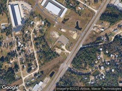
Map
Nearby Homes
- 101 Scotar Ct
- 32 Oak Grove Dr
- 200 E Keel Dr
- 00 Old Whitfield Rd
- 105 Sunset Ct
- 233 Hampton Ct
- 70 Buccaneer Blvd
- 20748 Us Highway 17 N
- 107 Westminster Way
- 20689 U S 17
- 43 Westminster Way
- 354 Crown Pointe Dr
- 805 Wildwood Cir
- 117 Canvasback Point
- 48 Crown Pointe Dr
- 45 Crown Pointe Dr
- 42 Crown Pointe Dr
- 46 Crown Pointe Dr
- 666 Bay Harbor Dr
- 103 Lumis Ct
- 21435 Us Highway 17
- 21417 U S 17
- 90 Oak Grove Dr
- 78 Oak Grove Dr
- 1 Royal Tern Dr
- 1 Royal Tern Dr Unit 1
- 120 Oak Grove Dr
- 196 Oak Grove Dr
- 183 Royal Tern Dr
- 85 Oak Grove Dr
- 85 Oak Grove Dr
- 85 Oak Grove Cir
- 63 Royal Tern Dr
- 21556 U S 17
- 103 Royal Tern Dr
- 47 Oak Grove Dr
- 127 Royal Tern Dr
- 44 Oak Grove Dr
- 21310 Us Highway 17
- 108 W Cormorant Ct