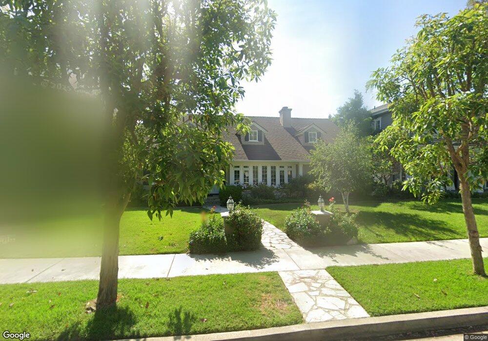
2144 Duxbury Cir Los Angeles, CA 90034
Beverlywood NeighborhoodEstimated Value: $3,019,268 - $4,504,000
3
Beds
3
Baths
2,886
Sq Ft
$1,206/Sq Ft
Est. Value
About This Home
This home is located at 2144 Duxbury Cir, Los Angeles, CA 90034 and is currently estimated at $3,480,817, approximately $1,206 per square foot. 2144 Duxbury Cir is a home located in Los Angeles County with nearby schools including Castle Heights Elementary, Palms Middle School, and Alexander Hamilton Senior High School.
Ownership History
Date
Name
Owned For
Owner Type
Purchase Details
Closed on
Aug 14, 2024
Sold by
Ron Levanson Trust and Vanransom Victoria
Bought by
Phyllis Conway 1995 Trust and Conway
Current Estimated Value
Purchase Details
Closed on
Feb 4, 2016
Sold by
Levanson Ron and Conway Phyllis
Bought by
Levanson Ron and Ron Levanson Trust
Home Financials for this Owner
Home Financials are based on the most recent Mortgage that was taken out on this home.
Original Mortgage
$625,500
Interest Rate
3.79%
Mortgage Type
New Conventional
Purchase Details
Closed on
Feb 12, 1999
Sold by
Levanson Ron and Sadie Levanson 1978 Trust
Bought by
Levanson Ron and Ron Levanson Trust
Purchase Details
Closed on
Nov 5, 1998
Sold by
Levanson Family Trust and Ron
Bought by
Levanson Ron and Sadie Levanson 1978 Trust
Create a Home Valuation Report for This Property
The Home Valuation Report is an in-depth analysis detailing your home's value as well as a comparison with similar homes in the area
Home Values in the Area
Average Home Value in this Area
Purchase History
| Date | Buyer | Sale Price | Title Company |
|---|---|---|---|
| Phyllis Conway 1995 Trust | -- | None Listed On Document | |
| Levanson Ron | -- | Accommodation | |
| Levanson Ron | -- | Title 365 | |
| Levanson Ron | -- | -- | |
| Levanson Ron | -- | -- | |
| Levanson Ron | -- | -- |
Source: Public Records
Mortgage History
| Date | Status | Borrower | Loan Amount |
|---|---|---|---|
| Previous Owner | Levanson Ron | $625,500 |
Source: Public Records
Tax History Compared to Growth
Tax History
| Year | Tax Paid | Tax Assessment Tax Assessment Total Assessment is a certain percentage of the fair market value that is determined by local assessors to be the total taxable value of land and additions on the property. | Land | Improvement |
|---|---|---|---|---|
| 2025 | $2,199 | $2,034,767 | $1,615,672 | $419,095 |
| 2024 | $2,199 | $149,734 | $72,080 | $77,654 |
| 2023 | $2,167 | $146,799 | $70,667 | $76,132 |
| 2022 | $2,084 | $143,922 | $69,282 | $74,640 |
| 2021 | $2,039 | $141,101 | $67,924 | $73,177 |
| 2019 | $1,985 | $136,917 | $65,910 | $71,007 |
| 2018 | $1,867 | $134,233 | $64,618 | $69,615 |
| 2016 | $1,756 | $129,021 | $62,109 | $66,912 |
| 2015 | $1,733 | $127,084 | $61,177 | $65,907 |
| 2014 | $1,750 | $124,595 | $59,979 | $64,616 |
Source: Public Records
Map
Nearby Homes
- 2700 Anchor Ave
- 9313 Bolton Rd
- 2671 Anchor Ave
- 9503 Beverlywood St
- 9730 Cresta Dr
- 2631 Castle Heights Place
- 9125 David Ave
- 2411 S Canfield Ave
- 1625 Rexford Dr
- 9142 Monte Mar Dr
- 2718 Forrester Dr
- 1601 S Beverly Dr
- 2714 Forrester Dr
- 9521 Cattaraugus Ave
- 2775 Motor Ave
- 2950 Club Dr
- 9752 Castello Place
- 2502 S Robertson Blvd
- 1515 S Beverly Dr Unit 201
- 10267 Cresta Dr
- 2136 Duxbury Cir
- 2200 Duxbury Cir
- 2128 Duxbury Cir
- 2208 Duxbury Cir
- 2201 S Beverly Dr
- 2131 S Beverly Dr
- 2209 S Beverly Dr
- 2125 S Beverly Dr
- 2147 Duxbury Cir
- 2120 Duxbury Cir
- 2216 Duxbury Cir
- 2201 Duxbury Cir
- 2175 S Beverly Dr Unit 406
- 2175 S Beverly Dr
- 2175 S Beverly Dr Unit 404
- 2175 S Beverly Dr Unit 210
- 2175 S Beverly Dr Unit 403
- 2175 S Beverly Dr Unit 306
- 2175 S Beverly Dr Unit 402
- 2175 S Beverly Dr Unit 309