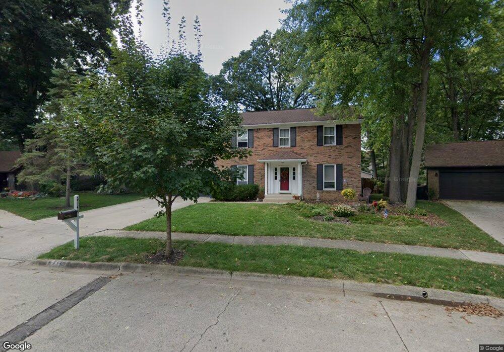
2144 Sharwood Ct Columbus, OH 43235
Summerwood NeighborhoodEstimated Value: $398,000 - $432,000
3
Beds
3
Baths
1,727
Sq Ft
$242/Sq Ft
Est. Value
About This Home
This home is located at 2144 Sharwood Ct, Columbus, OH 43235 and is currently estimated at $418,056, approximately $242 per square foot. 2144 Sharwood Ct is a home located in Franklin County with nearby schools including Granby Elementary School, McCord Middle School, and Worthington Kilbourne High School.
Ownership History
Date
Name
Owned For
Owner Type
Purchase Details
Closed on
Sep 29, 2000
Sold by
Risk Paul N
Bought by
Loring Kevin L and Loring Amy M
Current Estimated Value
Home Financials for this Owner
Home Financials are based on the most recent Mortgage that was taken out on this home.
Original Mortgage
$147,100
Interest Rate
7.99%
Purchase Details
Closed on
Jul 26, 1996
Sold by
Schumick Mark A
Bought by
Paul N Risk
Home Financials for this Owner
Home Financials are based on the most recent Mortgage that was taken out on this home.
Original Mortgage
$72,000
Interest Rate
8.43%
Mortgage Type
Balloon
Purchase Details
Closed on
Mar 2, 1994
Purchase Details
Closed on
Jan 20, 1988
Create a Home Valuation Report for This Property
The Home Valuation Report is an in-depth analysis detailing your home's value as well as a comparison with similar homes in the area
Home Values in the Area
Average Home Value in this Area
Purchase History
| Date | Buyer | Sale Price | Title Company |
|---|---|---|---|
| Loring Kevin L | $163,500 | Gahanna Title | |
| Paul N Risk | $134,500 | -- | |
| -- | $127,500 | -- | |
| -- | $110,000 | -- |
Source: Public Records
Mortgage History
| Date | Status | Borrower | Loan Amount |
|---|---|---|---|
| Open | Loring Kevin L | $65,000 | |
| Closed | Loring Kevin L | $50,000 | |
| Closed | Loring Kevin | $145,000 | |
| Closed | Loring Kevin L | $31,000 | |
| Closed | Loring Kevin L | $155,200 | |
| Closed | Loring Kevin L | $10,100 | |
| Closed | Loring Kevin L | $149,000 | |
| Closed | Loring Kevin L | $147,100 | |
| Closed | Paul N Risk | $72,000 |
Source: Public Records
Tax History Compared to Growth
Tax History
| Year | Tax Paid | Tax Assessment Tax Assessment Total Assessment is a certain percentage of the fair market value that is determined by local assessors to be the total taxable value of land and additions on the property. | Land | Improvement |
|---|---|---|---|---|
| 2024 | $7,076 | $115,260 | $30,800 | $84,460 |
| 2023 | $6,767 | $115,260 | $30,800 | $84,460 |
| 2022 | $6,443 | $87,080 | $17,850 | $69,230 |
| 2021 | $5,944 | $87,080 | $17,850 | $69,230 |
| 2020 | $5,726 | $87,080 | $17,850 | $69,230 |
| 2019 | $5,239 | $71,900 | $14,880 | $57,020 |
| 2018 | $4,763 | $71,900 | $14,880 | $57,020 |
| 2017 | $4,573 | $71,900 | $14,880 | $57,020 |
| 2016 | $4,451 | $62,690 | $16,910 | $45,780 |
| 2015 | $4,452 | $62,690 | $16,910 | $45,780 |
| 2014 | $4,450 | $62,690 | $16,910 | $45,780 |
| 2013 | $2,214 | $62,685 | $16,905 | $45,780 |
Source: Public Records
Map
Nearby Homes
- 2220 Surreygate Dr
- 7692 Schoolway Ct
- 2074 Hard Rd
- 2127 Sutter Pkwy
- 7484 Blue Fox Ln
- 7492 Sagewood Ct
- 2383 Queen Ann Ct
- 7607-7609 Penwood Place
- 7602-7604 Bingham Ct
- 1955 Slaton Ct Unit 1955
- 7581-7583 Pickett Ln
- 7673 Starmont Ct
- 2036 Queensbridge Dr
- 2010 Shallowford Ave
- 1909 Laramie Dr Unit 1909
- 1735 Gardenstone Dr
- 1954 Laramie Dr Unit 13
- 7771 Strathmoore Rd
- 1908 Lost Valley Rd
- 1813 Worthington Run Dr Unit A
- 2144 Sharwood Ct
- 2150 Sharwood Ct
- 2138 Sharwood Ct
- 7656 Smoketree Ct
- 7664 Smoketree Ct
- 7644 Smoketree Ct
- 2132 Sharwood Ct
- 2156 Sharwood Ct
- 2127 Sharwood Ct
- 7636 Smoketree Ct
- 7670 Smoketree Ct
- 2126 Sharwood Ct
- 2151 Sharwood Ct
- 2139 Sharwood Ct
- 7628 Smoketree Ct
- 2120 Sharwood Ct
- 2120 Sharwood Ct
- 2158 Surreygate Dr
- 2150 Surreygate Dr
- 7657 Smoketree Ct