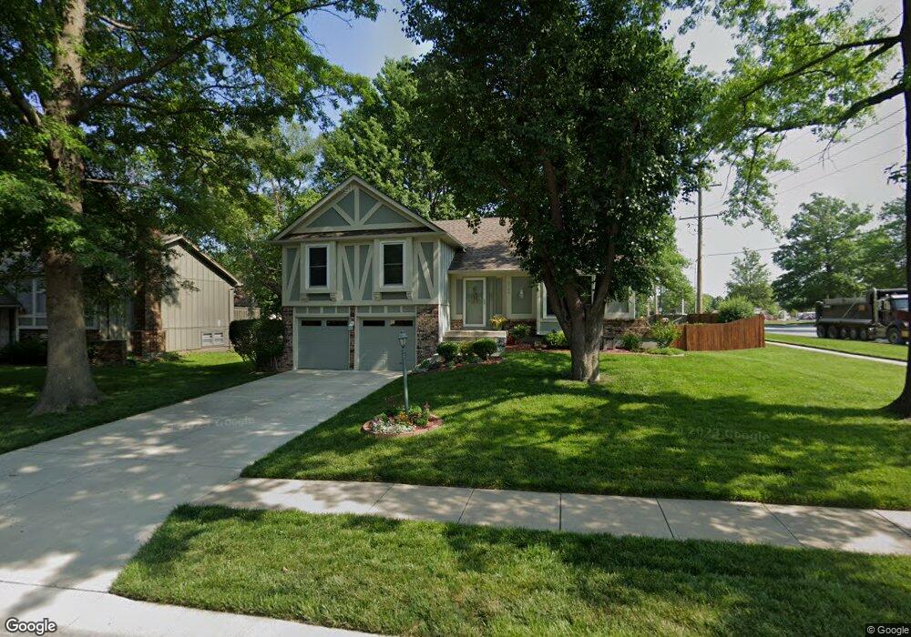
2146 E 152nd St Olathe, KS 66062
Estimated Value: $336,867 - $362,000
3
Beds
3
Baths
1,407
Sq Ft
$246/Sq Ft
Est. Value
About This Home
This home is located at 2146 E 152nd St, Olathe, KS 66062 and is currently estimated at $346,467, approximately $246 per square foot. 2146 E 152nd St is a home located in Johnson County with nearby schools including Scarborough Elementary School, Indian Trail Middle School, and Olathe South Sr High School.
Ownership History
Date
Name
Owned For
Owner Type
Purchase Details
Closed on
Feb 16, 2018
Sold by
Demoss Melanie L
Bought by
Stumbo Laura M
Current Estimated Value
Home Financials for this Owner
Home Financials are based on the most recent Mortgage that was taken out on this home.
Original Mortgage
$85,600
Outstanding Balance
$71,824
Interest Rate
3.99%
Mortgage Type
New Conventional
Estimated Equity
$274,643
Purchase Details
Closed on
Dec 29, 2003
Sold by
Demoss Melanie L and Demoss Michael B
Bought by
Demoss Melanie L
Create a Home Valuation Report for This Property
The Home Valuation Report is an in-depth analysis detailing your home's value as well as a comparison with similar homes in the area
Home Values in the Area
Average Home Value in this Area
Purchase History
| Date | Buyer | Sale Price | Title Company |
|---|---|---|---|
| Stumbo Laura M | -- | Thomson Affinity Title Llc | |
| Demoss Melanie L | -- | -- |
Source: Public Records
Mortgage History
| Date | Status | Borrower | Loan Amount |
|---|---|---|---|
| Open | Stumbo Laura M | $85,600 |
Source: Public Records
Tax History
| Year | Tax Paid | Tax Assessment Tax Assessment Total Assessment is a certain percentage of the fair market value that is determined by local assessors to be the total taxable value of land and additions on the property. | Land | Improvement |
|---|---|---|---|---|
| 2025 | $3,901 | $38,272 | $7,430 | $30,842 |
| 2024 | $3,901 | $34,983 | $6,753 | $28,230 |
| 2023 | $3,704 | $32,476 | $6,142 | $26,334 |
| 2022 | $3,517 | $29,992 | $5,343 | $24,649 |
| 2021 | $3,380 | $27,405 | $5,343 | $22,062 |
| 2020 | $3,198 | $25,714 | $4,854 | $20,860 |
| 2019 | $2,992 | $23,920 | $4,852 | $19,068 |
| 2018 | $2,900 | $23,023 | $4,852 | $18,171 |
| 2017 | $2,695 | $21,195 | $4,039 | $17,156 |
| 2016 | $2,356 | $19,044 | $4,039 | $15,005 |
| 2015 | $2,248 | $18,193 | $3,366 | $14,827 |
| 2013 | -- | $15,893 | $3,366 | $12,527 |
Source: Public Records
Map
Nearby Homes
- 16545 W 153rd St
- 15437 S Bradley Dr
- 2027 E Mohawk Ct
- 15404 S Summertree Ln
- 15482 S Wyandotte Dr
- 16720 W 155th Terrace
- 16021 W 153rd St
- 1836 E 153rd Cir
- 1508 S Pawnee Cir
- 14747 S Homestead Dr
- 17340 W 155th Terrace
- 16764 W 157th St
- 14739 S Locust St
- 2120 S Lindenwood Dr
- 15207 S Navaho Dr
- 0 E 151st St
- 2020 E Cherokee Place
- C 151st St
- 2101 E Sheridan Bridge Ln
- 15813 W 147th Terrace
- 2142 E 152nd St
- 2143 E 151st Terrace
- 2137 E 151st Terrace
- 2138 E 152nd St
- 2147 E 152nd St
- 2143 E 152nd St
- 2131 E 151st Terrace
- 2134 E 152nd St
- 2139 E 152nd St
- 2127 E 151st Terrace
- 2142 E 151st Terrace
- 12918 & 12920 S Blackfoot Dr
- 16312 & 16314 W 123rd St
- 17412 W 165th St
- 1680 E 152nd Circle Bedroom 1b
- 16364 159th Terrace
- 10102 W 175th St
- 2152 E 152nd Terrace
- 2135 E 152nd St
- 2136 E 151st Terrace
Your Personal Tour Guide
Ask me questions while you tour the home.