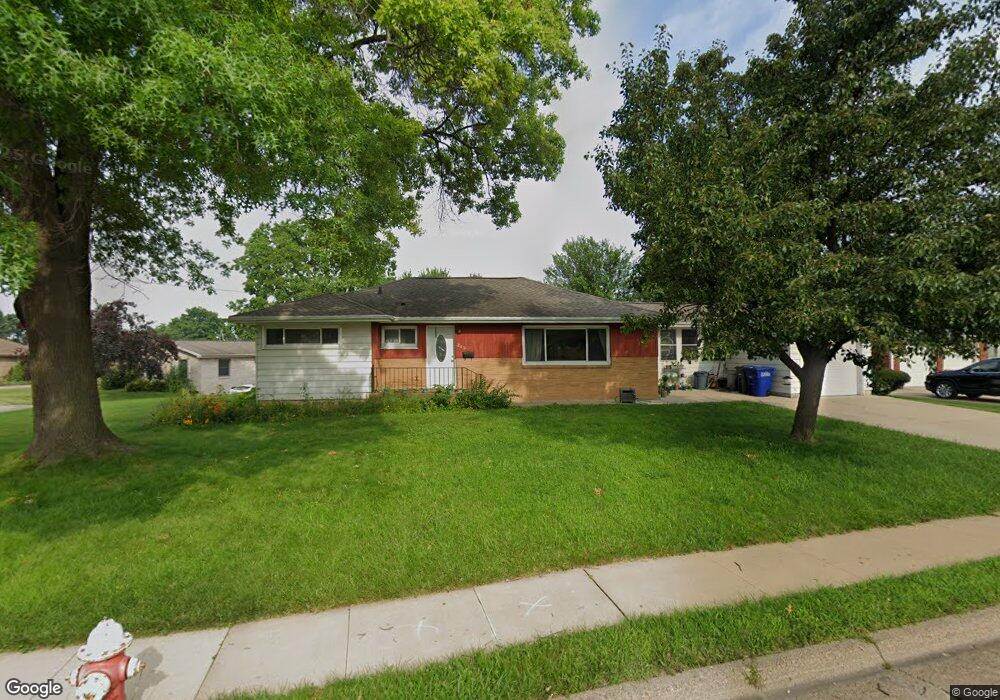
215 Devon Dr Dubuque, IA 52001
Estimated Value: $206,295 - $230,000
3
Beds
1
Bath
1,256
Sq Ft
$175/Sq Ft
Est. Value
About This Home
This home is located at 215 Devon Dr, Dubuque, IA 52001 and is currently estimated at $220,074, approximately $175 per square foot. 215 Devon Dr is a home located in Dubuque County with nearby schools including Irving Elementary School, George Washington Middle School, and Dubuque Senior High School.
Ownership History
Date
Name
Owned For
Owner Type
Purchase Details
Closed on
Sep 9, 2021
Sold by
Sweeney Properties Llc
Bought by
Melville Robert S
Current Estimated Value
Home Financials for this Owner
Home Financials are based on the most recent Mortgage that was taken out on this home.
Original Mortgage
$157,500
Outstanding Balance
$143,313
Interest Rate
2.8%
Mortgage Type
New Conventional
Estimated Equity
$76,761
Purchase Details
Closed on
Jan 23, 2018
Sold by
Sweeney John L and Sweeney Leslie J
Bought by
Sweeney Properties Llc
Purchase Details
Closed on
Jan 4, 2012
Sold by
Ramos Reinaldo and Ramos Sonia
Bought by
Sweeney John L and Sweeney Leslie J
Purchase Details
Closed on
Aug 17, 2007
Sold by
In The Matter Of The Estate
Bought by
Ramos Reinaldo and Ramos Sonia
Create a Home Valuation Report for This Property
The Home Valuation Report is an in-depth analysis detailing your home's value as well as a comparison with similar homes in the area
Purchase History
| Date | Buyer | Sale Price | Title Company |
|---|---|---|---|
| Melville Robert S | $175,000 | None Available | |
| Sweeney Properties Llc | -- | None Available | |
| Sweeney John L | $99,500 | None Available | |
| Ramos Reinaldo | $108,500 | None Available |
Source: Public Records
Mortgage History
| Date | Status | Borrower | Loan Amount |
|---|---|---|---|
| Open | Melville Robert S | $157,500 |
Source: Public Records
Tax History
| Year | Tax Paid | Tax Assessment Tax Assessment Total Assessment is a certain percentage of the fair market value that is determined by local assessors to be the total taxable value of land and additions on the property. | Land | Improvement |
|---|---|---|---|---|
| 2025 | $2,680 | $205,600 | $38,700 | $166,900 |
| 2024 | $2,680 | $186,300 | $36,800 | $149,500 |
| 2023 | $2,600 | $186,300 | $36,800 | $149,500 |
| 2022 | $2,160 | $151,030 | $34,840 | $116,190 |
| 2021 | $2,160 | $130,630 | $34,840 | $95,790 |
| 2020 | $2,106 | $118,460 | $32,900 | $85,560 |
| 2019 | $2,118 | $118,460 | $32,900 | $85,560 |
| 2018 | $2,086 | $113,900 | $30,970 | $82,930 |
| 2017 | $2,028 | $113,900 | $30,970 | $82,930 |
| 2016 | $1,986 | $104,980 | $30,970 | $74,010 |
| 2015 | $1,986 | $104,980 | $30,970 | $74,010 |
| 2014 | $1,932 | $104,980 | $30,970 | $74,010 |
Source: Public Records
Map
Nearby Homes
- 2476 Pearl St
- 2637 Nebraska St
- 105 Cherokee Dr
- 1642 Drexel Ave
- 2163 Lombard St
- 2750 Pennsylvania Ave
- 124 Cherokee Dr
- 2155 Decorah St
- 2628 University Ave
- 3063 Brunskill Rd
- 2935 Van Buren St
- 1698 N Algona St
- 2844 Oak Meadow Ct
- 1556 Auburn St
- 81 Fremont Ave
- 1765 Eden Ln
- 1425 Adair St
- 1930 Saint Anne Ct
- 1921 Avalon Rd
- 1780 Horizon Ct
- 235 Devon Dr
- 195 Croydon Crest
- 222 Devon Dr
- 200 Devon Dr
- 2614 Mineral St
- 255 Devon Dr
- 185 Croydon Crest
- 2624 Mineral St
- 240 Devon Dr
- 189 Devon Dr
- 190 Devon Dr
- 2608 Mineral St
- 2640 Mineral St
- 250 Devon Dr
- 175 Croydon Crest
- 225 Princeton Place
- 201 Princeton Place
- 180 Devon Dr
- 245 Princeton Place
- 265 Devon Dr
Your Personal Tour Guide
Ask me questions while you tour the home.