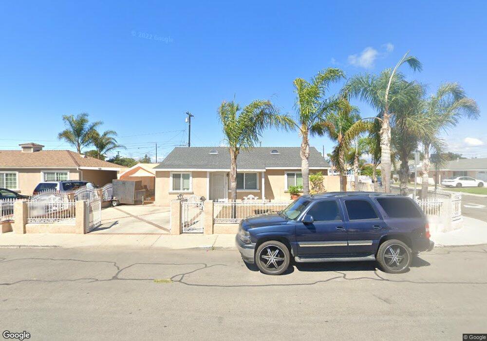
215 Hughes Dr Oxnard, CA 93033
Blackstock North NeighborhoodEstimated Value: $610,915 - $671,000
3
Beds
1
Bath
779
Sq Ft
$828/Sq Ft
Est. Value
About This Home
This home is located at 215 Hughes Dr, Oxnard, CA 93033 and is currently estimated at $644,979, approximately $827 per square foot. 215 Hughes Dr is a home located in Ventura County with nearby schools including Ansgar Larsen Elementary School, Channel Islands High School, and Santa Clara High School.
Ownership History
Date
Name
Owned For
Owner Type
Purchase Details
Closed on
May 20, 2020
Sold by
Limon Angela R
Bought by
Limon Angela R and The Angela Limon Revocable Liv
Current Estimated Value
Purchase Details
Closed on
Nov 17, 2009
Sold by
Rojo Antonio
Bought by
Limon Angela R
Purchase Details
Closed on
Mar 29, 1993
Sold by
Sandoval Luis M and Sandoval Martha
Bought by
Limon Alfonso and Limon Angela R
Create a Home Valuation Report for This Property
The Home Valuation Report is an in-depth analysis detailing your home's value as well as a comparison with similar homes in the area
Home Values in the Area
Average Home Value in this Area
Purchase History
| Date | Buyer | Sale Price | Title Company |
|---|---|---|---|
| Limon Angela R | -- | None Available | |
| Limon Angela R | -- | None Available | |
| Limon Angela R | -- | None Available | |
| Limon Alfonso | -- | -- |
Source: Public Records
Tax History
| Year | Tax Paid | Tax Assessment Tax Assessment Total Assessment is a certain percentage of the fair market value that is determined by local assessors to be the total taxable value of land and additions on the property. | Land | Improvement |
|---|---|---|---|---|
| 2025 | $2,586 | $216,599 | $86,637 | $129,962 |
| 2024 | $2,586 | $212,352 | $84,938 | $127,414 |
| 2023 | $2,442 | $208,189 | $83,273 | $124,916 |
| 2022 | $2,391 | $204,107 | $81,640 | $122,467 |
| 2021 | $2,421 | $200,105 | $80,039 | $120,066 |
| 2020 | $2,466 | $198,055 | $79,219 | $118,836 |
| 2019 | $2,392 | $194,172 | $77,666 | $116,506 |
| 2018 | $2,304 | $190,366 | $76,144 | $114,222 |
| 2017 | $2,229 | $186,634 | $74,651 | $111,983 |
| 2016 | $2,124 | $182,976 | $73,188 | $109,788 |
| 2015 | $2,156 | $180,230 | $72,090 | $108,140 |
| 2014 | $2,118 | $176,702 | $70,679 | $106,023 |
Source: Public Records
Map
Nearby Homes
- 3151 Fournier St
- 622 E Poplar St
- 3130 Paula St
- 3631 La Costa Place
- 360 Ibsen Place Unit 129
- 3638 S B St
- 140 Gaviota Place Unit 157
- 860 Morro Way
- 4160 Petit Dr Unit 39
- 280 Columbia Place Unit 48
- 558 E Hemlock St
- 4029 S B St
- 4221 Justin Way
- 225 W Iris St
- 2024 S J St
- 1140 Teakwood St
- 4340 Highland Ave
- 4632 S C St
- 4716 S B St
- 1239 S C St
Your Personal Tour Guide
Ask me questions while you tour the home.